Country:

 City:
City:


The Route de la Fennematt starts from Sewen at a place called Lerchenmatt, after a bridge crossing the Wagenstallbach. There is space to park a few cars on the right-hand side of the road.
(S/E) From the car park, follow the road westwards for about a hundred metres.
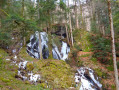
(1) At the junction, take the path on the right marked with a Red Triangle. Walk uphill alongside the Wagenstallbach waterfalls. Above the waterfalls, where an electric fence runs alongside the path, go through the wooden gate and head towards the Grand Langenberg farm.
(2) Cross the road in front of the farm and continue uphill, following the Red Triangle markings. Then cross the D466 carefully and continue uphill without taking the marked path on the right above the road.
(3) At the Gentiane ski runs, take the path on the left and head down to the footbridge over the D466; cross it and join the path leading uphill through the Gentiane stubble fields: in winter, avoid taking this path which crosses the ski runs and instead head uphill alongside the ski lift to the right of it, following the Red Rectangle markings. Pass by the Vierge du Wissgrut for a 360° view, then continue to the junction of marked trails at a place called Les Plaines.
(4) Carry on straight ahead, leaving the unmarked GR®5 (Red Rectangle) trail, which has been replaced by Blue Rectangle markings: these markings have not yet been updated on the base map or the IGN app.
(5) At the Col du Hirtzelach, carry on straight ahead along the Blue Rectangle-marked path, to the right of the Route de la Fennematt. Reach the Col du Lochberg.
(6) Turn left towards Fennematt.
(7) At the junction, take the GR®531 to the left again: a few dozen metres down the left-hand side is the source of the Doller. Walk past the new Fennematt building.
(8) Below Fennematt, take the path on the right marked with a Blue Rectangle (GR®531) and a Red Ring. You’ll reach a junction of marked paths.
(9) Head left to reach the Abri du Graber.
(10) Retrace your steps back to the junction.
(9) Take the GR®531 (Blue Rectangle) on the left. Descend along this winding path, emerge onto a forest track and continue to the right.
(11) At the three-way junction, take the forest track on the left marked with a Blue Rectangle: please note that the markings are difficult to see at this junction.
(12) At the next junction, turn left and follow the signs for Langenberg, marked with a Red Triangle. Return to the car park on the Route de la Fennematt (S/E).
 Visorando Member
 Difficult
 Easy
Easy 
 Very difficult