Circular route on the Plateau de l’Artense via Notre-Dame de Natzy

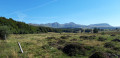
From the car park at the lake in La Tour-d’Auvergne, take the circular route heading north, climbing to the Notre-Dame de Natzy promontory via the Way of the Cross, to enjoy a 360° panoramic view of the Sancy massif, La Tour-d’Auvergne and its peak, the Artense and Cézallier plateaus, all the way to the Cantal mountains. You’ll then cross numerous pastures grazed by herds of cows of various breeds and pass by farms before returning to the charming village of La Tour-d’Auvergne, perched on a basalt outcrop whose origins date back to the 10th century.

Details

n°110134109
Creation:
Last update:
Last review:
–
  • Walking
    Activity: Walking
  • ↔
    Distance: 5.99 mi
  • ◔
    Average duration: 3h 30 
  • ▲
    Difficulty: Moderate

  • ⚐
    Back to start: Yes
  • ↗
    Ascent: + 866 ft
  • ↘
    Descent: - 863 ft

  • ▲
    Highest point: 3,573 ft
  • ▼
    Lowest point: 3,048 ft

Description of the walk

Start from the car park at the Tour d’Auvergne lake.

(S/E) From the car park, follow the path running alongside the lake heading north, then turn right at the first junction.

(1) Take thefirst street on the left for 80 metres, then cross the D203 with care and follow the path opposite.

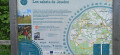
(2) At thefirst junction and the information sign for Notre-Dame de Natzy, turn right onto the Way of the Cross, which climbs to the top of the promontory and back.

(3) From the top of the headland, with its 360° view, head back down to the previous junction of paths.

(2) Turn right and, at the next junction, turn left, ignoring the signposted route.

(4) At the junction with the D203, you can head straight ahead for a round trip (300 m one way) to visit the remarkable church of Saint-Pardoux.

(5) Retrace your steps back to the D203.

(4) Follow it to the left, heading north, for 250 m until you reach the first bend to the left on this road.

(6) At the monument honouring the fighters of the Auvergne Maquis, take the unmarked path which climbs to the right of the monument.

(7) After crossing a ford or a footbridge and walking past a farmstead, at the next junction, turn right onto the road towards Pissols. Walk through the hamlet. At the end of the tarmac road, take the path to the left of a fenced-off pasture and continue straight on between the pastures. At one point, the path turns 90° to the right and then runs alongside the first farm until it joins the D129 at the entrance to the hamlet of Féreyrolles.

(8) To avoid following the D129 and its traffic, take the alley opposite which leads down into the hamlet. Turn right between two houses on the edge of the street or follow the small street until it joins the D129 at the end of the houses.

(9) At this junction, follow the D129 to the left for just under a kilometre until you reach the next crossroads.

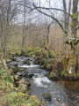
(10) At the junction, cross the D129 carefully, then follow the signposted path which descends to the left; after crossing the Ruisseau d’Ayssard via a bridge, head back up and cross the D129 again to take a signposted path opposite.

(11) At the junction, cross the D129 carefully and follow it towards La Tour d’Auvergne for 1 km.

(12) Just before the garage on the right, turn left towards the market square. Continue straight on, cross the market square, then head down to the Place de l’Église.

(13) Walk past the church, then keep to its left, climb a few steps and reach the top of the basalt outcrop to enjoy the view over the village and the surrounding area. There is an orientation board on the basalt outcrop and a viewpoint.

(14) Head back down from the outcrop, passing behind the church and taking several flights of steps to reach Rue des Bacs; cross Route de Chastreix and head to the lake car park (S/E).

Waypoints

  1. S/E : mi 0 - alt. 3,068 ft - Car park - Plan d'Eau de La Tour-d'Auvergne
  2. 1 : mi 0.23 - alt. 3,081 ft - Path x Road
  3. 2 : mi 0.5 - alt. 3,189 ft - Turn-off towards the chapel
  4. 3 : mi 0.71 - alt. 3,402 ft - Chapelle Notre-Dame de Natzy (La Tour-d'Auvergne)
  5. 4 : mi 1.13 - alt. 3,179 ft - Turn-off towards the church
  6. 5 : mi 1.33 - alt. 3,100 ft - Église Saint-Pardoux (Saint-Pardoux)
  7. 6 : mi 1.65 - alt. 3,163 ft - D203 road x Unmarked track – Maquis memorial stone
  8. 7 : mi 2.37 - alt. 3,274 ft - Junction of unmarked path and road
  9. 8 : mi 3.68 - alt. 3,566 ft - Junction with the D129 – Féreyrolles
  10. 9 : mi 3.88 - alt. 3,481 ft - D129 road
  11. 10 : mi 4.29 - alt. 3,501 ft - D129 road x Marked trail
  12. 11 : mi 5.06 - alt. 3,333 ft - Road junction – Le Méniaud
  13. 12 : mi 5.34 - alt. 3,264 ft - Road junctions
  14. 13 : mi 5.64 - alt. 3,225 ft - Place de l’Église
  15. 14 : mi 5.72 - alt. 3,241 ft - Orientation board above the - Église Saint-Louis (La Tour-d'Auvergne)
  16. S/E : mi 5.99 - alt. 3,071 ft - Car park - Plan d'Eau de La Tour-d'Auvergne

Notes

As for signposting, it is rather vague where it exists, but following the route remains straightforward with the accompanying instructions.

Watch out for traffic on the few sections of local roads that the route crosses.

Worth a visit

Climb up to the promontory of the Church of Notre-Dame de Natzy, facing the village.

Visit the Church of Saint-Pardoux, an iconic medieval building dating from the 12th century.

Visit La Tour-d’Auvergne, a former 10th-century barony. The history of La Tour-d’Auvergne is intrinsically linked to that of Marguerite de Valois, daughter of Catherine de’ Medici, better known as ‘Queen Margot’. She was the heir to part of the former barony of La Tour and the castle of the same name, the remains of which can still be seen today (a small wall at the top of the basalt columns).

Other walks in the area

For more walks, use our search engine .

The GPS track and description are the property of this route's author. Please do not copy them without permission.