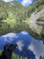
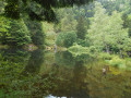
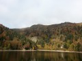
Cottages from the Herrenberg Pass to the Rainkopf, Altenweiher Lake

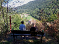
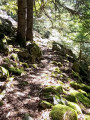
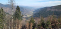
From the exit at Mittlach at the bottom of the Munster Valley, there is a steady climb through the beautiful Vosges forest of Herrenberg up to the high-altitude scree slopes between the Schweisel to the south (Herrenberg Pass) and the Rainkopf to the north, offering a 360° view of the mountains (Grand Ballon, Hohneck...) and the surrounding valleys, as well as the more distant mountain ranges (the Swiss Alps, the Black Forest, etc.) on a clear day;

Details

n°2082127
Creation:
Last update:
–
Last review:
  • Walking
    Activity: Walking
  • ↔
    Distance: 10.54 mi
  • ◔
    Average duration: 7h 30 
  • ▲
    Difficulty: Moderate

  • ⚐
    Back to start: Yes
  • ↗
    Ascent: + 3,064 ft
  • ↘
    Descent: - 3,054 ft

  • ▲
    Highest point: 4,311 ft
  • ▼
    Lowest point: 1,798 ft

Description of the walk

Car park 100 metres from the exit of Mittlach, after turning left in front of the hotel-restaurant and then going straight on at the bridge over the Große Fecht.

Red and whiteGR®5signposting

(S/E) Set off along the path to the right of the road, heading south. Continue along this path, following theGR® markings (Red Rectangle).

(1) At the junction with the forest track, keep left.

(2) When you reach the forest road, follow it to the right, then take the 180° left-hand bend.

(3) At the Fork in the road, turn right.

(4) Leave the forest track and take the path on the right, heading uphill; once you reach the first patches of stubble, cross them and continue with the forest on your right until you reach the Col du Herrenberg.

(5) Head north along theGR®5alternative route (Red Rectangle, White Rectangle, Red Rectangle), veering to the right, and follow the ridge line from south to north.

(6) Walk past the Neurod shelter and continue northwards.

(7) Cross the Col du Batteriekopf (to avoid additional elevation gain, you can bypass these ‘kopf’ by going round them to the left along the ridge road (same markings).

(8) Continue via the Rothenbachkopf Pass. At the junction with theGR®531(Blue Rectangle), keep right.

(9) Rainkopf: view of the summit of the Hohneck and the Altenweiher lake below; (you can also avoid climbing to the summit of the Rainkopf by turning left at the pass between the descent from the Rothenbachkopf and the ascent to the Rainkopf).
Start the descent, continuing northwards.

Yellow Cross markings

(10) Leave theGR®531, which continues straight on, and turn immediately right towards the Altenweiher for a descent through the forest.

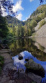
(11) At the end of the Altenweiher lake embankment, take a path on the right which runs alongside the lake’s overflow stream. Follow the forest track on the right.

(12) Kolben Fir Tree: To avoid the descent along the tarmac road to Mittlach, walk back up this road for a few dozen metres, passing the small chapel.

Blue Cross signposting

(13) After the bend to the right in the road, take the connecting path downhill, cross a footbridge and immediately rejoin the Blue Cross-marked path (Steinwasen – Mittlach) on the right as you descend. This path becomes a forest track (Chemin du Kolben) running alongside the stream until you reach the starting point (S/E).

Waypoints

  1. S/E : mi 0 - alt. 1,801 ft - Car park at the entrance to Mittlach - Source de la Fecht
  2. 1 : mi 0.9 - alt. 2,516 ft - Junction: footpath and forest track
  3. 2 : mi 1.49 - alt. 3,035 ft - Junction: footpath and forest track
  4. 3 : mi 1.96 - alt. 3,274 ft - Junction of footpath and forest track at point 997
  5. 4 : mi 2.46 - alt. 3,629 ft - Junction: forest track and footpath
  6. 5 : mi 3.58 - alt. 3,907 ft - Col du Herrenberg (1191m)
  7. 6 : mi 3.88 - alt. 4,022 ft - Neurod car park shelter
  8. 7 : mi 4.63 - alt. 4,301 ft - Batteriekopf
  9. 8 : mi 5.12 - alt. 4,311 ft - Rothenbachkopf
  10. 9 : mi 5.8 - alt. 4,278 ft - Rainkopf
  11. 10 : mi 6.21 - alt. 3,911 ft - Trail junction at point 1192
  12. 11 : mi 7.82 - alt. 3,031 ft - Altenweiher
  13. 12 : mi 8.79 - alt. 2,257 ft - Kolbenwasen
  14. 13 : mi 8.87 - alt. 2,303 ft - Road junction, connecting path
  15. S/E : mi 10.54 - alt. 1,798 ft - Car park at the entrance to Mittlach

Worth a visit

The route passes very close to several farm inns (Herrenberg Pass: Huss Farm) (north of the Rainkopf: Ferschmuss Farm Inn) offering food and drink);

Always be cautious and plan ahead when you're outdoors. Visorando and the author of this route cannot be held responsible for any accidents occurring on this route.

The GR® and PR® markings are the intellectual property of the Fédération Française de Randonnée Pédestre.

Reviews and comments

4.2 / 5
Based on 2 reviews

Reliability of the description
4 / 5
Ease of following the route
4 / 5
Route interest
4.5 / 5
AlH
AlH

Overall rating : 4.3 / 5

Date of your route : May 25, 2023
Reliability of the description : ★★★★☆ Good
Ease of following the route : ★★★★☆ Good
Route interest : ★★★★★ Very good
Very busy route : No

A lovely walk, with forests, pastures and magnificent views from the ridges; the Yellow Cross markings at the summit of the Rainkopf are difficult to spot, and care is needed on the descent to the beautiful Altenweiher Lake.

Machine-translated

vechri
vechri

Overall rating : 4 / 5

Date of your route : Sep 02, 2019
Reliability of the description : ★★★★☆ Good
Ease of following the route : ★★★★☆ Good
Route interest : ★★★★☆ Good

This route is actually a potential project, so it is difficult to assess, but it looks promising at first glance

Machine-translated

Other walks in the area

For more walks, use our search engine .

The GPS track and description are the property of this route's author. Please do not copy them without permission.