Camp Turenne, Ostein Rock via the Rangen Cross, Engelbourg from Thann

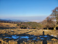
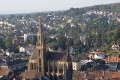
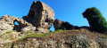
Starting from the Kattenbach car park, a pleasant climb via the Croix du Rangen, through the vineyards, passing through Waldkapelle, Pastetenplatz and the Becherkopf shelter, to Camp Turenne – a historic site – and the Ostein rock, renowned for its views over the Thur Valley and the surrounding peaks. Return via theGR®5, passing Camp des Pyramides, Place des Canaries, the Col de Grumbach and the Ruins of Engelbourg (the Witch’s Eye) overlooking Thann to enjoy the view.

Details

n°46066405
Creation:
Last update:
Last review:
  • Walking
    Activity: Walking
  • ↔
    Distance: 8.74 mi
  • ◔
    Average duration: 5h 40 
  • ▲
    Difficulty: Moderate

  • ⚐
    Back to start: Yes
  • ↗
    Ascent: + 1,900 ft
  • ↘
    Descent: - 1,880 ft

  • ▲
    Highest point: 2,982 ft
  • ▼
    Lowest point: 1,204 ft

Description of the walk

Car park at Kattenbach, at the end of Rue du Kattenbachi in Thann.

(S/E) From the car park, head north-east to the crossroads; take thefirst path on the right – unmarked – towards the Croix du Rangen.

(1) Follow the path on the left, which climbs through the vineyard, until you reach a Fork in the road.

(2) Take the path climbing up to the left through the vineyards until you reach another fork.

(3) Take the left-hand path and continue to a hairpin bend.

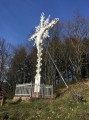
(4) Turn left at the hairpin bend. As you approach the Croix du Rangen, take the signposted path on the right, marked with a Green Cross and a Red Ring. When the path becomes a forest track, head up to the right.

(5) When the path becomes a forest track, take the path climbing to the right and head towards a junction of marked paths leading to the Waldkapelle.

(6) Turn onto thesecond forest track on the left, marked with a red and white Rectangle and a Blue Ring, and follow it to the next fork.

(7) At the junction, leave the forest track and follow the signposted path (same markings) to the right until you reach the junction with another signposted path.

(8) At the junction of the footpath and the signposted tracks, turn right towards the nearby Pastetenzplatz.

(9) Turn left onto the path marked with red and white rectangles and head up towards the Becherkopf shelter.

(10) Continue along the ascending forest track which leads to Camp Turenne.

(11) Take thesecond path on the left to reach the Rocher d’Ostein viewpoint.

(12) Retrace your steps back to the junction of paths at Camp Turenne.

(11) Take thefirst path (GR®5) on the far right to descend to Camp des Pyramides.

(13) Take thesecondpath on the right, signpostedGR®5, towards the Col de Grumbachite and arrive at the Place des Canaries.

(14) Continue straight on, following the sameGR®5markings, to reach the Col de Grumbach.

(15) Take thesecond path on the right, signpostedGR®5, towards the ruins.

(16) Following theGR®5, turn right at a right angle and carry on to reach the entrance to the ruins of Engelbourg Castle.

(17) At the junction of the signposted paths, take the path on the right which climbs towards the ruins of Engelbourg Castle, known as the ‘Witch’s Eye’.

(18) Retrace your steps.

(17) Turn right and walk for 50 metres to reach a track.

(19) Turn left onto this track and continue downhill until you reach the bend in the track.

(20) Leave the main road and take the footbridge on the left to reach the Kattenbach car park (S/E).

Waypoints

  1. S/E : mi 0 - alt. 1,214 ft - Car park at Kattenbach
  2. 1 : mi 0.31 - alt. 1,266 ft - Junction with a signposted footpath
  3. 2 : mi 0.55 - alt. 1,391 ft - Path junction in the vineyard. Near the - La Thur
  4. 3 : mi 0.71 - alt. 1,496 ft - Path junction in the vineyard
  5. 4 : mi 0.79 - alt. 1,552 ft - Hairpin bend
  6. 5 : mi 1.04 - alt. 1,614 ft - Crossroads near the - Croix du Rangen
  7. 6 : mi 1.92 - alt. 1,893 ft - Waldkapelle
  8. 7 : mi 2.38 - alt. 2,083 ft - Junction of signposted trails. Elevation 635
  9. 8 : mi 3.16 - alt. 2,546 ft - Junction of marked footpaths
  10. 9 : mi 3.22 - alt. 2,559 ft - Elevation 778 - Pastetenplatz
  11. 10 : mi 3.78 - alt. 2,795 ft - Abri du Becherkopf
  12. 11 : mi 4.37 - alt. 2,982 ft - Camp Turenne monument. Return route junction
  13. 12 : mi 4.5 - alt. 2,917 ft - Rocher d'Ostein
  14. 13 : mi 5.77 - alt. 2,582 ft - Camp des Pyramines
  15. 14 : mi 6.6 - alt. 2,133 ft - Place des Canaries – path junction
  16. 15 : mi 6.86 - alt. 1,909 ft - Col du Grumbach
  17. 16 : mi 7.11 - alt. 1,919 ft - Junction of marked and unmarked paths
  18. 17 : mi 8.18 - alt. 1,378 ft - Crossroads. Return trip to the castle
  19. 18 : mi 8.23 - alt. 1,437 ft - Witch’s Eye. Ruins of the - Château de l'Engelbourg
  20. 19 : mi 8.32 - alt. 1,368 ft - Junction of signposted paths
  21. 20 : mi 8.7 - alt. 1,207 ft - Crossroads near the footbridge
  22. S/E : mi 8.74 - alt. 1,211 ft - Car park at the start

Notes

Picnic area with tables and benches at Waldkapelle and, in particular, at Camp Turenne.
Possible shelters include the one at Rehbrunnel near Wotan’s Oak close to Pastetenplatz and the one at Becherkopf;

Worth a visit

Camp Turenne: this site was formerly known as Thomannsplatz (Thomann Square) when Alsace was part of the German Empire (from France’s defeat in 1871 until the end of theFirst World War) and became Camp Turenne during that war. This site quickly became strategic for the French army during the fighting at Steinbach and during the terrible and bloody Battle of Hartmannswillerkopf (HWK – known as the ‘man-eater’).
This site served as an observation post for monitoring enemy lines from the nearby Ostein rock below, as a supply point for ammunition and provisions – as it was supplied via a cable from the Baerenthal sector below – and, from mid-1915, as a surgical hospital for the wounded who could not be transported.

Camp des Pyramides: this camp was one of the French camps around the Hartmannswillerkopf, following the French army’s occupation of the Thur Valley in 1914. There are no pyramids at Camp des Pyramides; the camp’s name relates to the history of the regiments that took part in the Battle of the Pyramids alongside the French army commanded by Bonaparte.

Engelbourg Castle (Œil de la Sorcière): this castle was built in the 13th century by the Count of Ferrette to keep watch over the Thur Valley. Following the Treaties of Westphalia, which annexed Alsace to France, the border was pushed back from the Vosges to the Rhine and the castle lost its strategic importance. Louis XIV therefore ordered its dismantling in February 1673. After several attempts at demolition, the large tower of the keep broke into several pieces; one of these fell to the ground, forming what has come to be known as the ‘Witch’s Eye’ (source: Wikipedia).

Always be cautious and plan ahead when you're outdoors. Visorando and the author of this route cannot be held responsible for any accidents occurring on this route.

The GR® and PR® markings are the intellectual property of the Fédération Française de Randonnée Pédestre.

Reviews and comments

4.3 / 5
Based on 2 reviews

Reliability of the description
4.5 / 5
Ease of following the route
4.5 / 5
Route interest
4 / 5
agnes67640
agnes67640

Overall rating : 4.7 / 5

Date of your route : May 09, 2024
Reliability of the description : ★★★★★ Very good
Ease of following the route : ★★★★★ Very good
Route interest : ★★★★☆ Good
Very busy route : Yes

A lovely walk, mainly along lovely little shaded paths

Machine-translated

resark68310
resark68310

Overall rating : 4 / 5

Date of your route : Apr 29, 2024
Reliability of the description : ★★★★☆ Good
Ease of following the route : ★★★★☆ Good
Route interest : ★★★★☆ Good
Very busy route : No

Machine-translated

Other walks in the area

For more walks, use our search engine .

The GPS track and description are the property of this route's author. Please do not copy them without permission.