Country:

 City:
City:


Start from the Malvaux car park, near the holiday camp.
(S/E) Set off due north, following theGR®®5signposting.
(1) Continue straight on, leaving the buildings on your left.
(2) Cross the D465 with care and take the path leading uphill opposite. Shortly afterwards, enjoy the view of the Rummel Waterfall.
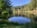
(3) At the junction with a forest track, leave theGR®®5and turn left, crossing the stream. Follow the Yellow Disc markings and walk alongside the Étang des Roseaux.
(4) At the Refuge de la Grande Goutte, take the path leading uphill to the right, continuing to follow the Yellow Disc markings.
(5) At the junction, take the signposted path on the right, then, at the next junction, turn right, still following the Yellow Disc markings.
(6) Take the Yellow Disc-marked path on the left. At the Col du Ballon monument, continue to the D465 road.
(7) Cross the road carefully and turn right, heading towards the Ferme du Ballon. (From the road crossing, it is possible to make an easy climb to the summit of the Ballon d’Alsace via the Statue of Joan of Arc, the summit orientation table and the Virgin of the Ballon (additional elevation gain: 75m)). Below the Ferme du Ballon, join theGR®®5trail which descends from the summit, cross the Bérézina and, just as the D465 veers to the right, continue straight on, following the Yellow Disc andGR®®5markings, until you reach a picnic area.
(8) Continue due south and descend the Manneheimer ski run, then pass at the foot of the Tête des Redoutes ski run.
(9) Cross the D466 – always taking care – before the footbridge spanning it at La Gentiane, then walk alongside the buildings and follow the path south-east towards the Ferme-auberge du Wissgrut, crossing a track and a ski lift at La Gentiane.
(10) Follow theGR®®5signposting. (Shortly afterwards, you can opt to climb up to see the Vierge du Wissgrut and then descend back down towards the Ferme-auberge du Wissgrut).
(11) At the Ferme-auberge du Wissgrut, take the signposted path on the right (GR®®5markings) which leads into the woods.
(12) At the junction of the marked Gros Hêtre trails, head down to the right, following the Blue Triangle markings.
(13) At the Col du Houx, turn left, continuing to follow the Blue Triangle markings. Cross a forest track.
(14) At the junction with the forest track, near the Goutte des Forges, follow the track to the right, marked with a Yellow Triangle. About 300 m further on, leave the forest track and follow the path marked with a Yellow Triangle, slightly to the right. Cross the kennel enclosures.
(15) After the kennels, continue straight on, following the same markings. (Until recently, the path marked with Yellow Triangles turned left before the markings were removed. The IGN map base still needs updating for this section to reflect the current markings).
At the junction with the D465, follow the road to the right, pass beneath the Roche du Cerf, and continue to the bridge over the Savoureuse. Take great care with traffic on this short stretch as the verge is narrow, or even non-existent.
(16) Just after the bridge, turn right and walk alongside the Syndicat des Eaux’s land, cross the river again and turn left, passing close to the Saut de la Cuvotte and reaching the Malvaux car park, near the holiday camp (S/E).


 Visorando Member

 Local authority
 Difficult
 Not specified