Country:

 City:
City:


Car park on Rue de l’Église, by the fountain.
(S/E) Take the street that runs alongside the Savoureuse and use the footbridge to cross the river.
(1) Cross the county road and take the street leading uphill (marked with a Blue Ring). At the Fork in the road, take the path passing under the house on the right and head uphill into the forest.
(2) Leave the signposted path and carry on straight ahead, then follow the path to the left.
(3) At the junction below the Mont-Jean farmhouse inn, where there is a tarmac road, turn right, then immediately afterwards take the path leading uphill to the right. At the following junctions, go straight on, then join a signposted path (marked with a Red Rectangle and a Yellow Disc) and follow it to the left. Continue straight on all the way to the Col du Chantoiseau.
(4) At the Col du Chantoiseau, climb up behind the shelter and turn right (marked with a Red Triangle) towards the Roches du Serpent.
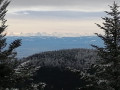
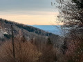
(5) Magnificent views from the Roches du Serpent, with the possibility of seeing the Bernese Alps (Eger, Munsch, Jungfrau...). Continue along the path marked with Red Triangles.
(6) Shortly afterwards, turn left towards the Tremonkopf (marked with a Red Rectangle) without descending towards the Col sans Nom. Climb up to the Tremonkopf and continue towards the Wissgrut farmhouse inn, crossing Les Plaines.
(7) At the Wissgrut farmhouse inn, continue to follow the Red Rectangle markings.
(8) At the Vierge du Wissgrut, a magnificent viewpoint. Carry on, still following the Red Rectangle markings, along the edge of the forest to the Gentiane ski run.
(9) At the Gentiane car park (start of the ski runs), take the path marked with the Blue Disc.
(10) At the chalet, carry straight on, ignoring the signposted path to the right, then emerge from the forest and rejoin the original route. This circular route towards La Gentiane can be omitted to reduce the distance and save time.
(7) At the Wissgrutt farmhouse inn, carry on following the Red Rectangle markings along the path on the right, heading down towards the forest entrance in the direction of the Gros Hêtre.
(11) At the Gros Hêtre, continue down slightly to the right (Blue Triangle signposting).
(12) At the Col du Houx, turn left and continue down the forest track.
(13) Follow it to the left, then quickly take a path leading down to the right until you are running alongside the Goutte des Forges (stream). Then take the forest road, heading down to the right for 500 m (marked with a Yellow Triangle).
(14) Take the path on the right (note that the Yellow Triangle markings are difficult to see) and walk along the top of the kennel enclosure.
(15) Immediately after the end of the kennel enclosure, take the path on the left that leads down (marked with a Yellow Triangle) and then descend to the road (RD465) at the corner of the Auberge des Moraines.
(16) Cross the Route du Ballon d’Alsace opposite the Auberge des Moraines and take the path between two hedges, which is unmarked at the start from the road. Walk down between the built-up plots to the sawmill and turn left. At the next junction, take the path on the right and cross the Savoureuse via a wooden footbridge to join the signpostedGR®® 5 (red and white) trail.
(17) At the junction with theGR®® 5, take this path on the left. Walk alongside two ponds. The path becomes a track and then a tarmac road. After thefirst junction, continue alongside the football pitch.
(18) Leave the road (Rue de la Charrière) and turn left onto the signposted path (GR®® Red and White) towards the village of Lepuix, following the Savoureuse. At the junction with Rue du Moulin, turn left and you’ll soon reach the car park on Rue de l’Église (S/E).


 Visorando Member

 Very difficult
  Local authority
 Difficult