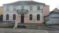
The Boundstone Trail from Nommay to Brevilliers in the Principality of Montbéliard

In addition to the Historical Trail of the Boundary Stones of the Principality of Montbéliard, which runs between Villars-lès-Blamont and Bussurel, this circular walk starting from Nommay follows thethird stage of the Historical Trail of the Boundary Stones on its outward leg.
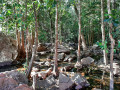
This easy walk, in addition to its historical interest, passes through beautiful forests with open undergrowth, spanning three departments of Franche-Comté and situated in the immediate vicinity of the towns of Belfort and Montbéliard.

Details

2839228
Creation:
Last update:
Last review:
  • Walking
    Activity: Walking
  • ↔
    Distance: 10.78 mi
  • ◔
    Average duration: 5h 35 
  • ▲
    Difficulty: Moderate

  • ⚐
    Back to start: Yes
  • ↗
    Ascent: + 699 ft
  • ↘
    Descent: - 682 ft

  • ▲
    Highest point: 1,404 ft
  • ▼
    Lowest point: 1,096 ft
  • ⚐ Country: France
  • ⚐ City: Nommay (25600)
  • ⚑
    Start/End: N 47.541189° / E 6.844193°
  • ❏
    IGN map(s): Ref. 3621OT
  • Hour-by-hour weather

Description of the walk

(S/E) At the top of Rue sous les Coteaux in Nommay, at the edge of the tarmac, continue straight ahead. Pass under the high-voltage power lines.

(1) Turn left.

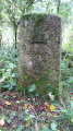
(2) You’ll reach the first boundary stones, nos. 205 and 206, situated side by side with an information sign. Carry on straight ahead.

(3) At the junction with a forest track, carry on straight ahead. Then, after a few hundred metres, leave the forest track which branches off to the right.

(4) Turn left before the high-speed rail line (LGV) to pass underneath it 400 metres further on.
200 m after the high-speed rail line, turn right to rejoin the GR®5. On this section, there are two boundary stones (dated 1764 and 1761).

(5) At the junction with theGR®5, turn right (Blue Triangle markings). Continue for 500 m.

(6) At this point, there is a triangular boundary stone marking the border between three departments: Haute-Saône, Territoire de Belfort and Doubs (the Seigneurie d’Héricourt, the County of Belfort and the County of Montbéliard in the 17th and 18th centuries).
Turn left uphill (Blue Triangle signposting).

(7) Historic boundary stone; continue straight ahead.

(8) At the crossroads, turn right (Blue Triangle signposting).

(9) At this other junction, continue left, heading downhill.

(10) At the junction with a forest track, turn left.

(11) Junction with access to the dolmen (indicated by a sign).
Turn left (marked with a Red Triangle). Continue to the sheltered dolmen.

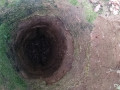
(12) Brévilliers dolmen.

(13) Junction withthe GR®5. Turn left onto the forest track (GR®5markings) and follow the markings to a crossroads you have already passed on the way there.

(5) Turn left then carry on straight ahead to a junction you have already passed on the way there.

(6) Carry on straight ahead.

(14) Junction with a forest track before the tunnel under the high-speed rail line.
Carry on straight ahead under the high-speed rail line until you reach the recycling centre.

(15) Turn right, leaving theGR®. Pass under the power lines.

(16) Turn right twice.

(17) At the crossroads, turn right; then, under the high-voltage power line, turn left and follow it for 250 m. After thefirst climb, continue straight on down the slope at thefirst junction and climb back up under the high-voltage power line, then turn right at the boundary of the municipality and follow an unmarked path through the forest.

(1) At the junction with the outbound path, turn left and retrace your steps to the Rue sous les Coteaux de Nommay (S/E).

Waypoints

  1. S/E : mi 0 - alt. 1,099 ft - Starting point: Rue sous les vignes, Nommay
  2. 1 : mi 0.74 - alt. 1,171 ft - Junction with the A/R route
  3. 2 : mi 0.86 - alt. 1,247 ft - Markers 205 and 206
  4. 3 : mi 1.61 - alt. 1,273 ft - Junction with a forest track
  5. 4 : mi 2.56 - alt. 1,224 ft - On the left, before the high-speed rail line
  6. 5 : mi 3.02 - alt. 1,211 ft - Junction with the A/R route
  7. 6 : mi 3.29 - alt. 1,188 ft - Junction with the A/R route
  8. 7 : mi 3.49 - alt. 1,224 ft - Historic boundary stone
  9. 8 : mi 3.76 - alt. 1,276 ft - Junction of marked trails
  10. 9 : mi 4.18 - alt. 1,257 ft - Junction of marked trails
  11. 10 : mi 4.31 - alt. 1,207 ft - Junction of marked trails and paths
  12. 11 : mi 5.2 - alt. 1,365 ft - Junction with the dolmen trail
  13. 12 : mi 5.4 - alt. 1,404 ft - Dolmen des Issières
  14. 13 : mi 5.89 - alt. 1,296 ft - Junction of marked trails
  15. 14 : mi 7.95 - alt. 1,178 ft - Crossroads. Passage beneath the high-speed rail line (LGV)
  16. 15 : mi 8.74 - alt. 1,188 ft - Junction of footpath and road. End of GR signposting.
  17. 16 : mi 9.15 - alt. 1,194 ft - Crossroads after the power line
  18. 17 : mi 9.52 - alt. 1,152 ft - Crossroads (trees)
  19. S/E : mi 10.78 - alt. 1,102 ft - Finish: Rue sous les coteaux – Nommay

Notes

The boundary stones: history
Until the 18th century, the town of Montbéliard was part of the Holy Roman Empire. The name ‘Principality of Montbéliard’ dates from the 15th century. Throughout this route, you can discover the boundary stones that bear witness to the upheavals in the history of this region.
The boundary stones bear a coat of arms on each side: the Bear of Bern, a bishop’s crozier from Basel, three fleurs-de-lis for the King of France, and three pairs of deer antlers for the County of Montbéliard.
As for Belfort, it became French during the Thirty Years’ War (16th century). After Louis XIV gifted Belfort, along with the seigneury of Delle, to Cardinal Mazarin, the boundary stones along this border came to bear Mazarin’s coat of arms: a battle-axe with three stars, sometimes surmounted by a ducal crown. These boundary stones are sometimes referred to as ‘Mazarines’.

The sheltered dolmen at Brevilliers is the remains of a burial site dating from between 3,400 and 2,300 years before Christ.

It is the Randonnée Hérimoncourtoise that has signposted and maintains the Historic Trail of the Boundary Stones of the Principality of Montbéliard.

Always be cautious and plan ahead when you're outdoors. Visorando and the author of this route cannot be held responsible for any accidents occurring on this route.

The GR® and PR® markings are the intellectual property of the Fédération Française de Randonnée Pédestre.

Reviews and comments

4.3 / 5
Based on 3 reviews

Reliability of the description
4.7 / 5
Ease of following the route
4.3 / 5
Route interest
4 / 5
fredmotard
fredmotard

Overall rating : 4.3 / 5

Date of your route : Apr 29, 2024
Reliability of the description : ★★★★★ Very good
Ease of following the route : ★★★★☆ Good
Route interest : ★★★★☆ Good
Very busy route : Yes

Just a walk where you can keep your feet dry in very muddy areas

Machine-translated

kristianbdr
kristianbdr

Overall rating : 4.7 / 5

Date of your route : Jan 08, 2024
Reliability of the description : ★★★★★ Very good
Ease of following the route : ★★★★★ Very good
Route interest : ★★★★☆ Good
Very busy route : No

A lovely walk, with the highlight being the discovery of the boundary stones of the Principality of Montbéliard and the descriptions of the region’s historic coats of arms.... Thanks to the Herimoncourtois club for signposting and maintaining part of the route, and to the creator of this route...

Machine-translated

Pinkies
Pinkies

Overall rating : 4 / 5

Date of your route : Sep 18, 2023
Reliability of the description : ★★★★☆ Good
Ease of following the route : ★★★★☆ Good
Route interest : ★★★★☆ Good
Very busy route : No

We didn’t complete the entire route because of the total distance involved. At point 6, we headed straight to point 14 for the return journey; it’s still an 11-kilometre hike that ends up being mostly in direct sunlight, so it’s best avoided on very hot days. The route features numerous short, steep sections where you need to be careful as there may be mountain bikes about.

Machine-translated

Other walks in the area

For more walks, use our search engine .

The GPS track and description are the property of this route's author. Please do not copy them without permission.