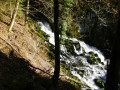
Cirque de Consolation circular walk, taking in viewpoints and balcony-style paths

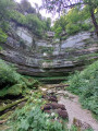
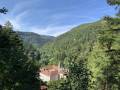
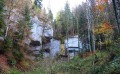
From the car park at the Monastère de Consolation, explore the Cirque and the Val de Consolation, with its many springs (Dessoubre, Lançot, Tabourot and Noire), via the viewpoints at La Roche du Prêtre, Chauve Roche and La Roche Sainte-Catherine, and its balcony-style paths winding through rocky outcrops, offering breathtaking views.

Details

95972552
Creation:
Last update:
Last review:
  • Walking
    Activity: Walking
  • ↔
    Distance: 9.40 mi
  • ◔
    Average duration: 6h 15 
  • ▲
    Difficulty: Difficult

  • ⚐
    Back to start: Yes
  • ↗
    Ascent: + 2,198 ft
  • ↘
    Descent: - 2,178 ft

  • ▲
    Highest point: 2,844 ft
  • ▼
    Lowest point: 1,637 ft

Description of the walk

The starting car park is that of the Monastère de Consolation.

(S/E) Walk uphill along the road, following the ‘Roche du Prêtre’ signposts, then, before a bridge over the Dessoubre, take the path on the right, continue along the road and pass beneath the restaurant.

(1) Walk straight up to the Source du Dessoubre.

(2) Head back down to the fork in the road.

(1) Follow the road to the left for a few dozen metres, then take the path on the left which zigzags uphill, then follow the D39 until you reach the end of the bend on the right-hand side of the road and turn left.

(3) Take the path on the right across the stream and climb up the valley alongside the stream to La Scie Dessus.

(4) Turn left. At the next signposted junction, after the cattle grating, continue to the right and climb up to the Roche du Prêtre viewpoint.

(5) From the viewpoint, carry on to the junction a few hundred metres past the car park.

(6) At the junction, turn left, cross the meadow and join the D41a.

(7) Follow it to the left until you reach the entrance to Mont-de-Laval.

(8) At the junction, turn left and carry on until you reach a path on the left.

(9) Take this track, which leads to the Chauve Roche viewpoint.

(10) Turn back at the fork in the path.

(9) Turn left and head down to the next junction.

(11) At the junction, carry on straight ahead until the next junction of paths.

(12) Carry on straight ahead, ignoring the “Source Noire” signposting. In this section, up to near point (13), walkers are warned of the risk (a real one, as observed on the ground in the middle of August) of rockfalls.

(13) Please note that after the Grande Grotte and the Source du Lancot, the path deviates from the route shown on the IGN map, passing higher up.

(4) At the junction, turn right and take the path you came along in the opposite direction, heading uphill to the D39.

(3) At this junction, take the path signposted “Circular Sainte-Catherine” on the right, before the road. Continue to the Sainte-Catherine viewpoint.

(14) From the viewpoint, walk a few metres uphill and turn left. Go downhill and then cross the Ruisseau du Lançot via a footbridge.

(15) Turn left, then cross the stream a second time before reaching the monastery garden, which you should walk through before turning right to reach the car park (S/E).

Waypoints

  1. S/E : mi 0 - alt. 1,637 ft - Car park below the monastery
  2. 1 : mi 0.41 - alt. 1,923 ft - Junction
  3. 2 : mi 0.45 - alt. 1,969 ft - Source of the - Dessoubre (rivière)
  4. 3 : mi 0.67 - alt. 2,087 ft - Junction with marked trails
  5. 4 : mi 1.12 - alt. 2,201 ft - Junction of the circular loop
  6. 5 : mi 1.95 - alt. 2,762 ft - Roche du Prêtre orientation table
  7. 6 : mi 2.26 - alt. 2,802 ft - Junction with marked trails
  8. 7 : mi 3.22 - alt. 2,802 ft - D41a road
  9. 8 : mi 4.4 - alt. 2,661 ft - Mont-de-Laval
  10. 9 : mi 5.22 - alt. 2,467 ft - Junction
  11. 10 : mi 5.34 - alt. 2,434 ft - Belvédère de Chauve Roche
  12. 11 : mi 5.88 - alt. 2,057 ft - Junction with marked trails
  13. 12 : mi 6.32 - alt. 1,864 ft - Junction with marked trails
  14. 13 : mi 6.85 - alt. 1,831 ft - Large cave - Source du Lançot
  15. 14 : mi 8.47 - alt. 1,870 ft - Belvédère Sainte-Catherine
  16. 15 : mi 8.92 - alt. 1,663 ft - Footbridge
  17. S/E : mi 9.4 - alt. 1,637 ft - Car park below the monastery

Notes

A challenging route with a few exposed sections, to be undertaken in good weather only.

The route features several exposed sections, including a number of metal ladders on the ascent, and there is a risk of rockfall between points (12) and (13) in particular.

The Roche Sainte-Catherine circular route features a few technical sections but poses little danger.

There is a village hall available as shelter 150 m past the point (8) on the way towards the centre of Mont-de-Laval, on the right before the church. A picnic area with tables is located 400 to 500 m past the point (8) in a communal orchard equipped with facilities on the left-hand side of the path.

Worth a visit

Enjoy the magnificent views of the cirque (Roche du Prêtre, Chauve Roche, Roche Sainte-Catherine, etc.) and the Val de Consolation, as well as from the section of the path running along the cliff ledge between points (11) and .

Other walks in the area

For more walks, use our search engine .

The GPS track and description are the property of this route's author. Please do not copy them without permission.