


alainc5939

 Visorando Member
 Premium user
- Location: Moirans-en-Montagne (39260)
- Gender: man
Sign up:
Published route(s)
 Exploring the forests of Baltmannsweiler
 9.61 mi
 +659 ft
 -669 ft
 5h 00
 Moderate
 Departure from Baltmannsweiler (Regierungsbezirk Stuttgart)
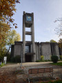
This circular walk, starting from the church in Baltmannsweiler, allows you to explore the wooded and undulating landscapes of Baden-Württemberg, east of Stuttgart. The route mainly follows wide forest paths that wind through unspoilt countryside, perfect for relaxation and observing the surroundings.
Presenting no particular difficulty, this route will appeal to nature walkers seeking tranquillity and authenticity. A lovely getaway in the heart of the Swabian forests, ideal for getting away from it all for a few hours and discovering a remarkable natural heritage on the outskirts of Stuttgart.
Through forests and panoramic views around Baltmannsweiler
 6.90 mi
+935 ft
-938 ft
4h 00
Moderate
Departure from Baltmannsweiler (Regierungsbezirk Stuttgart)
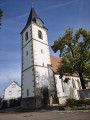
This circular walk invites you to explore the eastern slopes of Baltmannsweiler, in the heart of the rolling landscapes of the Schurwald. Alternating between peaceful forest paths, sun-drenched woodland edges and open views of the Swabian countryside, the route offers a different perspective on the region.The route takes you through vast wooded areas dotted with remarkable trees and places steeped in history. Combining religious heritage, unspoilt nature and a typically Württemberg atmosphere, this walk allows you to appreciate the full diversity of the landscapes surrounding Baltmannsweiler.A pleasant circular walk, with no major difficulties, ideal for immersing yourself in the tranquillity of the Schurwald forests whilst enjoying some beautiful views of the surrounding hills.
The rediscovered Gorges de l’Abîme, at the heart of an exceptional Jura canyon
 0.91 mi
+354 ft
-358 ft
0h 45
 Difficult
Departure from Saint-Claude (Jura)
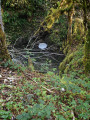
Long closed for safety reasons, the spectacular Gorges de l’Abîme, near Saint-Claude, now reveal a whole new side to themselves. After several years of development and works, this remarkable natural site is once again accessible thanks to a fully secured trail that allows visitors to experience, up close, one of the most impressive landscapes in the Haut-Jura.
As you follow the path, you’ll walk amongst steep cliffs, rock faces sculpted by water and specially designed sections offering breathtaking views of the deep canyon carved out by the torrent. This walk combines the untamed beauty of an environment that was long difficult to access with the pleasure of a comfortable and safe exploration. With its geological heritage, woodland atmosphere and the roar of the water echoing at the bottom of the gorges, the route invites you to immerse yourself in the heart of one of the Jura’s most iconic natural sites.
Circular loop above Moirans-en-Montagne
 6.09 mi
+879 ft
-883 ft
3h 35
Moderate
Departure from Moirans-en-Montagne (Jura)
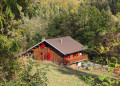
This circular walk starting from Moirans-en-Montagne takes you to one of the finest viewpoints overlooking the town. After a steady climb through the forest, Mont Saint-Christophe offers an exceptional view of Moirans-en-Montagne and Lake Vouglans. A second viewpoint rounds off this exploration of the hills before a pleasant return to the town centre.
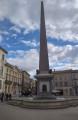
An easy, step-by-step discovery of Arles' heritage
 2.06 mi
+36 ft
-39 ft
1h 00
 Easy
Departure from Arles (Bouches-du-Rhône)
Arles, a city of art and history, is perfect for a short but intense urban stroll. This short route takes you through the must-see sites of the old town: from the ancient theatre to the Roman arena, passing through narrow streets bathed in Provençal light. An easy walk, ideal for strolling between heritage sites and Mediterranean atmosphere.
 Spirituality, flamingos and sea salt at Saintes-Maries-de-la-Mer
 7.35 mi
+3 ft
-3 ft
38min
Moderate
Departure from Saintes-Maries-de-la-Mer (Bouches-du-Rhône)
A circular loop in the heart of Saintes-Maries-de-la-Mer, between living traditions and vibrant nature. Around the fortified church, guardian of gypsy legends, the route winds its way through lively alleys, wild beaches and salt marshes. The song of the seagulls accompanies your steps, while flamingos, like quiet sentinels, dot the horizon. This easy route, accessible to all, invites you to slow down, contemplate and feel the soul of the Camargue in all its diversity: between spirituality, biodiversity and Mediterranean light.
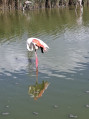
Immersion in the Pont de Gau Ornithological Park
 3.25 mi
+3 ft
-3 ft
1h 30
Easy
Departure from Saintes-Maries-de-la-Mer (Bouches-du-Rhône)
This easy circular takes you to the heart of one of the jewels of the Camargue: the Pont de Gau Ornithological Park, located a few kilometres from Saintes-Maries-de-la-Mer. Between marshes, reed beds and lagoons, the trail winds through a landscape shaped by water and wind, offering a total immersion in the world of migratory birds.Flamingos, herons, egrets and sometimes even rarer species can be seen by walkers, often just a few metres away. Discreet observatories are dotted along the route, allowing you to watch without disturbing the birds.Beyond birdwatching, this hike is an invitation to slow down, listen to the rustling of wings and the song of the marshes. A timeless interlude, where the Camargue reveals its wild and poetic soul.Admission fee
Discover Aigues-Mortes, a city that comes alive with every step you take
 2.47 mi
+7 ft
-7 ft
1h 10
Easy
Departure from Aigues-Mortes (Gard)
In the heart of the Camargue, Aigues-Mortes unfurls its ramparts like an open book on history. This easy stroll invites you to wander among medieval towers, cobbled streets and salt reflections, where every stone seems to whisper tales of the Crusades and the marshes. A charming urban getaway, where you walk as much in the past as in the present, with the added bonus of a few lively surprises around every corner.
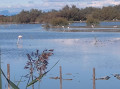
Wild scorpion beetle: a Camargue symphony
 3.10 mi
+3 ft
-3 ft
1h 25
Easy
Departure from Vauvert (Gard)
In the heart of the Petite Camargue, this easy circular invites you to immerse yourself in the vibrant world of the Scamandre Nature Reserve. Between rustling reed beds, sparkling ponds and footbridges on stilts, the trail unfolds like a musical score where each step reveals a new note of wildlife.This trail winds through a preserved landscape, a refuge for many species of birds, including the elegant little egret, the mischievous cattle egret and the flamingo. Discreet observatories punctuate the walk, offering moments of tranquillity to contemplate without disturbing.
Les Baux-de-Provence, Carrières des Lumières: between stone and light
 2.30 mi
+374 ft
-354 ft
1h 25
Easy
Departure from Les Baux-de-Provence (Bouches-du-Rhône)
Perched on its rocky outcrop, the village of Les Baux-de-Provence welcomes you like a life-size film set. Here, every cobbled street and every sculpted façade seems to whisper centuries of history. Stroll among the stone houses, Renaissance mansions, discreet chapels and ramparts overlooking the valleys. The view of the Alpilles is breathtaking.As you climb to the heights, the Château des Baux offers you a glimpse into medieval times: a fortress carved into the rock, war machines and breathtaking views of the heath. It reveals the village's warrior spirit.And to end the day on a high note, head to the Val d'Enfer, just below. There, the Carrières des Lumières await you for a unique, almost magical sensory experience that prolongs the emotion of the village in another register: that of living art.
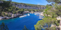
Between sea and limestone: a gentle circular to the Calanque de Port-Miou
 4.85 mi
+331 ft
-331 ft
2h 30
Moderate
Departure from Cassis (Bouches-du-Rhône)
From the picturesque heart of Cassis, this easy circular takes you to discover the Calanque de Port-Miou, the easternmost of the famous calanques in the National Park. The trail runs along the coastline, offering beautiful views of the white cliffs of Cap Canaille and the turquoise waters of the Mediterranean. After strolling along the natural harbour of Port-Miou, lined with sailing boats and maritime pines, the return to Cassis is a gentle walk along urban paths and shaded passages. A hike accessible to all, ideal for a warm-up or a contemplative getaway.
Between sails and old stones in Saint-Tropez
 3.40 mi
+151 ft
-151 ft
1h 40
Easy
Departure from Saint-Tropez (Var)
This walk begins on the bustling quays of Saint-Tropez, where the hulls of boats dance to the rhythm of the reflections. We walk along the jetty to the lighthouse, a red sentinel facing the horizon, before returning along the seafront, between sunny terraces and pastel-coloured façades. Then, you climb up to the old town, with its cobbled streets, flower-filled balconies and memories of a fishing village that has become legendary. An easy circular loop, between sea splashes and Provençal memories, ideal for strolling along the water's edge and through time.
Ramatuelle, to the rhythm of cicadas and old stones
 1.62 mi
+197 ft
-197 ft
0h 55
Easy
Departure from Ramatuelle (Var)
Nestled in the hills above the Gulf of Saint-Tropez, the village of Ramatuelle offers a timeless escape. This walk invites you to stroll through its narrow streets, lined with houses with ochre facades and pastel shutters, where every turn reveals a shaded square, a discreet fountain or a panorama of the Var hills.Along the way, you will discover the Church of Notre-Dame, the medieval ramparts and a few artisan workshops that perpetuate the Provençal spirit. The song of the cicadas accompanies your steps, while the scents of jasmine and fig trees awaken your senses. An ideal getaway for lovers of heritage, tranquillity and southern charm.
Through the narrow streets and memories of Pierrefeu-du-Var
 1.74 mi
+233 ft
-246 ft
1h 00
Easy
Departure from Pierrefeu-du-Var (Var)
Nestled against a rocky peak, Pierrefeu-du-Var reveals itself as a Provençal gem at the gateway to the Massif des Maures. This picturesque village invites you to stroll through its narrow streets, where every stone seems to whisper history. The route naturally leads to the site of Sainte-Croix, the spiritual and historical cradle of the commune.
L'Échappée Jurassienne
 193.43 mi
+24,944 ft
-24,242 ft
16 days
Difficult
Departure from Dole (Jura)
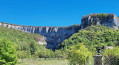
The Échappée Jurassienne is an invitation to discover, step by step, the striking diversity of the Jura Mountains. This 15-day itinerary links the west to the east, from the plains to the mountains, crossing the unspoilt landscapes of the Haut-Jura Regional Nature Park, far from the borders and close to the essentials.
From the peaceful canals of Dole, the trail winds its way through the most iconic sites of the Jura: the Cirque de Baume, lakes, remote valleys, viewpoints and deep forests, before ending majestically in Saint-Claude, a town nestled in the heart of the mountains.
Over the course of these 311 km, this itinerary becomes much more than a hike: it is a true distillation of the most exceptional things the Jura has to offer. The richness of the landscapes, the contrasts in altitude and the authenticity of the villages you encounter allow everyone to surpass themselves, immerse themselves fully in the wild beauty and reconnect with the essentials.
From Le Manon to Saint-Claude
 10.81 mi
+1,076 ft
-3,428 ft
5h 55
Moderate
Departure from Septmoncel (Jura)
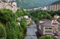
Sixteenth stage of the Échappée Jurassienne. For this last stage, you will reach Septmoncel before beginning a long descent along the Chemin des Moines to the Gorges du Flumen. Walking along the Flumen, Grosdar and Tacon rivers, you will arrive at Saint-Claude, nestled in the Jura Mountains at the confluence of the Bienne and Tacon rivers.
Saint-Claude is not only the capital of briar pipes: heir to a long tradition of craftsmanship, the town has built a reputation for woodturning and diamond and gemstone cutting. Tucked away at the bottom of its valley, the town stands out for its rugged natural environment and unique heritage attractions, such as Saint-Pierre Cathedral, the Pipe and Diamond Museum, Le Monde des Automates and the Abbey Museum, a hub for lovers of modern art.
Prémanon - Le Manon
 11.46 mi
+1,398 ft
-1,161 ft
6h 30
Difficult
Departure from Les Rousses (Jura)
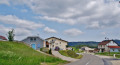
Fifteenth stage of the Échappée Jurassienne. In the heart of the Haut-Jura Regional Nature Park, this stage will quickly take you to the highest point, the Belvédère des Dappes. This is followed by a crossing of the Forêt du Massacre, rich in exceptional flora and fauna, with varied landscapes alternating between thick forests and open valleys. You will also discover some curiosities and pretty summer chalets. Enjoy this beautiful forest, taking care not to stray from the marked paths and trails to preserve the tranquillity of the area!
From the Combe à la Chèvre and its tall gentians, you will reach the village of Lajoux, home to the Haut-Jura Regional Nature Park.
Bellefontaine – Prémanon
 12.49 mi
+1,982 ft
-1,778 ft
7h 30
Moderate
Departure from Bellefontaine (Jura)
Fourteenth stage of the Échappée Jurassienne. For this stage, you will begin your adventure in Bellefontaine, a picturesque village nestled in the heart of the Jura. The hike will take you through the heights of the town of Morez and across the Bienne Valley, where you can admire spectacular views of the surrounding mountains. Along the way, you will reach Les Rousses, a welcoming town with authentic charm. Don't miss a visit to the Fort des Rousses, an impressive historical site that also houses the Comté cheese cellars, where you can discover how this renowned local cheese is made. From there, you will continue your descent to the Bief de la Chaille, a peaceful and enchanting place. The hike ends at the La Grenotte lodge in Prémanon, an ideal place to rest and enjoy the surrounding serenity.
From Foncine-le-Haut to Bellefontaine
 12.87 mi
+1,575 ft
-994 ft
7h 15
Difficult
Departure from Foncine-le-Haut (Jura)
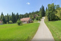
Thirteenth stage of the Échappée Jurassienne: discover the Jura Mountains on this stage between Haut-Jura and Haut-Doubs. Explore the cross-country ski trails of the Mont Noir massif, which are transformed into superb hiking trails in summer. Immerse yourself in a peaceful, unspoilt environment, where alpine flowers bloom alongside the woody scents of fir and spruce trees. Between the woods, valleys and ridges, enjoy the fresh air while admiring the picturesque landscapes.
This stage will also take you along the Bellefontaine and Mortes lakes, known for their peat bogs, which are home to remarkable flora and fauna.
From Chaux-des-Crotenay to Foncine-le-Haut
 12.62 mi
+1,998 ft
-1,765 ft
7h 35
Difficult
Departure from Chaux-des-Crotenay (Jura)
Twelfth stage of the Échappée Jurassienne. For this stage,prepare to be amazed by the wild and authentic beauty of the Jura as you let yourself be carried away by the water for a peaceful break, out of time.
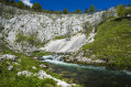
Follow the tumultuous course of the Saine River through theLangouette Gorges, then discover the village of Les Planches-en-Montagne and the spectacular Malvaux Gorges, where the Saine has formed the Cascade du Bief de la Ruine, the largest waterfall in the department with a drop of 110 metres. The river then winds its way under the viaduct of the old tramway towards Foncine-le-Bas, offering breathtaking natural landscapes.
Finally, cross the Mont Bayard at an altitude of over 1,000 metres for a remarkable view of the surrounding mid-mountain landscape. End your day with a descent to the village of Foncine-le-Haut, ideal for a restful and rejuvenating night.
From Menetru-en-Joux to Chaux-des-Crotenay
 10.27 mi
+2,182 ft
-1,273 ft
6h 35
Difficult
Departure from Menétrux-en-Joux (Jura)
Eleventh stage of the Échappée Jurassienne. Although relatively short,this stage is a veritable festival of natural sites, each more incredible than the last. It begins with the Hérisson waterfall trail, a refreshing escape along a picturesque path dotted with 31 waterfalls and 7 cascades, revealing breathtaking panoramas where the water flows majestically in an aquatic ballet.
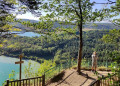
You then continue your journey by entering the Haut Jura Regional Nature Park via the plateau of the seven lakes. To round off this day full of discoveries, from the Pic de l'Aigle and the Belvédère des Quatre Lacs, you can enjoy not one but several breathtaking views of four of these turquoise lakes: the lakes of Ilay, Petit and Grand Maclu, and Narlay. Dominate the whole scene from the Pic de l'Aigle and the Belvédère des Quatre Lacs... There's no denying it, this stage is spectacular!
From Châtillon to Menétrux-en-Joux
 13.88 mi
+1,368 ft
-1,227 ft
7h 35
Difficult
Departure from Châtillon (Jura) (Jura)
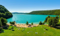
Tenth stage of the Échappée Jurassienne. For this stage starting from Châtillon, you will head towards the largest natural lake in the Jura: the magnificent Lac de Chalain. A true blue jewel surrounded by limestone rocks, the lake can be seen in all its splendour from the plateau, offering breathtaking panoramic views. You will then walk through stunning natural landscapes before reaching Menétrux-en-Joux, located near the famous Hérisson waterfalls. An adventure where every step will reveal enchanting and varied scenery!
Perrigny - Châtillon
 14.96 mi
+1,654 ft
-1,690 ft
8h 20
Difficult
Departure from Perrigny (Jura)
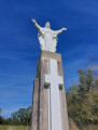
Ninth stage of the Échappée Jurassienne. This transitional stage marks the end of a region full of unexpected treasures, including salt mines, majestic forests, vineyards, charming villages and iconic remote areas, and takes you to the Pays des Lacs et des Cascades (Land of Lakes and Waterfalls). A winding balcony trail will take you to the first plateau with its pastures, farms and small villages. Overlooking the Ain valley, you will end this route in Châtillon, where you will catch a glimpse of the first foothills of the Jura.
From Blois-sur-Seille to Périgny
 10.44 mi
+1,604 ft
-1,027 ft
6h 10
Moderate
Departure from Blois-sur-Seille (Jura)
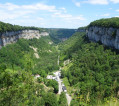
Eighth stage of the Échappée Jurassienne. This iconic stage gets off to a great start. From the bottom of the Blois-sur-Seille valley, you will climb back up to the plateau to reach the small village of Granges-sur-Baume, which overlooks the most beautiful valley in the Jura. From the Belvédère de Granges-sur-Baume, you will have a bird's eye view of the Baume-les-Messieurs valley and, after a steep descent, you will arrive in one of the "Most Beautiful Villages in France".Dominated by vertiginous cliffs, Baume-les-Messieurs, home to a 9th-century Cluniac abbey, nestles in the middle of three secluded valleys typical of the Jura landscape.As you follow the Dard river upstream, you will discover one of the most beautiful waterfalls in the Jura, the tufa waterfall of Baume-les-Messieurs, and, a little further on, the spectacular Baume caves.After another climb up to the plateau via the Crançot ladders and a walk through the Perrigny forest, you will end this stage not far from Lons-le-Saunier.
From Miéry to Blois-sur-Seille
 10.51 mi
+1,509 ft
-1,680 ft
6h 10
Difficult
Departure from Miéry (Jura)
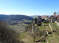
Seventh stage of the Échappée Jurassienne. After passing through the charming wine-growing villages of the Jura, such as Frontenay with its 12th-century castle and Menétru-le-Vignoble, you will discover Château-Chalon, a jewel of the Échappée Jurassienne. Listed as one of the "Most Beautiful Villages in France", this village is the birthplace of Vin Jaune and offers magnificent views.
Leaving Château-Chalon, you will descend into the remote village of Blois-sur-Seille, where you will discover a picturesque village with yellow stones and a peaceful river. Explore this charming village, admire its vernacular heritage (bridges, farms, shepherds' huts, mission crosses, oratory, fountains, etc.) and enjoy the Olympian calm. Don't miss the central square with its fountain featuring a statue of Joan of Arc, its horseshoe-making machine and its unique milk cable car.
Pupillin- Miéry
 13.72 mi
+2,218 ft
-2,608 ft
8h 15
Difficult
Departure from Pupillin (Jura)
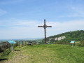
Sixth stage of the Échappée Jurassienne. This rugged stage starts in Pupillin and crosses forests and vineyards to Poligny, a former fortified town and religious capital of the Dukes of Burgundy. Poligny, looking to the future thanks to the Comté cheese industry, is home to the Maison du Comté and the headquarters of the Comité Interprofessionnel de Gestion du Comté. After a climb to the Croix du Dan, offering superb views of Poligny and the Culée de Vaux, the hike continues through the pastures and villages of the first plateau, where Montbéliard cows graze, before arriving in Miéry.
Arbois - Pupillin
 13.31 mi
+2,579 ft
-2,028 ft
8h 20
Difficult
Departure from Arbois (Jura)
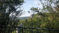
Fifth stage of the Échappée Jurassienne. This stage allows you to discover the remote valleys, particularly that of Planches-Près-Arbois, and to understand the geological phenomenon, with views from the Belvédère de la Roche du Feu. You will then descend to the bottom of the valley to reach the village of Planches-Près-Arbois and its tufa waterfall. Next, you will head towards the wine-growing village of Pupillin, the "World Capital of Ploussard", where you can explore its viewpoint, 19th-century church, Saint-Léger oratory and beautiful fountains.
Salins-les-Bains – Arbois
 12.48 mi
+2,365 ft
-2,457 ft
7h 50
Difficult
Departure from Salins-les-Bains (Jura)
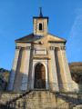
Fourth stage of the Échappée Jurassienne. Right from the start of this stage, things get serious with a demanding route punctuated by steep ascents and descents in the limestone massif of Revermont. Then, through undergrowth, pastures and picturesque viewpoints, the second part of the route reveals itself to be full of charm and tranquillity, offering a perfect transition before reaching Montigny-les-Arsures, a superb wine-growing village where the vineyards come into view. A few more kilometres will take you to Arbois, the capital of Jura wines. Louis Pasteur had his family home here, which is still open to visitors. This colourful town is full of Jura wine tasting cellars and great places to eat for food lovers.
From Arc-et-Senans to Salins-les-Bains
 13.63 mi
+968 ft
-686 ft
7h 05
Difficult
Departure from Arc-et-Senans (Doubs)
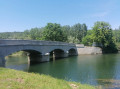
Third stage of the Échappée Jurassienne. From the Royal Saltworks in Arc-et-Senans to the Grande Saline in Salins-les-Bains, you will discover a unique sporting and cultural trail between the Doubs and Jura mountains, following in the footsteps of the great salt trade, with a stop in the village of Port-Lesney.
Dole - La Vielle Loye
 9.03 mi
+305 ft
-276 ft
4h 25
Moderate
Departure from Dole (Jura)
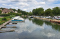
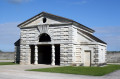
First stage of the Échappée Jurassienne. This stage starts off relatively easily. Leaving Dole station, you walk through the narrow streets of the town centre of Dole, birthplace of Louis Pasteur, nicknamed "Little Venice" because it is crossed by the River Doubs, which gives it all its charm.Then, inthe second part of the route, you will find some cool shade in the Chaux forest before reaching the village of Vieille-Loye, built in the heart of a cleared clearing, once part of thesecond largest deciduous forest in France.
La Vieille Loye - Arc et Senans
 10.94 mi
+164 ft
-164 ft
5h 10
Moderate
Departure from La Vieille-Loye (Jura)
Second stage of the Échappée Jurassienne. The first 12 kilometres of this route are sheltered by the Chaux forest. Pay close attention to the signposts so you don't get lost! As you leave the edge of the woods, you will discover an architectural gem: the village of Arc-et-Senans, home to the Royal Saltworks, which will take you on a journey through the history of salt in the Bourgogne-Franche-Comté region.
The headlands of the Gulf of Morbihan, on the Rhuys Peninsula
 16.22 mi
+141 ft
-161 ft
2 days
Difficult
Departure from Arzon (Morbihan)
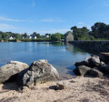
Set off on the ‘Balade des Pointes’ walk, a truly ever-changing spectacle shaped by the tides, cruise ships, pleasure craft and birds. This walking route on the Rhuys Peninsula offers, in two stages, magnificent panoramic views of the islands of the Gulf of Morbihan
Discover Châteauroux
 2.34 mi
+62 ft
-59 ft
1h 10
Easy
Departure from Châteauroux (Indre)
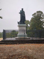
Châteauroux, set to host the shooting events at the 2024 Olympic Games, is the capital of South Berry. Boasting a wealth of unexpected heritage, ranging from the medieval to the contemporary, Châteauroux reveals its character through its churches, Château Raoul and the Cordeliers Convent... Its cobbled streets often lead to peaceful gardens, and the meandering River Indre is never far away, flowing freely through the heart of a town with a well-preserved environment, where it feels good to take your time.
From the Île de Saint-Cado to Pointe de Roquenec
 7.01 mi
+43 ft
-46 ft
3h 15
Moderate
Departure from Belz (Morbihan)
At the western end of Quiberon Bay, the Ria d'Étel, a stunning marriage of land and sea, stretches for over 22 km. This inlet is home to small authentic ports, secret beaches and famous oyster beds.
I invite you to discover the Île de Saint-Cado in Belz, a charming site in the heart of the Ria d'Étel. Cross the stone bridge to discover a delightful little village with its fishermen's houses and chapel. The islet of Nichtarguer will charm you at first sight: a pretty house with blue shutters, a real picture postcard of the Ria.
Then, at the foot of the Pont Lorois bridge, you will find the small Port Niscop. Follow the footpath and walk along this pretty, peaceful cove sheltered by the Ria d'Étel, which was once home to shipyards.
Île d’Arz, a hiker’s paradise
 6.58 mi
+39 ft
-39 ft
3h 05
Moderate
Departure from France
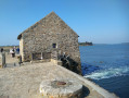
Come and set foot on this wild strip of land. With its gentle terrain and full of charm thanks to its varied landscapes, village and old manor houses weathered by time, Île d’Arz is a walker’s paradise. The coastal path takes you all the way round the island and offers superb views of the gulf. At Pointe du Berno, the tide mill built in the 16th century, restored by passionate volunteers, is now fully operational.
Port Louis, the citadel town
 2.92 mi
+151 ft
-154 ft
1h 30
Easy
Departure from Port-Louis (Morbihan)
Visit Port-Louis, a town facing the sea. Bordered by the ocean and the ‘Petite Mer de Gâvres’, Port-Louis is best known for its impressive and magnificent citadel, a must-see overlooking Larmor-Plage and the harbour of Lorient.
L'Île aux Moines, a Breton paradise
 7.67 mi
+200 ft
-200 ft
3h 40
Moderate
Departure from Île-aux-Moines (Morbihan)
Located in the heart of the ‘petite mer’, Île aux Moines is just a five-minute boat ride from the mainland. The crossing from Port-Blanc to Baden takes you to Port du Lério, situated in the north-west of the island. From the jetty, you can explore “the pearl of the gulf” in part or in its entirety, depending on how much time you have. Lushly wooded, it captivates with the beauty of its landscapes both along the coast and inland. Here, the scent of pine mingles with the fragrance of wisteria and hydrangeas.Let yourself be charmed by its peaceful atmosphere as you follow the paths that reveal stunning views of the gulf, nestled between small beaches and woods with enchanting names.
From Amlikon-Bissegg to Konstanz
 13.91 mi
+682 ft
-745 ft
7h 00
Difficult
Departure from Amlikon-Bissegg (Thurgau)
Nineteenth stage: From Les Rousses to Lake Constance via the Jura mountain range.
For this final stage, you will take the ViaJacobi, the ancient pilgrimage route that leads German pilgrims to Santiago de Compostela via Geneva. Following in their footsteps, you will reach the city of Constance (Konstanz), nestled in southern Germany.
Constance charms visitors with its medieval charm, particularly in the picturesque Niederburg district, where narrow streets and half-timbered houses tell centuries of history. Its majestic Romanesque cathedral, the Münster Unserer Lieben Frau, has watched over the city since the Middle Ages. Finally, Lake Constance (Bodensee), a true natural gem, stretches out at the foot of the Alps and unites three nations — Germany, Switzerland and Austria — in a landscape of serene beauty.
From Uesslingen-Buch to Amlikon-Bissegg
 13.83 mi
+259 ft
-128 ft
6h 35
Difficult
Departure from Uesslingen-Buch (Thurgau)
Stage 18 From Les Rousses to Lake Constance via the Jura ridges. This stage, starting from Uesslingen, first takes you through peaceful agricultural pastures before skirting the vineyards of an old monastery. You then reach Warth, home to the Ittingen Charterhouse, which bears witness to more than 850 years of history and spirituality. Passing through Frauenfeld, the capital of the canton of Thurgau, you leave the hustle and bustle of the city behind and return to the tranquillity of the banks of the Thur. The route takes you to Pfyn, then offers a beautiful immersion along the river, punctuated by the passage of the superb Eschikofen customs bridge. A stage combining heritage, nature and the gentle flow of the river.
From Embrach to Uesslingen-Buch
 16.28 mi
+968 ft
-945 ft
8h 20
 Very difficult
Departure from Embrach (Canton of Zürich)
Seventeenth stage From Les Rousses to Lake Constance via the Jura ridges. Through the landscapes of northern Zurich, this stage takes you from Embrach to Uesslingen-Buch, following the rivers and villages that line the Huguenot Trail. From hamlet to hamlet, you will walk along well-marked footpaths, between discreet forests, peaceful farms and typical bell towers. Gradually, the scenery opens up onto the vast agricultural expanses of the Thur Valley, signalling the proximity of the German border. This route, rich in heritage and contrasts, ends gently by the river, in the peaceful countryside of Uesslingen.
Dielsdorf - Embrach
 13.66 mi
+1,050 ft
-1,161 ft
7h 10
Difficult
Departure from Dielsdorf (Canton of Zürich)
Sixteenth stage From Les Rousses to Lake Constance via the Jura ridges. This transitional stage marks the departure from the Jura ridges and their mountainous panoramas to begin the descent towards Lake Constance. You leave the Jura Höhenweg to cross a more urban landscape, bypassing the metropolis of Zurich while skirting the runways of its imposing international airport. This contrast between nature and infrastructure gives the route a unique character. The stage ends gently on the banks of the peaceful Töss Valley, where the river meanders between woods and meadows, offering a relaxing setting after a varied day's walking.
Brugg - Dielsdorf
 14.93 mi
+2,428 ft
-2,192 ft
9h 00
Very difficult
Departure from Windisch (Aargau)
Fifteenth stage From Les Rousses to Lake Constance via the Jura ridges. This stage marks the end of the ridge trail, running from west to east through the typical landscapes of the Swiss Jura. To conclude, a gentle descent winds its way through the vineyards, taking you to Dielsdorf, a charming village nestled at the foot of the Lägern, the last rocky outcrop of the eastern Jura.
Staffelegg - Brugg
 11.97 mi
+978 ft
-1,906 ft
6h 20
Difficult
Departure from Küttigen (Aargau)
Fourteenth stage From Les Rousses to Lake Constance via the Jura ridges. This relatively short stage takes you from the lowest pass in the Jura, the Staffelegg, offering breathtaking views of the Herzberg, Asperstrihe and Wasserfluh. You then cross vast alpine-style pastures before entering the peaceful Linnerberg forest. Take the time to stop in front of the majestic Linn Linden Tree, a legendary tree over 700 years old, with a circumference of over eleven metres, which has survived three fires. The hike continues with a long descent through the impressive Aare Gorge, finally leading to the charming historic town of Brugg, rich in heritage and atmosphere.
Hauenstein - Staffelegg
 12.50 mi
+2,297 ft
-2,421 ft
7h 45
Difficult
Departure from Trimbach (Canton de Soleure) (Canton of Solothurn)
Stage 13 – From Les Rousses to Lake Constance via the Jura ridges.
This demanding stage takes us over five successive passes: after Hauenstein come Schafmatt, Salhöhe, Bänkerjoch and finally the Staffelegg Pass. Between these passes, the terrain becomes more intense with the ascent of the Geissfluh, a steep peak marking the border of the canton of Basel-Landschaft. The route alternates between dense Jura forests, peaceful clearings and a few open pastures, offering a beautiful variety of landscapes and atmospheres.
Balsthal - Hauenstein
 13.25 mi
+3,379 ft
-2,851 ft
9h 00
Difficult
Departure from Balsthal (Canton of Solothurn)
Twelfth stage From Les Rousses to Lake Constance via the Jura ridges.
From Balsthal, the route begins with a steady climb to Roggenflue (998 m), offering a breathtaking view of the Swiss Plateau and two giants of the Jura: Mont Tendre and La Dôle. The hike continues through a majestic Jura beech forest, nestled between 600 and 900 metres above sea level, where the tranquillity of the forest accompanies your steps to Roggenschnarz. There, a spectacular descent awaits you: hundreds of steps carved into the slope lead you to the Wishöchi Pass.
After this passage, a new ascent guides you to the picturesque hamlet of Bärenwil, before reaching the highest point of the stage: the Belchenflue (1,099 metres). The descent to the southern slope of the Solothurn Jura reveals a landscape steeped in history, dotted with concrete blocks, anti-tank obstacles and bunkers, silent witnesses to Switzerland's fortifications during the two world wars.
Weissenstein - Balsthal
 13.36 mi
+1,270 ft
-3,776 ft
7h 15
Difficult
Departure from Oberdorf (Canton de Soleure) (Canton of Solothurn)
Stage 11 From Les Rousses to Lake Constance via the Jura ridges.
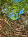
On this mainly downhill stage, you leave the green pastures of the Weissenstein and descend towards the Balmberg winter ski area before reaching Bättlerchuchi, a small panoramic plateau offering unobstructed views of the surrounding ridges.
You then continue along an old mule track, probably used since Roman times, which leads you to the Schattenberg ridge. This historic passage immerses you in an almost timeless atmosphere.
The descent continues along sometimes steep paths, winding through the Jura mountains to Balsthal, nestled on the banks of the Dünnern. This village is a strategic crossroads at the foot of three iconic passes in the Jura mountain range: the Upper Hauenstein, the Passwang and the Scheulte.
Frinvillier - Weissenstein
 15.54 mi
+4,524 ft
-2,169 ft
11h 05
Difficult
Departure from Biel/Bienne (Canton of Bern)
Tenth stage From Les Rousses to Lake Constance via the Jura ridges. From Frinvillier, the route begins with a beautiful climb through fields and old solitary trees to Sur le Chables, the last French-speaking stop in Switzerland. The landscape then changes: a clearing opens onto a dense forest lined with ferns, leading to Wäsmeli. After a paved section between Unterer Stierenberg and Grenchenberg, short climbs take you up to the Stallflue plateau. There, you are treated to a breathtaking panorama: the Alps, the Swiss Plateau and the meandering Aare River, before arriving at Weissenstein.
Chasseral - Frinvillier
 11.34 mi
+571 ft
-3,875 ft
5h 45
Difficult
Departure from Nods (Canton de Berne) (Canton of Bern)
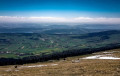
Ninth stage from Les Rousses to Lake Constance via the Jura ridges. At the summit of Chasseral, you pass close to the imposing 114-metre transmitter, a metal sentinel standing at an altitude of 1,606 metres, the highest point of this stage. From there, the trail levels out and takes you on a peaceful descent along the ridge, winding between large century-old trees and the typical pastures of the Bernese Jura, where the air is fragrant with alpine herbs. At an altitude of around 1,000 metres, the landscape narrows: you reach the steepest part of the route, where rocks jut out and steps carved into the stone bear witness to the steeper terrain. The view then opens up onto the Bernese Jura mountain range, before the path gently descends towards the steep-sided Schüss valley. The steady descent takes you to the charming village of Frinvillier, nestled in the valley. Here you will cross the Suze bridge, the final passage of this stage rich in contrasts and panoramic views.
View of the Alps - Chasseral
 11.63 mi
+2,749 ft
-1,909 ft
7h 45
Difficult
Departure from Unknown (Canton of Neuchâtel)
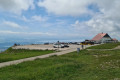
Eighth stage From Les Rousses to Lake Constance via the Jura ridges. From the Col de la Vue des Alpes, the flower-filled route winds through pastures to Mont d'Amin, offering a vast panorama of the Mittelland and the Chasseral massif. A long descent then leads to Les Vieux Prés, whose bocage landscape is reminiscent of Normandy: hedges, trees and dry stone walls delimit the plots. After the farming village of Le Pâquier, the trail crosses the Combe Biosse, a limestone gorge carved out by erosion, before reaching the Chasseral ridge, with the Alps and the lakes of Morat, Biel and Neuchâtel as a backdrop.
Noiraigue - Vue des Alpes
 14.53 mi
+3,573 ft
-1,765 ft
9h 50
Difficult
Departure from Noiraigue (Canton of Neuchâtel)
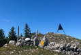
Seventh stage from Les Rousses to Lake Constance via the Jura ridges. From Noiraigue, the route begins with a steady climb before joining a varied trail that runs along a ridge dotted with viewpoints and clearings. Le Creux du Van, Lake Neuchâtel and, on a clear day, the Alps with Mont Blanc accompany you on your way to the Tablettes viewpoint. The hike continues towards the Tête de Ran (1,422 m), offering breathtaking views of the Alps, Lake Neuchâtel and La Chaux-de-Fonds. Finally, a short descent takes you to the Col de la Vue des Alpes, a natural link between the valleys of Neuchâtel and La Chaux-de-Fonds.