Country:

 City:


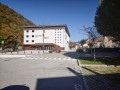
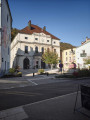
To reach the start, head towards Moirans-en-Montagne (39260) and then go to the village hall at 1 Avenue Jean Jaurès. You’ll find a large car park there.
No signposting
(S/E) Start this route by walking along the left-hand side of the village hall on Rue Voltaire. Walk past the cinema, then continue to La Grenette, situated behind Moirans-en-Montagne Town Hall.
(1) Turn right into Impasse de l’Hôtel de Ville, then head towards Place de la Mairie. Continue left along Rue Roussin, pass the wash house, then, at the end of the street, turn left onto the right-hand pavement of Avenue de Franche-Comté. Walk past the police station and a DIY shop before reaching the chemist’s.
(2) Take the stony path leading uphill to the right, heading north-west. Walk past the entrance to the Chazier farm before reaching a crossroads.
(3) Take the forest track on the right (north-east), which continues as a steep concrete path. Carry on downhill until you reach the first bend on the left.
(4) Head down to the right along the stony path, cross a small stream, then join a tarmac road at a feather-shaped signpost marking a nature trail.
(5) Turn right and continue up the Mont St-Christophe forest road.
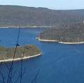
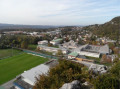
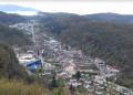
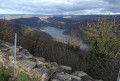
(6) Ignore the return path on your left. Carry on straight ahead to the mobile phone masts, where you’ll enjoy a superb view over the town of Moirans-en-Montagne and Lake Vouglans.
(7) Retrace your steps and walk downhill for about 500 metres until you reach the junction with the path known as Montée de la Bessoule.
(6) Turn right and continue south-west to the signpost.
Yellow markings
(8) Turn left towards Tongea and the Étang de la Penne along a steeply ascending path. You’ll reach a viewpoint with a bench, ideal for admiring the view over Moirans-en-Montagne.
(9) Follow the path eastwards to a junction (signposted ‘Tongea’).
(10) Turn left onto the concrete path and head downhill to the junction with Rue de Tongea.
(11) Continue to the right along the street and head downhill to the bridge crossing the Leat du Murgin.
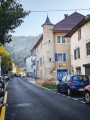
(12) Turn right into Rue du Moulin. After the Moulin residential block, at the fountain, turn left onto Rue du Jura (one-way). Walk past the École Saint-Joseph before reaching Place de Verdun.
(13) Continue left onto Rue Pasteur, walk past the Église Saint-Nicolas and stay on this street until you reach the wash house. Cross Rue Pasteur carefully to walk past the post office and reach the car park (S/E) situated in front of the village hall.
 Visorando Member

 Difficult

 Easy
 Very difficult