Country:
 City:


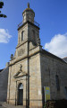
To get to the starting point, head towards Port-Louis (56290); there is a free car park on Place Notre-Dame, near the Church of Notre-Dame-de-l’Assomption
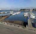
(S/E) From Place Notre-Dame, with your back to the church, head to the right and then, shortly afterwards, turn right into Rue Mercière. At the end of this street, carefully cross Rue de la Pointe and, once past the car park, turn left onto the path at the top of the ramparts. You will now be looking down on the Port of Port-Louis. Continue north-east until you reach Rue de la Pointe. Keep heading in the same direction, walking down a gentle slope at the end of the ramparts to reach Boulevard de la Compagnie des Indes. Turn right to take the pedestrian crossing and you’ll find yourself opposite on Quai du Port and on theGR®34.
Red and white markings forthe GR®34
(1) Heading south-west, go round the Port-Louis Nautical Centre on your right (watch out for traffic – the pavement is very narrow!), then climb the few steps on your right to continue along the fortified wall. Cross the Place aux Canons, then walk past a sailing club and on to Plage de la Brèche before reaching the Memorial to the Patriots shot in June 1944. Continue to the entrance to the Port-Louis Citadel on Avenue du Fort de l’Aigle.
(2) Enter the citadel and head to the portico where the ticket office is located. With your admission ticket, you can visit the Compagnie des Indes Museum and the Lorient City Museum of Art and History, and, above all, you can stroll along the citadel’s ramparts , from where you’ll enjoy superb views of Lorient harbour, the Pointe de Gâvres, the Lorient Submarine Base, Île Saint-Michel and the Port of Locmiquélic. After visiting the site, leave the citadel via the portico and head towards Avenue du Fort de l’Aigle
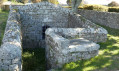
(2). Continue south-east on theGR®34. Cross the car park at the main beach, keeping the fortified wall on your right. Pass a children’s playground and walk through the fort’s grounds to reach the Promenade Henri François Buffet. Following the fortified wall, you’ll pass the ‘Grande Poudrière’ (main powder magazine), followed by the ‘Lavoir Couvert des Récollets’ (covered washhouse). (Feel free to climb the towers to admire the view from the top of the ramparts), then continue south-east until you reach the ‘Tour des Prisonniers’ (prisoners’ tower) opposite the cannonball park.
No signposting
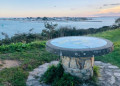
(3) Carry on along the Promenade Henri François Buffet, leaving theGR® 34 to run alongside the beach. Walk past the Tour Saint-François to reach the site of Fort de Papegaut. Head right until you reach the Belvédère du Lohic.
(4) From the viewpoint, return to the Promenade Henri François Buffet opposite the small powder magazine and continue north-east along Rue du Fort to go round the Fort de Papegaut site. You will arrive near the sea to the west of the Cale de Locmalo.
(5) Turn left onto Rue de la Grande Porte, going against the one-way flow. Cross Place du Grand Bastion on the left to stay on Rue de la Grande Porte. Continue north-west to the roundabout and the Chapelle Saint-Pierre.
(6) Cross the roundabout and head straight ahead onto Rue Saint-Pierre; cross this road carefully and continue left onto the rampart path. Carry on to the metal footbridge spanning Rue de la Poste.
(7) Cross the footbridge and turn left onto Rue de la Poste. Head west until, a little further on, you reach Place Notre Dame (S/E) and your car park.

 Local authority

 Visorando Member

 Moderate