Country:
 City:
City:


To get to the starting point, head for the Town Hall car park, 1 Rue Porte aux Guédons, 36000 Châteauroux. Exit the car park onto Place de la République.
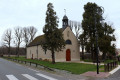
: /A: With your back to the Tourist Office, cross Place de la République heading south-east. On Rue Victor Hugo, turn right, go round the roundabout and continue straight ahead onto Rue Jean-Jacques Rousseau. After the blocks of flats, keep to the right to enter the park. In front of the Monument to the Deportation, turn left. At Square Notre-Dame, turn right onto Passage Notre-Dame. You’ll arrive in front of the Church of Notre-Dame de Châteauroux.
(1) With your back to the church porch, head right, cross the roundabout and continue along the cobbled Rue Petite du Palan. Walk along the wall on your right and take the second stone staircase that leads through the wall. You’ll arrive at Place du Palan. Head south-west to return to the roundabout. Cross the roundabout and continue straight ahead onto Place Roger Brac. Turn left in front of the Association Diocésaine, then right onto Place de la Victoire et des Alliés. Walk alongside the railings of the Indre Prefecture until you reach the gate of Château Raoul. (The château is open during the summer and the European Heritage Days as part of guided tours).
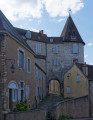
(2) Walk round Place de la Victoire and des Alliés, then turn left onto Rue de la Vieille Prison. Walk up the cobbled street. Before reaching the lodge, veer slightly to the left to continue along the narrow Rue de la Vieille Prison. Pass through the Porte de la Vieille Prison before going down a few steps to reach Rue Descente de Ville. Turn left (north-west) and carry on straight ahead until you reach the Pont Gütersloh.
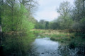
(3) Turn right after the bridge to walk alongside the river on your right along the Allée des Rives de l’Indre. Stay on this path until you reach the footbridge. Cross the Indre and continue to the Petit Lac de Belle-Isle. Turn right to go round the lake on your left. At the Fork in the road, veer right to walk alongside the Jardin des Sens. Continue to the pétanque court at the junction with the Chemin de la Baignade.
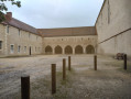
Turn left and continue along the Chemin de la Baignade until you reach Rue du Gué aux Chevaux. Walk past the Jardin des Cordeliers playground and cross a small bridge before reaching a ‘Stop’ sign. Continue to the left, heading through the park running alongside Rue Alain Fournier. You will arrive in front of the Couvent des Cordeliers.
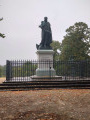
(4) Turn left to cross the convent courtyard and turn right after the archway. Climb a few steps and cross Place Sainte-Hélène heading south-east, noting the statue of General Bertrand, then leave Place Sainte-Hélène to find yourself at a roundabout with trees facing the War Memorial for the First and Second World Wars.
Walk to the left of the War Memorial and follow Place Lafayette to the roundabout. Go round it on the right to pass close to the Soldats Lindre (War Memorial to the 1870 War on Place Gambetta). Return to the roundabout and turn into Rue Saint-Luc. Continue to the Church of Saint-André in Châteauroux.
(5) With your back to the church porch, head straight ahead into Cour Saint-Luc (between the two buildings). Continue to Rue de la Gare and turn right, following the signs for the Town Hall. Turn left onto Rue Victor Hugo and continue to Place de la République (S/E) where you will find the entrance to the Town Hall car park.

 Visorando Member
 Average