


 Country:
 City:


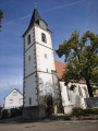
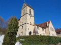
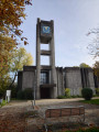
To return to the starting point, head towards Baltmannsweiler, then go to 8 Kirchstraße / Kirchplatz to park near the Aegidiuskirche (St Giles’ Church).
(S/E) In front of the church, turn right onto Kirchplatz, then immediately turn left to go round the back of the building. On Brunnenstraße, continue to the junction, then turn left at the signpost towards Schorndorf. Stay on Zinkstraße until the first junction with Rilkestraße.
(1) Turn right onto the grassy path that leads down through the meadows. At the junction with a stony track, turn left and carry on until you reach the tarmac road.
(2) Carry on to the right along the descending forest track until you reach a junction in front of a sewage treatment plant.
(3) Carry on to the left (north-west) along the stony forest track. Keep heading in this direction until you reach the next junction.
(4) Carry on to the right, heading south-east, until you reach the junction with the Reichenbach-Hohengehren track.
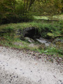
(5) Turn right, heading south. You’ll come to a small stone bridge.
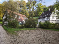
(6) Carry on along the path heading south. You’ll reach an elegant half-timbered farmhouse nestled in the valley. Continue along the tarmac road running alongside the Reichenbach stream, pass a small pond, then arrive at a Christmas tree nursery.
(7) At the signpost, turn right, then at the junction, continue left (south-west) along a gently ascending forest track. At the end of the track, you’ll reach a small bridge spanning the Reichenbach stream at the entrance to the village of Reichenbach an der Fils.
Signposting: green arrow indicating a cycle route
(8) Cross the bridge, turn right and continue along the pavement beside Schorndorfer Straße. Walk to the signpost at the junction.
(9) Turn right towards Plochingen and continue along Schorndorfer Straße. Walk to the signpost at the junction with Gerber Straße.
No signposting
(10) Ignore the signpost and continue to the right, then turn left onto Gerber Straße. At the end of the street, turn right and follow Kirchstraße slightly uphill. You’ll arrive in front of St Maurice’s Church (Mauritiuskirche). Walk along the church wall.
(11) Turn right onto the steeply ascending lane. At the Fork in the road, keep left to walk alongside a low dry-stone wall marking property boundaries. Continue uphill to the crossroads.
(12) Continue to the right (north-west) along a wide forest track which leads to Baltmannsweiler Straße.
(13) Turn right and walk alongside this road. Caution! This road has no hard shoulder. Please take great care. Walk for 150 metres until you reach the junction with a forest track.
(14) Turn right onto the forest road. You’ll soon come to a Fork in the road. Take the left-hand path, which heads north into a wood. Keep going in this direction until you reach a crossroads.
(15) Turn left to leave the woods. Stay on the main path, ignoring any side paths. Walk through the farmland until you reach the first house in the village of Baltmannsweiler.
(16) Carry on straight ahead along Karlstraße until you reach the junction with Veitenstraße.
(17) Turn left to arrive behind Baltmannsweiler Town Hall. Continue right onto Brunnenstraße and, at the end of the street, you will find St Gilles’ Church and the car park (S/E).
 Visorando Member


 Easy
 Tourism professional

