


Les Benézes du Guyoult

 Association / Club / Walk leader
PRO  Premium user
Premium user Sign up:
Published route(s)
 Saint-Léonard, Les Ormes and the ‘White City’
 7.41 mi
 +108 ft
 -105 ft
 3h 30
3h 30
 Moderate
 Departure from Epiniac (Ille-et-Vilaine)
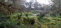
The route takes you through the Domaine des Ormes Park, which has been developed as a luxury campsite. It then leads you through the countryside along wooded paths and small roads. With a bit of luck, if you keep quiet, you might spot some large game, including wild boar, and no doubt some birds such as little egrets, great egrets or grey herons.
No particular difficulty.
Route from the Saint-Macaire Fountain to Baguer Pican
 5.12 mi
+203 ft
-223 ft
2h 30
5.12 mi
+203 ft
-223 ft
2h 30
 Easy
Departure from Baguer-Pican (Ille-et-Vilaine)
Easy
Departure from Baguer-Pican (Ille-et-Vilaine)
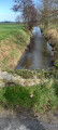
Trail, half on dirt track, half on road. Beautiful sights with the Saint-Macaire (or Maker) Fountain on one side and the megalithic rock site (also known as the "Field of Tombs") on the other. Part of the trail runs along the Canal de la Banche, which joins Dol de Bretagne at Quercourt.
Circular loop through the Parc de la Higourdais via Le Brégain to Épiniac
 8.66 mi
+374 ft
-387 ft
4h 20
Moderate
Departure from Epiniac (Ille-et-Vilaine)
8.66 mi
+374 ft
-387 ft
4h 20
Moderate
Departure from Epiniac (Ille-et-Vilaine)
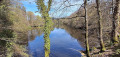
This route crosses the Parc de la Higourdais on the heights of Épiniac. It leads to the banks of the Ruisseau du Landal, which it follows through woodland that is particularly pleasant in summer. It then continues, half on road and half on footpaths. The walk passes over Brégain Hill, which offers a beautiful view of the Guyoult basin to the north. In good weather, you can see Mont-Saint-Michel to the north-east. The return journey takes you along small roads that are generally quite pleasant and quiet, allowing you to discover old hamlets and some beautiful stone houses.
La Gouesnière circular via Bois Renou
5.04 mi
+164 ft
-174 ft
2h 30
Easy
Departure from La Gouesnière (Ille-et-Vilaine)
This is a short, peaceful walk, partly through built-up areas and partly through what is known locally as the white marsh. In fact, the only remaining evidence of the marsh is the leat Jean. The route follows part of the GRP® Tour du Pays Malouin.
Around Bonnemain
 4.60 mi
+98 ft
-98 ft
2h 10
Easy
Departure from Bonnemain (Ille-et-Vilaine)
4.60 mi
+98 ft
-98 ft
2h 10
Easy
Departure from Bonnemain (Ille-et-Vilaine)
Bonnemain is one of the twenty-six communes in the canton of Combourg (also known as Romantic Brittany). This walk complements the one to the north-east, which runs between the village and the Domaine des Ormes. It winds its way through the countryside via sunken paths and past some pretty little houses.
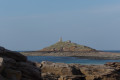
Saint Michel Chapel in Erquy
 1.07 mi
+125 ft
-154 ft
0h 35
Easy
Departure from Erquy (Côtes-d'Armor)
1.07 mi
+125 ft
-154 ft
0h 35
Easy
Departure from Erquy (Côtes-d'Armor)
A pleasant little walk, but the chapel is only accessible at low tide, so you need to calculate the time available before crossing. The ford is a little difficult to cross due to large rocks. The chapel is open to visitors and an association called "Les Amis de la Chapelle Saint-Michel" is responsible for its renovation and maintenance.
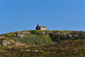
Tour of Cap d'Erquy via the beaches
 5.87 mi
+446 ft
-446 ft
3h 05
Moderate
Departure from Erquy (Côtes-d'Armor)
5.87 mi
+446 ft
-446 ft
3h 05
Moderate
Departure from Erquy (Côtes-d'Armor)
This route goes around the tip of Cap d'Erquy via the beaches on the north side and passes by the old pink sandstone quarries on the south side.These quarries were in operation until 1974 and date back to the 18th century. A superb walk, especially in good weather, which is often the case. The route is lined with gorse and broom, which you may be lucky enough to see in bloom. The northern part of the route is a little wilder and more exposed to the wind, but at high tide the waves are a magnificent sight.
Circular around the Fort de Saint-Père-Marc-en-Poulet
5.13 mi
+148 ft
-174 ft
2h 30
Easy
Departure from Saint-Père (Ille-et-Vilaine)
The main attraction of this hike is the Fort de Saint-Père, built between 1777 and 1785 to protect Saint-Malo from English attacks by land and to complete the defence system designed by the famous Vauban. Part of its enclosure was destroyed in 1944 by the Germans as they fled during the Liberation. Today, the fort has become a cultural and leisure space. Every year, it hosts various trail events, flower markets, festivals and concerts. The fort is open to the public during the events it hosts, but the outer rampart walk is accessible to walkers all year round.
Circular route to Saint-Suliac via Mont Gareau and Moulin du Tertre
 5.37 mi
+463 ft
-463 ft
2h 50
Easy
Departure from Saint-Suliac (Ille-et-Vilaine)
5.37 mi
+463 ft
-463 ft
2h 50
Easy
Departure from Saint-Suliac (Ille-et-Vilaine)
Shortly after setting off, you will come to the oratory, dedicated to the safety of sailors setting out to sea for the banks of Newfoundland. There is a magnificent view of the village, the Rance and the opposite bank as far as the Pont Chateaubriand bridge.
The walk continues along the banks of the Rance to the summit of Mont Gareau, where another viewpoint will surprise you.
Along the way, you can admire two old mills: a windmill overlooking the hill (not open to visitors, as it is on private land) and an old tide mill, built inthe 16th century, which was in operation until the 1940s. An association is working to restore it.
Circular of the Arguenon via the Moulin de Lorgeril bridge
4.45 mi
+322 ft
-305 ft
2h 20
Moderate
Departure from Jugon-les-Lacs (Côtes-d'Armor)
A pleasant walk along the Arguenon downstream from Jugon-les-Lacs, following the water's edge, with a few difficult sections. Suitable in all seasons, but take care in heavy rain.
Circular Tournemine along the Arguenon
 8.11 mi
+771 ft
-778 ft
4h 25
Moderate
Departure from Plorec-sur-Arguenon (Côtes-d'Armor)
8.11 mi
+771 ft
-778 ft
4h 25
Moderate
Departure from Plorec-sur-Arguenon (Côtes-d'Armor)
A very pleasant circular route around the Arguenon with many wooded sections. The route is sometimes steep and strewn with rocks. There is a series of viewpoints over the river, some of which are magnificent.
Route de la Rigaudière via La Roche aux Fées
8.12 mi
+246 ft
-243 ft
3h 55
Moderate
Departure from Essé (Ille-et-Vilaine) (Ille-et-Vilaine)
This is a short circular variation on the walk known as the ‘Boucle dans la campagne du Theil-de-Bretagne’ starting from La Roche aux Fées (no.88594830)
The circular route starts at the Allée couverte de la Roche aux Fées, an iconic monument that is extremely well preserved. Le Theil de Bretagne is a predominantly rural commune, rich in architectural, religious and natural heritage. The Résidence Bon Abri, the Notre-Dame de Beauvais Chapel (listed as a Historic Monument), the Château de La Rigaudière, and the Church, with its patriotic stained-glass windows, are just a few examples. This countryside walk crosses the commune of Le Theil-de-Bretagne.
The Theil and La Rigaudière forest route
12.39 mi
+371 ft
-364 ft
6h 00
Moderate
Departure from Essé (Ille-et-Vilaine) (Ille-et-Vilaine)
The route starts at the Roche aux Fées dolmen, the best-preserved iconic monument in Europe. The walk takes you through meadows and fields, perfect for relaxation. The crossing of Theil-de-Bretagne is fairly short, so you can take the opportunity to stop at the wash house park. The route continues through the hamlet of La Rigaudiére and the pond of the same name.
The Forges route in Baguer-Morvan
 6.01 mi
+141 ft
-141 ft
2h 55
Easy
Departure from Baguer-Morvan (Ille-et-Vilaine)
6.01 mi
+141 ft
-141 ft
2h 55
Easy
Departure from Baguer-Morvan (Ille-et-Vilaine)
This route runs largely through the countryside and follows sunken lanes. It passes through several hamlets whose names raise questions about their origins: Les Forges, Le Portail des Forges and La Ville Feu.
Guissény - LiLia
 15.02 mi
+226 ft
-266 ft
7h 05
15.02 mi
+226 ft
-266 ft
7h 05
 Difficult
Departure from Guissény (Finistère)
Difficult
Departure from Guissény (Finistère)
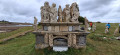
Hike along the GR®34, on a coastal path between Guisseny and Plouguerneau Lilia. A feast for the eyes; you’ll never tire of the ever-changing landscapes shaped by the tides. Magnificent white sandy beaches that invite you to sunbathe. The rocks, sculpted by the elements, evoke a surrealist bestiary.
Circular between Guissény and Beg ar Skeiz
 6.78 mi
+46 ft
-46 ft
3h 10
Easy
Departure from Guissény (Finistère)
6.78 mi
+46 ft
-46 ft
3h 10
Easy
Departure from Guissény (Finistère)
A circular without difficulty (but take care along the roads), offering views of Anse de Tresseny and Pointe de Beg ar Skeiz, as well as a few other points of interest. Don't miss the parish enclosure.
Cap de la Chèvre at the start of Crozon
 13.00 mi
+1,375 ft
-1,371 ft
7h 10
Difficult
Departure from Crozon (Finistère)
13.00 mi
+1,375 ft
-1,371 ft
7h 10
Difficult
Departure from Crozon (Finistère)
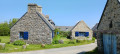
A superb walk between Crozon and Cap de la Chèvre. Memorable views. The outward route, along the coast, is quite challenging with a very rugged coastline and a succession of steep ascents and descents. But the route, which follows the GR®34, is well worth the effort, offering a guaranteed change of scenery. Starting from Crozon, after Fort du Kador, you can take the old route of the GR® 34, which is a bit more challenging but closer to the cliff edge! The return route, via the interior of the headland, is easier.
Circular Eastern of Dol-de-Bretagne via Champ Dolent
6.78 mi
+108 ft
-115 ft
3h 10
Moderate
Departure from Dol-de-Bretagne (Ille-et-Vilaine)
Dol-de-Bretagne is a small town full of character offering numerous hiking opportunities, the most popular being the Marais Blanc and Marais Noir trails. The route suggested here follows part of the Nominöe route, but differs in that it passes through the countryside further south, taking in the Menhir du Champ Dolent and the Fontaine Saint-Samson.
The Domaine des Ormes from Bonnemain
 5.67 mi
+72 ft
-69 ft
2h 40
Easy
Departure from Bonnemain (Ille-et-Vilaine)
5.67 mi
+72 ft
-69 ft
2h 40
Easy
Departure from Bonnemain (Ille-et-Vilaine)
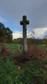
Located in the north-west of the Ille-et-Vilaine department, Bonnemain is one of the twenty-six parishes in the canton of Combourg, also known as Romantic Brittany. This gentle walk allows you to discover the surrounding countryside and the Domaine des Ormes, renowned for its campsite. The path is lined with some beautiful stone houses and two wayside crosses. The path around the Étang de la Sablonnière is particularly pleasant.
Short heritage trail in Josselin
 1.97 mi
+148 ft
-135 ft
1h 00
Easy
Departure from Josselin (Morbihan)
1.97 mi
+148 ft
-135 ft
1h 00
Easy
Departure from Josselin (Morbihan)
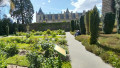
Take a stroll to discover what makes Josselin such a historic place. As you wander through the town's narrow cobbled streets, you can admire the many half-timbered houses, the oldest dating back to 1538, the churches and the castle (entrance fee). A very pleasant walk.
La Rigaudière route
 6.29 mi
+154 ft
-154 ft
3h 00
Easy
Departure from Le Theil-de-Bretagne (Ille-et-Vilaine)
6.29 mi
+154 ft
-154 ft
3h 00
Easy
Departure from Le Theil-de-Bretagne (Ille-et-Vilaine)
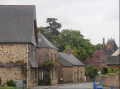
Le Theil-de-Bretagne is a predominantly rural commune with a rich architectural, religious and natural heritage. The Résidence Bon Abri, the Notre-Dame de Beauvais Chapel, listed as a historic monument, the Château de La Rigaudière and the church with its patriotic stained-glass windows are just a few examples.
This hike takes us through the countryside around Le Theil-de-Bretagne, where we can discover a landscape of hedgerows and orchards as we stroll along, enjoying the peace and quiet and gentle way of life.
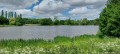
Circular starting from Bonnemain via La Perinne and Les Ormes.
 8.02 mi
+164 ft
-164 ft
3h 50
Moderate
Departure from Bonnemain (Ille-et-Vilaine)
8.02 mi
+164 ft
-164 ft
3h 50
Moderate
Departure from Bonnemain (Ille-et-Vilaine)
Bonnemain is one of the twenty-six communes in the canton of Combourg (also known as Romantic Brittany). This walk complements the one to the north-east, which runs between the village and the Domaine des Ormes. It winds its way through the countryside, via sunken paths and a few pretty little houses.
The Eastern Abers: from Guissény to Portsall
56.52 mi
+1,516 ft
-1,562 ft
4 days
Difficult
Departure from Guissény (Finistère)
A coastal walk following the GR®34 for the most part. The paths are well maintained and the signposting is adequate. The route offers beautiful views of the sea, the islands and the rocks, which vary with the tide but are always a pleasure to behold.
Lilia - Aber Wrac'h
12.18 mi
+515 ft
-522 ft
6h 05
Difficult
Departure from Plouguerneau (Finistère)
The route follows the GR®34 from Llia beach to the port of Aber Weac’h. It runs along the rugged coastline and offers magnificent views of Île Wrac’h and Île Vierge, as well as the lighthouses of the same name. The route presents no particular difficulties, either in terms of navigation or physically. The route faces west, which exposes it to the prevailing wind, which can blow strongly at times.
Aber Wrac'h - Tréglonou
13.12 mi
+390 ft
-420 ft
6h 20
Difficult
Departure from Landéda (Finistère)
Walk along the GR®34 along the coast between Aber Wrac’h and the bridge over Aber Benoît. There are magnificent landscapes all along the route, enhanced by the presence of numerous birds. Along the way, there are opportunities for culinary stops.
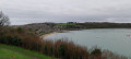
Circular via Pointe du Puits and Clos de la Croix in Saint-Suliac.
 4.79 mi
+256 ft
-272 ft
2h 25
Easy
Departure from Saint-Suliac (Ille-et-Vilaine)
4.79 mi
+256 ft
-272 ft
2h 25
Easy
Departure from Saint-Suliac (Ille-et-Vilaine)
Saint-Suliac, a former fishing village, is located a stone's throw from Saint-Malo. The landscapes are varied, and this walk will allow you to discover the maritime side of Saint-Suliac and the narrow streets of the old part of the village. The steep side of the shore along the Rance is somewhat reminiscent of the GR®34 between Saint-Malo and Cancale, all things considered. There is a beautiful view of the Rance from the Pointe du Puits.
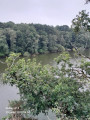
Circular route between Jugon and Tournemine along the Arguenon.
 9.55 mi
+535 ft
-522 ft
4h 50
Moderate
Departure from Jugon-les-Lacs (Côtes-d'Armor)
9.55 mi
+535 ft
-522 ft
4h 50
Moderate
Departure from Jugon-les-Lacs (Côtes-d'Armor)
A pleasant walk along part of the Arguenon downstream from Jugon-les-Lacs, following the watercourse, with a few difficult sections. Suitable in all seasons, but take care in heavy rain.
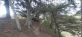
The Pointe du Meinga and the Malouinière de la Vieille Bague
 7.65 mi
+318 ft
-341 ft
3h 50
Moderate
Departure from Saint-Coulomb (Ille-et-Vilaine)
7.65 mi
+318 ft
-341 ft
3h 50
Moderate
Departure from Saint-Coulomb (Ille-et-Vilaine)
The Pointe du Meinga and Île Besnard areas are ideal for beautiful hikes in any season. This hike starts on the GR®34 and then turns inland to discover some of the malouinières near the Étang Sainte-Suzanne. You can extend the hike by going around Île Besnard.
Le Marais Blanc and Le Haut Pont via the Mont Dol hill
 8.40 mi
+194 ft
-217 ft
4h 00
Moderate
Departure from Dol-de-Bretagne (Ille-et-Vilaine)
8.40 mi
+194 ft
-217 ft
4h 00
Moderate
Departure from Dol-de-Bretagne (Ille-et-Vilaine)
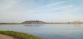
The route is mainly in the countryside, through the Marais Blanc and Marais Noir marshes, with no particular difficulties except for the ascent of the Mont-Dol hill via the north face (slippery in wet weather) and the descent to the town hall (uneven steps). The route takes the Chemin Vert between Dol de Bretagne and Mont-Dol. Beautiful view of the Marais Blanc and the Bay of Mont Saint-Michel from the top of the Mont Dol hill.
Circular starting from Dol-de-Bretagne via Epiniac and the Chemin des Évêques.
 8.19 mi
+233 ft
-236 ft
4h 00
Moderate
Departure from Dol-de-Bretagne (Ille-et-Vilaine)
8.19 mi
+233 ft
-236 ft
4h 00
Moderate
Departure from Dol-de-Bretagne (Ille-et-Vilaine)
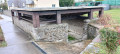
A peaceful hike along grassy paths and a few quiet roads. You will follow part of the Chemin des Évêques, which was used by bishops to reach their summer residence. The nearby Château du Domaine des Ormes was once (in the early 14th century) the summer residence of the bishops of Dol-de-Bretagne. Today, it is a campsite. The paths are shaded. If you walk them in autumn, you can collect lots of chestnuts.
A circular loop along the banks of the Rance, starting from Minihic
 11.75 mi
+594 ft
-607 ft
5h 55
Moderate
Departure from Le Minihic-sur-Rance (Ille-et-Vilaine)
11.75 mi
+594 ft
-607 ft
5h 55
Moderate
Departure from Le Minihic-sur-Rance (Ille-et-Vilaine)
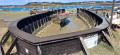
This walk combines the routes suggested on Visorando around the Minihic, forming a double circular route around the Minihic and Langrolay further south. It is a pleasant walk along the banks of the Rance, with Mont Gareau, Saint-Suliac and the Pointe du Puits opposite. The path overlooks the Rance and offers numerous viewpoints. The route passes by the Landriais shipyards and dry dock, to the north of the Minihic. On the return journey, there are sunken paths via Langrolay and the Chapel of Sainte-Anne in Saint-Buc, dating from 1631. The walk is well shaded in summer and late spring.
Langrolay-sur-Rance route starting from the Souhaitier Chapel
 8.34 mi
+528 ft
-525 ft
4h 20
Moderate
Departure from Plouër-sur-Rance (Côtes-d'Armor)
8.34 mi
+528 ft
-525 ft
4h 20
Moderate
Departure from Plouër-sur-Rance (Côtes-d'Armor)
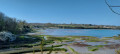
This hike follows the Rance river and the valleys around Langrolay-sur-Rance. It starts at the foot of the Souhaitier Chapel and follows a north-south route offering beautiful views of the Rance and the opposite bank, Saint-Suliac and Mont Gareau. The route is also dotted with some very pretty stone houses. The route follows a branch of the GR®34 to GR®37 trail.
Circular in the Villecartier National Forest
 7.65 mi
+102 ft
-102 ft
3h 35
Moderate
Departure from Bazouges-la-Pérouse (Ille-et-Vilaine)
7.65 mi
+102 ft
-102 ft
3h 35
Moderate
Departure from Bazouges-la-Pérouse (Ille-et-Vilaine)
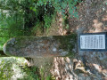
The Villecartier National Forest is known for its leisure centre, miniature harbour and hiking trails. The forest, formerly royal, covers an area of 1,000 hectares. It is dotted with monuments of varying ages that bear witness to human activity throughout its history. The proposed route allows you to discover some of these monuments and, with a little luck, the four-legged animals that inhabit the forest. To do so, you need to be relatively quiet and have a little luck.
The Marais Blanc and La Banche starting from Quercourt.
8.07 mi
+7 ft
-3 ft
3h 45
Moderate
Departure from Dol-de-Bretagne (Ille-et-Vilaine)
This is an easy route through the Marais Blanc and along the Canal de la Banche and the Banche itself. It allows you to discover a few old farms scattered throughout the marsh.
A peaceful route taking in the monuments of the Villecartier National Forest.
 4.96 mi
+105 ft
-98 ft
2h 20
Easy
Departure from Bazouges-la-Pérouse (Ille-et-Vilaine)
4.96 mi
+105 ft
-98 ft
2h 20
Easy
Departure from Bazouges-la-Pérouse (Ille-et-Vilaine)
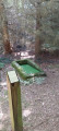
The Villecartier National Forest is known for its leisure centre, miniature harbour and hiking trails. The forest, formerly royal, covers an area of 1,000 hectares. It is dotted with monuments of varying ages that bear witness to human activity throughout its history. The proposed route allows you to discover some of them, and with a little luck, the four-legged animals that inhabit it. To do so, you must be relatively quiet.
Around Saint-Georges-de-Gréhaigne
 5.41 mi
+256 ft
-253 ft
2h 45
Easy
Departure from Saint-Georges-de-Gréhaigne (Ille-et-Vilaine)
5.41 mi
+256 ft
-253 ft
2h 45
Easy
Departure from Saint-Georges-de-Gréhaigne (Ille-et-Vilaine)
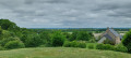
Enjoy a peaceful stroll through the polders and return via the plateau that marks the end of the old coastline. In principle, you can enjoy a breath of fresh air. The route presents only one small difficulty, namely the coast between Chanel and Haut Chanel, with a difference in altitude of 15 m to 75 m. The reward in season is cherries!
Short tour of the Polders in Cherrueix
 4.19 mi
+13 ft
-13 ft
1h 55
Easy
Departure from Cherrueix (Ille-et-Vilaine)
4.19 mi
+13 ft
-13 ft
1h 55
Easy
Departure from Cherrueix (Ille-et-Vilaine)
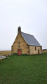
This hike follows the path along the dyke between Chapelle Sainte-Anne and Polder du Nouveau Conseil and, on the way back, takes the Greenway linking Mont Saint-Michel to Cancale and continuing on to Saint-Malo and beyond. Beautiful view of the bay when the weather is good, which is often the case!
From Sainte-Anne Chapel in Cherrueix to the polders
 8.12 mi
+10 ft
-13 ft
3h 45
Moderate
Departure from Saint-Broladre (Ille-et-Vilaine)
8.12 mi
+10 ft
-13 ft
3h 45
Moderate
Departure from Saint-Broladre (Ille-et-Vilaine)
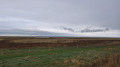
This hike follows the path along the dyke between the Sainte-Anne Chapel and the Bertrand Polder and, on the way back, takes the Greenway linking Mont Saint-Michel to Cancale and continuing on to Saint-Malo and beyond. Beautiful view of the bay when the weather is good, which is often the case!
Lake Guerlédan via the Guerlédan Dam and the Trou à Cochons
 9.42 mi
+1,237 ft
-1,220 ft
5h 25
Moderate
Departure from Morbihan
9.42 mi
+1,237 ft
-1,220 ft
5h 25
Moderate
Departure from Morbihan
Hike on the south side of Lake Guerlédan, starting from the church of Saint-Aignan in the commune of the same name. A rather bucolic route dotted with a few farms. The route runs along the shores of the lake and through the forest surrounding it. The landscapes are therefore very varied. Numerous paths allow you to diversify the route.
Route des 3 Valleys in Coutances
 7.41 mi
+610 ft
-594 ft
3h 55
Moderate
Departure from Coutances (Manche)
7.41 mi
+610 ft
-594 ft
3h 55
Moderate
Departure from Coutances (Manche)
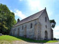
Coutances, the historic former capital of the Cotentin, offers a contrasting spectacle of countryside almost within the city. This hike takes you through the outskirts of the town, winding its way through the three valleys that surround it, each with its own lazy river. Half on land and half on roads or alleyways, the urban passages allow you to discover a small part of Coutances' heritage, despite the industrial area that spoils the pleasure a little, but you quickly forget about that.
Circular route in the Villecartier Forest via the Colonne des Chouans
 5.05 mi
+85 ft
-85 ft
2h 25
Easy
Departure from Bazouges-la-Pérouse (Ille-et-Vilaine)
5.05 mi
+85 ft
-85 ft
2h 25
Easy
Departure from Bazouges-la-Pérouse (Ille-et-Vilaine)
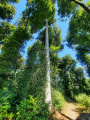
The Villecartier National Forest is known for its leisure centre, miniature harbour and hiking trails. The forest, formerly royal, covers an area of 1,000 hectares. It is dotted with monuments of varying ages that bear witness to human activity throughout its history. The proposed route allows you to discover some of them, and with a little luck, the four-legged animals that inhabit it; to do so, you must be relatively quiet.
Le Vivier and the Canal des Planches from Mont-Dol
7.70 mi
+187 ft
-190 ft
3h 40
Moderate
Departure from Mont-Dol (Ille-et-Vilaine)
Walk along small country roads, with the exception of the coastal stretch near Vivier-sur-Mer. In Vivier-sur-Mer, a point of interest is where the River Guyoult meets three estuaries flowing from the Marias de Dol: the Canal des Planches, the Banche and the Biez de Cardequin. To see them, head to the bridge at the village exit towards Cherrueix.
The Couesnon canalised at the start of Saint-Georges-de-Gréhaigne
 8.26 mi
+10 ft
-10 ft
3h 50
Moderate
Departure from Pontorson (Manche)
8.26 mi
+10 ft
-10 ft
3h 50
Moderate
Departure from Pontorson (Manche)
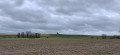
This walk takes you along the Couesnon between the dam and Anse de Moidrey, allowing you to see the polders on the Brittany side and also the fairly abundant wildlife, particularly birds.A bit of history: formerly known as Lerra Fluvius, the Couesnon rises in the commune of Saint-Pierre-des-Landes in Mayenne, at the Fontaine de Couesnette, 200 metres above sea level. The Couesnon was channelled in 1867, allowing boats to sail up the river as far as the port of Pontorson. The first dam, built in 1969, was intended to stop the tide from flowing back into the riverbed, which, during high tidal ranges, caused flooding. It was demolished in 2008 and replaced by the Couesnon Dam as part of the project to restore the maritime character of Mont-Saint-Michel.
Route du patrimoine et de la nature de Dinan
5.03 mi
+269 ft
-253 ft
2h 35
Moderate
Departure from Dinan (Côtes-d'Armor)
The route takes you through the old town of Dinan and past several points of interest, then down into the Rance valley. It passes through Léhon, a picturesque little village, and ends along the Rance and the port of Dinan. For the tour of the walls, see the map on the Dinan Agglo website (see practical information). The journey time does not include breaks and stops for visits or sightseeing!
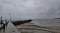
The heights of Cancale, Rocher Gaut and the points
 5.18 mi
+371 ft
-384 ft
2h 40
Moderate
Departure from Cancale (Ille-et-Vilaine)
5.18 mi
+371 ft
-384 ft
2h 40
Moderate
Departure from Cancale (Ille-et-Vilaine)
Circular route around Cancale following the GR®34 and GRP® du Pays Malouin and the PR® de Cancale. The route passes by the points that offer beautiful views of the Bay of Mont Saint-Michel. Along the way, you can sample some oysters in season.
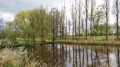
Route de l'Étang du Pas Gérault starting from Sains
 5.54 mi
+112 ft
-138 ft
2h 40
Easy
Departure from Sains (Ille-et-Vilaine)
5.54 mi
+112 ft
-138 ft
2h 40
Easy
Departure from Sains (Ille-et-Vilaine)
A short, peaceful walk starting from Sains. The route passes through wooded areas, including a charming section at the start. There are usually many water birds at the Étang du Pas Gérault, especially in autumn.
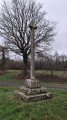
Le Pas Gérault and the Oak of Liberty at the start of Sains
 7.15 mi
+177 ft
-177 ft
3h 25
Moderate
Departure from Sains (Ille-et-Vilaine)
7.15 mi
+177 ft
-177 ft
3h 25
Moderate
Departure from Sains (Ille-et-Vilaine)
A short, peaceful walk starting from Sains. The route passes through wooded areas, including a charming section at the start. There are usually many water birds at the Pas Gérault pond, especially in autumn. This walk takes you along the Oak Trail, with its many remarkable trees, including the Oak of Liberty.
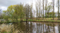
Route of Angevinière and Petite Claye starting from Sains
 7.64 mi
+318 ft
-308 ft
3h 45
Moderate
Departure from Sains (Ille-et-Vilaine)
7.64 mi
+318 ft
-308 ft
3h 45
Moderate
Departure from Sains (Ille-et-Vilaine)
From Étang du Pas Gérault, take the paths and trails on the plateau, then on the Claye plain. The trail takes you through the somewhat wild Guyoult before following a circular route back to the plain and the lake. This area is rich in wildlife, with numerous egrets and cattle egrets, and sometimes grey herons. Game is often seen here, but it is very shy.
The Breil and Moulin de la Corbonnais route in Epiniac
 5.03 mi
+338 ft
-318 ft
2h 35
Easy
Departure from Epiniac (Ille-et-Vilaine)
5.03 mi
+338 ft
-318 ft
2h 35
Easy
Departure from Epiniac (Ille-et-Vilaine)
A short, peaceful walk near Epiniac. It takes you along some pleasant sunken lanes that are passable in almost all seasons and not too difficult. Here and there you’ll find listed buildings. It’s not impossible to come across a herd of wild boars in the undergrowth, especially during the hunting season! So be careful.
The Rothéneuf and Varde headlands
 5.23 mi
+213 ft
-213 ft
2h 35
Easy
Departure from Saint-Malo (Ille-et-Vilaine)
5.23 mi
+213 ft
-213 ft
2h 35
Easy
Departure from Saint-Malo (Ille-et-Vilaine)
This route will take you along the customs officers' path between Rothéneuf and Pont beach, via Pointe de la Varde. Beautiful views of St-Malo bay, with Cézembre and Fort de la Conchée to the west, Île Besnard and Les Chevrets (large and small) to the east.