Trémeheuc Wind Farm

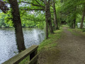
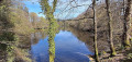
The route is very pleasant, often following wide paths lined with oak and chestnut trees. It winds through wooded countryside dotted with sunken lanes. And with a bit of luck, you might spot some of the local wildlife early on – and, if you’re lucky, roe deer frolicking at the foot of the wind turbines.

Details

105269756
Creation:
Last update:
Last review:
  • Walking
    Activity: Walking
  • ↔
    Distance: 5.24 mi
  • ◔
    Average duration: 2h 25 
  • ▲
    Difficulty: Easy

  • ⚐
    Back to start: Yes
  • ↗
    Ascent: + 46 ft
  • ↘
    Descent: - 46 ft

  • ▲
    Highest point: 394 ft
  • ▼
    Lowest point: 318 ft
  • ⚐ Country: France
  • ⚐ City: Trémeheuc (35270)
  • ⚑
    Start/End: N 48.43782° / W 1.705825°
  • ❏
    IGN map(s): Ref. 1216O, 1217SB
  • Hour-by-hour weather

Photos

Description of the walk

Start at the foot of the wind turbine, 48.43779, -1.705855.

(S/E) Head north and take the first dirt track on the right. At the first junction, turn left and follow the path under the trees until you reach a road.

(1) Take the road on the right. At the two wind turbines, take the track on the left.

(2) The track splits in two; take the one on the left to go round the wind turbine and join a road. Cross it and take the path opposite. Shortly afterwards, it turns right. Carry on straight ahead to reach another road.

(3) Turn right onto it. Pass through the hamlet of La Favrie, cross a road and take the path opposite. Continue until you reach the D83 and the hamlet of La Gautrais.

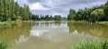
(4) Walk alongside the road for a few metres to the right, then take the path on the left, crossing the road. Continue along the path, go round a small pond and join a road.

(5) Turn right onto it and continue for about 300 m before turning right onto the stony farm track. Follow it until you reach a road.

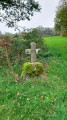
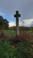
(6) Turn left onto this road. After 300 m, take the path on the right. It bends to the left, heading south. Follow it and, after about 250 m, at the path junction, take a track on the right to reach a wayside cross by the side of the D83.

(7) Walk up the D83 to the right for about thirty metres. Take the path on the left, crossing the road carefully . Follow it until you reach a farm track. Then turn left for about 130 m, then follow the path on the right to reach a road,

(8) Turn left onto it, cross the junction and take the path opposite. The path turns right after 350 m and heads north.

(9) After 500 m, at the junction, turn right this time, walk past the wind turbine and join a road; follow it to the right to return to the starting point after 250 m (S/E).

Waypoints

  1. S/E : mi 0 - alt. 348 ft - Wind turbine
  2. 1 : mi 0.72 - alt. 338 ft - Route
  3. 2 : mi 0.87 - alt. 344 ft - Dirt track on the left
  4. 3 : mi 1.51 - alt. 331 ft - Route
  5. 4 : mi 2.3 - alt. 351 ft - La Gautrais
  6. 5 : mi 2.63 - alt. 344 ft - Route
  7. 6 : mi 3.09 - alt. 358 ft - Road junction
  8. 7 : mi 3.71 - alt. 384 ft - D83, wayside cross
  9. 8 : mi 4.27 - alt. 344 ft - Route
  10. 9 : mi 4.98 - alt. 361 ft - Crossroads
  11. S/E : mi 5.24 - alt. 348 ft - Wind turbine

Notes

You can park at the foot of the wind turbine at the start of the trail.

Take care when crossing the roads.

Worth a visit


Wind Farm The
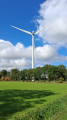
Trémeheuc site was chosen for its elevated position, reaching a height of 127 metres, which ensures it is swept by a steady, continuous wind. Six wind turbines were installed in 2008 on agricultural land. A stop at the foot of the first wind turbine allows you to understand how it works with the help of information panels. The 25 million kWh produced each year power nearly 6,500 households, or around 25,000 residents.

La Gautrais, the birthplace of Jean Richeux (4)
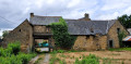
His birthplace was built in 1629 and comprises a private courtyard, the entrance to which is surmounted by an upper room constructed of half-timbering and cob. Opposite, along the path, you’ll pass a cross, likely erected in 1674.

Other walks in the area

For more walks, use our search engine .

The GPS track and description are the property of this route's author. Please do not copy them without permission.