Around Riniac

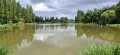
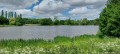
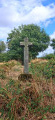
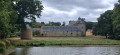
A countryside walk along sunken lanes and, to a lesser extent, on the hills overlooking the town of Combourg. A route with no particular difficulty. It alternates between paths through woodland and paths across fields. A significant portion is on roads with very little traffic. Riniac is of no particular interest. It is more of a "dormitory" village, but with pretty houses. The countryside offers beautiful views.

Details

96590744
Creation:
Last update:
Last review:
  • Walking
    Activity: Walking
  • ↔
    Distance: 4.87 mi
  • ◔
    Average duration: 2h 25 
  • ▲
    Difficulty: Easy

  • ⚐
    Back to start: Yes
  • ↗
    Ascent: + 174 ft
  • ↘
    Descent: - 190 ft

  • ▲
    Highest point: 318 ft
  • ▼
    Lowest point: 210 ft
  • ⚐ Country: France
  • ⚐ City: Combourg (35270)
  • ⚑
    Start/End: N 48.43161° / W 1.77053°
  • ❏
    IGN map(s): Ref. 1116ET, 1117SB, 1216O, 1217SB
  • Hour-by-hour weather

Description of the walk

(S/E) At the crossroads, leave La Doupterie on your right and head west towards the village exit, taking a dirt track. Keep to the right until you reach the junction with a farm track. Turn left and follow the track for about 270 metres until you reach the next crossroads.

(1) Turn right and keep to the left of the path until you reach the hamlet of "Les Bas Champs Moiteaux" and come to a small road.

(2) Turn right and follow the road. At the first crossroads, turn right and follow the road to the hamlet known as “Crépendel”.

(3) Turn right and, 50 metres on, after the small copse, continue left onto the grassy path running alongside the fence. The path is poorly marked. After a bend, it joins a dirt track which leads to a wider farm track. Continue to the left and keep to the right-hand side of the path.

(4) At the junction of the paths, turn left towards the east, cross the D80 and continue for 200 m; at the crossroads, continue straight ahead for another 200 m.

(5) Turn right to reach the hamlet of "Trémouard" and a small road that joins the D80. Cross it and take the path opposite, which is quite steeply downhill.

(6) The path joins a small road; turn right to climb the slope and pass the "Le Tertre Malouas" farm.

(7) Continue to the left, then carry on straight for 300 metres, ignoring the junction.

(8) At the next junction, take the road on the right and continue uphill until you return to the starting point (S/E).

Waypoints

  1. S/E : mi 0 - alt. 315 ft - Riniac
  2. 1 : mi 0.36 - alt. 289 ft - Crossroads
  3. 2 : mi 1.22 - alt. 217 ft - Ferme des Bas Champs Moiteaux
  4. 3 : mi 2.36 - alt. 243 ft - Crépendel Farm
  5. 4 : mi 2.96 - alt. 305 ft - Crossroads
  6. 5 : mi 3.5 - alt. 292 ft - Crossroads
  7. 6 : mi 4.11 - alt. 213 ft - Junction and road
  8. 7 : mi 4.48 - alt. 282 ft - Le Tertre Malouas Farm
  9. 8 : mi 4.73 - alt. 262 ft - Junction
  10. S/E : mi 4.87 - alt. 315 ft - Riniac

Notes

There is no car park in the village; park at the side of the road on the verge.

Worth a visit

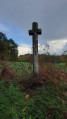
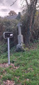
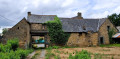
A few old houses along the route.

Other walks in the area

For more walks, use our search engine .

The GPS track and description are the property of this route's author. Please do not copy them without permission.