Route de la Mancelière from Baguer-Pican

A fairly easy walk, following sunken paths through the countryside and woodland. Very pleasant in fine weather, it can also be enjoyed in winter, although the ground is wetter.
There are some beautiful houses in the hamlet of Le Chatel, which was a strategic location during the French Revolution and the Second World War. The route also follows part of the ancient Roman road that linked Corseul to Avranches.

Details

105880109
Creation:
Last update:
Last review:
  • Walking
    Activity: Walking
  • ↔
    Distance: 6.71 mi
  • ◔
    Average duration: 3h 15 
  • ▲
    Difficulty: Moderate

  • ⚐
    Back to start: Yes
  • ↗
    Ascent: + 213 ft
  • ↘
    Descent: - 230 ft

  • ▲
    Highest point: 223 ft
  • ▼
    Lowest point: 46 ft
  • ⚐ Country: France
  • ⚐ City: Baguer-Pican (35120)
  • ⚑
    Start/End: N 48.55092° / W 1.6991°
  • ❏
    IGN map(s): Ref. 1215OT, 1216O
  • Hour-by-hour weather

Photos

Description of the walk

Yellow-marked walk.

The route starts at the church car park in Baguer Pican (48.55096, -1.698985).

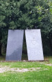
(S/E) Head south and join the small road known as the ‘Rouillère’, which continues as a track to the hamlet of Choiseul. On the right is a memorial to the 15,000 victims of the Battle of Dol-de-Bretagne.

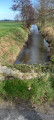
(1) Cross the D155 and take the safe crossing behind the crash barrier. Cross the bridge over the Ruisseau du Guilloche. Head down to the right along the shaded path bordering a wetland and follow the woodland on your right towards La Moignerais. After the houses, take the road on the left.

(2) At the junction, take the road on the right towards La Landelle. After about 80 metres, turn left onto the path (an old Roman road). Cross the D155 carefully and continue straight on until you reach the D85.

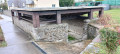
(3) Cross it carefully. At the wayside cross, take the sunken path lined with chestnut trees. When you reach a road, follow it to the right for 50 metres, then turn left past the water reservoir onto a path leading to the next road.

(4) Turn right and head down the road towards La Mancelière (Saint-Gilles Chapel, farms and outbuildings of the former manor house). Turn left towards the hamlet known as Le Prieuré.

(5) Take the signposted path on the left and walk along the hedge to the left of the farm. When you reach the road, turn right for about 25 metres, then turn left onto a sunken track at the edge of the woods. At the junction, turn left to join the D576.

(6) Cross the road carefully. Take the road on the right towards Le Petit Mesnil. Continue to the hamlet known as La Planche, then take the road on the left towards La Petite Barre.

(7) After about 350 metres, turn left onto the farm track. Go round the motocross track and carry on along the track. You’ll notice some exposed granite boulders. Carry on to the hamlet of Le Vauhéal.

(8) Turn right before the hamlet and follow the path to the localities known as La Fureterie and Le Chatel. Turn left onto the road and, a little further on, turn left at the junction to join the D576.

(9) Continue carefully to the right and turn left into Rue du Puits. Carry on straight ahead to reach the church (S/E).

Waypoints

  1. S/E : mi 0 - alt. 131 ft - Car park at the church
  2. 1 : mi 0.76 - alt. 62 ft - Memorial to the Battle of Dol
  3. 2 : mi 1.21 - alt. 56 ft - Junction
  4. 3 : mi 1.94 - alt. 144 ft - D85
  5. 4 : mi 2.72 - alt. 167 ft - Fitness trail and road
  6. 5 : mi 3.14 - alt. 112 ft - Le Prieuré
  7. 6 : mi 3.92 - alt. 203 ft - D576
  8. 7 : mi 4.78 - alt. 200 ft - La Petite Barre, a hamlet
  9. 8 : mi 5.59 - alt. 217 ft - Le Vauhéal, a hamlet
  10. 9 : mi 6.33 - alt. 135 ft - D576
  11. S/E : mi 6.71 - alt. 131 ft - Car park at the church

Notes

Take care when crossing roads and walking along them.
The path between the hamlet of Le Prieuré (5) and (6) can be very wet in winter and spring; leave the sunken path and walk along the edge

Worth a visit

Memorial to the Battle of Dol and Baguer Pican.
It pays tribute to all those who died in the battle – both the ‘Whites’ (the Vendéens) and the ‘Blues’ (the Republicans) – who suffered more than 15,000 casualties over the three days of fighting in the region.

La Mancellière and St Gilles Chapel, shortly after the (3).
The18th-century manor house has been destroyed; all that remains is the farmstead, comprising part of the original manor house, the outbuildings, the extensive French-style garden and the (private) chapel.
The chapel existed as early as 1634 and was rebuilt twice. On1 September , St Gilles’ Day, people would come to have their children blessed to protect them from fear.

Le Châtel
The village, with its beautiful, characterful houses, dates back to medieval times. Situated on a promontory with a rampart walk,

The Roman road
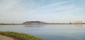
The route follows the course of the ancient Corseul–Avranches Roman road between La Moignerais (2) and (3). Unpaved, the route runs along a ridge line offering beautiful panoramic views.
Click here or there for further details.

Other walks in the area

For more walks, use our search engine .

The GPS track and description are the property of this route's author. Please do not copy them without permission.