Circular walk via Pointe de Cancaval from La Richardais

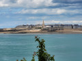
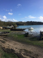
The route takes you along the banks of the Rance between La Richardais and the hamlet of Créhen, via the Pointe de Gronget. The Pointe de Cancaval offers a beautiful view of the Rance, the dam of the same name and the town of Alet towards Saint-Malo.

Details

98403524
Creation:
Last update:
Last review:
  • Walking
    Activity: Walking
  • ↔
    Distance: 5.03 mi
  • ◔
    Average duration: 2h 25 
  • ▲
    Difficulty: Easy

  • ⚐
    Back to start: Yes
  • ↗
    Ascent: + 157 ft
  • ↘
    Descent: - 174 ft

  • ▲
    Highest point: 89 ft
  • ▼
    Lowest point: 7 ft

Photos

Description of the walk

Car park at Place de la République.

(S/E) With your back to the church, walk down the square to reach Rue de Dinard. Follow it to the left and go straight on, keeping to the right.

(1) At the corner of the wall, turn right and head down to the beach. Turn right and continue along the beach, past the headland, until you reach the ramp by the harbour.

(2) Turn right onto Rue du Port and continue to the junction. Turn left onto Rue de Dinard and carry on to the bridge.

(3) Just after the bridge, take the steps on the left to reach the path below. Continue along the riverbank.

(4) At the track, continue left towards the mill, then follow the riverbank to Pointe de Cancaval. There is a view of the Rance dam and the town of Alet in the distance.

(5) Carry on along the riverbank, passing the Château de Mont-Marin on your left.

(6) After the castle gate, turn left onto the path towards numbers 20 to 26, and carry on to the wash house. Turn right, leaving the car park on your left. Continue along Impasse du Champ Rozé. At the junction, follow the road to the left and join the D114, Route des Bords de Rance.

(7) Cross over towards Pleurtuit, pass the houses and take the path on the right. Follow it through the woodland to reach the Étang du Moulin Neuf.

(8) Walk along the right-hand side of the pond until you reach the D114. Cross the road to return to the junction you passed on the way out.

(4) Turn left, then rejoin the road.

(3) Turn right and, about 180 m after the bridge, turn left onto Rue du Calvaire. At the calvary, continue along Rue Louis Bréhault, then Rue de la Paix, and return to the starting point (S/E).

Waypoints

  1. S/E : mi 0 - alt. 79 ft - Place de la République - Église Saint-Clément (La Richardais)
  2. 1 : mi 0.15 - alt. 59 ft - Turn right
  3. 2 : mi 0.78 - alt. 26 ft - Port
  4. 3 : mi 1.15 - alt. 33 ft - Bridge
  5. 4 : mi 1.32 - alt. 33 ft - Chemin du Moulin Neuf
  6. 5 : mi 2.37 - alt. 33 ft - Pointe de Cancaval
  7. 6 : mi 3.19 - alt. 52 ft - Junction with footpath - Château du Montmarin
  8. 7 : mi 3.54 - alt. 69 ft - D114
  9. 8 : mi 4.1 - alt. 30 ft - Pond
  10. S/E : mi 5.03 - alt. 79 ft - Place de la République - Église Saint-Clément (La Richardais)

Notes

There is a picnic area at the junction of Rue de Dinard and the Sentier des Grandes Rivières.

Worth a visit

Manoli Museum
Museum and Sculpture Garden.

Saint-Clément Church (1866–1873)
It was built to replace the former Saint-Clément Chapel (1719–1720): this chapel was a ‘frairie’. Saint-Clément remained the patron saint of La Richardais.
A ‘frairie’ is a subdivision of a parish, which emerged in the Middle Ages and survived until the French Revolution. Frairies existed only in certain areas of the Kingdom of France, but were very common in the Duchy of Brittany. See Wikipedia

Montmarin Castle (1760)
This luxurious ‘malouinière’, situated in the commune of Pleurtuit, enjoys an unrivalled setting on the banks of the Rance; it was once owned by the famous family of shipowners, the Magon de la Lande family. Its distinctive feature is its low Italian-style roof, rare in this region, whose balustrade is adorned with antique marble busts. These can also be seen on the balustrade at the entrance, visible from the road.
Visitors are welcome to explore the garden.

Reviews and comments

5 / 5
Based on 1 review

Reliability of the description
5 / 5
Ease of following the route
5 / 5
Route interest
5 / 5
User 8842339

Overall rating : 5 / 5

Date of your route : Sep 07, 2026
Reliability of the description : ★★★★★ Very good
Ease of following the route : ★★★★★ Very good
Route interest : ★★★★★ Very good
Very busy route : No

We did this walk in early September and came across very few people. It’s a pleasant, wooded route with no difficult sections.

Machine-translated

Other walks in the area

For more walks, use our search engine .

The GPS track and description are the property of this route's author. Please do not copy them without permission.