Country:
 City:
City:


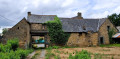
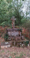

Start from the car park next to Trémeheuc cemetery.
(S/E) Walk past the church and continue along the D83 road, which climbs to the right. Pass the hamlet known as Le Chatroussé.
(1) At the crossroads, take the D83 to the left for about a hundred metres before carefully crossing the road to join the path under the trees that runs alongside a property. Carefully cross the D796 to rejoin a path, which you should follow until you reach the edge of the hamlet at a place called Le Rocher Mazier.
(2) Take the path on the right, then at the first junction, turn left to reach a road. Turn left towards the wind turbines. Pass the crossroads and follow the farm track until you reach a junction.
(3) Take the path on the right, heading north. It runs alongside the wind farm. Follow it, crossing a road, until you reach a crossroads after about 1 km, at a place called Les Douaires.
(4) Take the road on the right, heading east. Follow it until you come to a wind turbine on the right.
(5) Take the path on the left, then the track that runs 40 metres from the wind turbine. Cross the road and continue along the track opposite, which winds through the woodland.
(6) When you reach the road, turn right and follow the road almost in a straight line to a place called La Favrie. Then take the path opposite. Follow it to a place called La Gautrais and the D83, then follow the D83 to the right for about 20 m.
(7) Take the path on the left, crossing the road. Continue along the path, going round a small pond, until you reach a road.
(8) Turn right onto this road and continue for about 300 metres before turning left onto the stony farm track. Follow this until you reach another road.
(9) Turn right and carry on along the road, passing the hamlet of l’Aubertière, then that of Launé-Chartier, until you reach the D796.
(10) Turn right and take the path on the left immediately after the property. The path descends gently to a junction of paths. Take the slightly ascending path on the right. Continue until you come to a yellow marker post on the left; leave the post on your right and take the path heading south. Follow it until you reach a road.
(11) Turn right, then after about a hundred metres, take the path on the left and walk through the woodland. After about 150 m, take the path on the right. The path is lined with humorous signs. Follow the path until you reach a road at a place called Le Loup Pendu. Turn left onto the D3796.
(12) At the next junction, continue along the same road, keeping to the left. Pass the Linon (barely visible due to the vegetation) and reach the entrance to the village of Trémeheuc. Continue straight on to reach the hamlet known as Le Chatroussé.
(1) Head for the car park by taking the D83 on the left (S/E).
 Association / Club / Walk leader
 Easy
Easy 
 Visorando Member