Circular North-West Tour of Ouessant via Pointe de Pern

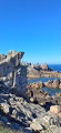
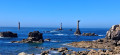
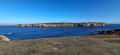
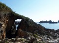
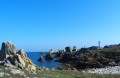
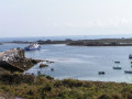
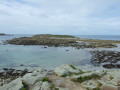
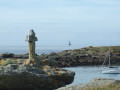
A superb walk starting from Lampaul, following the coastal path along the north-west of the island. The headland opposite KellerIslandoffers a view of Stiff Lighthouse on the right and Créac’h Lighthouse on the left. The rocks are very jagged all along the west coast; they form statues of stone giants that give free rein to the imagination. The Pointe de Pern offers a spectacular sight!

Details

n°100305215
Creation:
Last update:
Last review:
–
  • Walking
    Activity: Walking
  • ↔
    Distance: 8.59 mi
  • ◔
    Average duration: 4h 10 
  • ▲
    Difficulty: Moderate

  • ⚐
    Back to start: Yes
  • ↗
    Ascent: + 210 ft
  • ↘
    Descent: - 207 ft

  • ▲
    Highest point: 105 ft
  • ▼
    Lowest point: 13 ft
  • ⚐ Country: France
  • ⚐ City: Ouessant (29242)
  • ⚑
    Start/End: N 48.457346° / W 5.096436°
  • ❏
    IGN map(s): Ref. 0317OT
  • Hour-by-hour weather

Photos

Description of the walk

Start from the church square in Lampaul.

(S/E) Facing the church porch, turn left up the steps between two houses. Cross the road and continue up the steps opposite. Carry on along the road and turn right onto Porsnoan.

(1) At the next junction, turn right. At the following junction (youth hostel), follow the road to the left until you reach a Fork in the road at a place called Kerlann.

(2) Turn slightly to the right. At the junction immediately ahead, continue along the path opposite. Join a road and follow it to the left. Pass the hamlet of Lann Vraz and carry on straight on until you reach Keranchas.

(3) Turn right. At a Fork in the road, keep to the right and, at the next Fork in the road, turn left. Continue to Penn Ar Ru, opposite KellerIsland.

(4) Turn left and walk carefully along the edge of the cliff. Head south-west then west to Yuzin harbour.

(5) Continue along the path skirting the coast, heading south-south-west then west-south-west. Note the Men Du rock off the coast. This will take you to Créac’h Lighthouse.

(6) Leave the lighthouse on your left and continue along the path; you will soon reach Pointe de Créac’h.

(7) Then turn left and walk along the coast heading south-west. You’ll reach the remains of an old foghorn.

(8) Continue along the path to quickly reach Pointe de Pern (walls of an old sound signal structure; Nividic Lighthouse offshore).

(9) Turn left and continue eastwards along the coastal path. Pass the Trébéchou navigation mark on your right and note, below, the anchor of the Atlas, a ship that ran aground nearby in 1781. Go round the old Locqueltas battery on the right.

(10) Continue along the coastal path.

(11) At the T-junction (ruins of two small mills), turn right. Stay along the coast. You will arrive in Lampaul. Follow the Route du Phare to the right and you will soon reach the church (S/E).

Waypoints

  1. S/E : mi 0 - alt. 49 ft - Église Saint-Paul-Aurélien (Lampaul)
  2. 1 : mi 0.16 - alt. 105 ft - Crossroads
  3. 2 : mi 0.4 - alt. 92 ft - Fork in the road - Kerlann
  4. 3 : mi 0.93 - alt. 89 ft - Keranchas junction
  5. 4 : mi 1.59 - alt. 20 ft - Penn ar Ru Meur
  6. 5 : mi 2.61 - alt. 26 ft - Yusin Cove – Car park
  7. 6 : mi 4.61 - alt. 75 ft - Phare du Créac'h
  8. 7 : mi 4.95 - alt. 39 ft - Pointe de Créac'h
  9. 8 : mi 5.9 - alt. 33 ft - Ruins
  10. 9 : mi 6.12 - alt. 33 ft - A band of pebbles - Pointe de Pern
  11. 10 : mi 6.85 - alt. 59 ft - Batterie de Locqueltas
  12. 11 : mi 7.2 - alt. 62 ft - T-junction – Ruins of mills
  13. S/E : mi 8.59 - alt. 49 ft - Église Saint-Paul-Aurélien (Lampaul)

Notes

Keep well clear of the cliff edges.

Do not disturb wild animals or free-roaming sheep and goats.

Take care when walking alongside or crossing roads: even if there is little traffic, the roads are narrow.

Worth a visit

Créac’h Lighthouse (6)
Not open to visitors. 54 m high with a range of 60 km. Its black and white stripes are its distinguishing feature. Behind the lighthouse stands the sheer rock face on which, in 1900, an underwater bell was installed on a square platform. It was used until 1919.

The Lighthouse and Beacon Museum (6)
Closed until 2027 for renovation work.

The horse-driven foghorn (8)
Installed in 1866, this site housed a foghorn powered by four horses, which turned a wheel that compressed the air needed to operate the foghorn.

Pebbles ( 9)
Just north of Pointe de Pern, two bands of pebbles dating from between 1 and 3.6 million years ago can be seen. These pebbles, which are a protected heritage site, bear witness to a time when the sea level was higher.

The Villa des Sirènes (9)
This is a former maritime sound-signalling structure installed in 1885. It is a siren trumpet,

Other walks in the area

For more walks, use our search engine .

The GPS track and description are the property of this route's author. Please do not copy them without permission.