Country:
 City:
City:


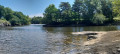
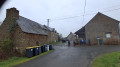
Start from the bridge on the D9 near the town hall.
(S/E) Head away from the town hall and, after the bridge, turn right onto Rue de la Mariais. Ignore the road leading to Les Freches on the right and continue straight on. The road becomes a farm track. About 650 metres after the ‘Les Freches’ sign, you’ll reach a crossroads.
(1) Continue along the path on the right to reach the D73.
(2) Follow it to the right for about 100 metres and turn right into the forest onto the path, which will curve to the left and rejoin the D73.
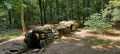
(3) Cross the road and take the path on the right which runs alongside the D73. At the junction with the road to La Salette, take the path opposite. After about 100 metres, take the small path on the left. Keep an eye out as it may be obscured by vegetation. The path winds through the forest and passes close to old retting pits for flax or hemp. It joins a forest track.
(4) Follow this to the right twice, then turn left at the junction and carry on straight ahead until you reach the junction known as Le Pertuis aux Chevreuils.
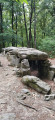
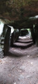
(5) Cross the D9 and continue straight on for 500 metres, then turn left onto a winding path. You will then cross a forest track and climb gently until you reach the dolmen, also known as the ‘Maison des Fées’.
(6) Head north again, turning right onto a path that begins a descent towards the north-east and crosses a farm track. Cross it, staying on the path until you reach a junction,
(7) Then follow the path on the left, bordered by a mound of earth, which resembles a half-sunken track. At the next junction, turn right to join the D73.
(8) Cross the road to take the path opposite, through the woods; cross a small bridge and turn right. Follow the path which runs along the edge of the forest, alongside a pasture on the right. You’ll reach a junction of roads and paths.
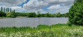
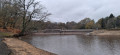
(9) Head right for a few metres, then turn left down the cul-de-sac to reach a car park. Walk past it and continue along the edge of the pond until you see a footbridge. Then turn right to stay by the water’s edge and join a stony path. Turn left. Leave the golf course on your left to reach a housing estate. Continue to the bridge.
(10) Turn right before the bridge to return to the car park (S/E).
 Visorando Member
 Easy
Easy 
 Association / Club / Walk leader
 Difficult