


 Country:
 City:
City:


Start from the church in Ouessant.
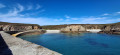
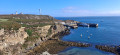
(S/E) From the church, head west along the D81 towards Pointe de Pern. At Locqultas, take the path on the right towards the coast to reach the small harbour of Bouguézen. Beautiful view over Lampual Bay. You can walk along the coast to reach the old Fort de Locqueltas.
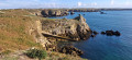
(1) Return to the D81 and continue left to reach Pointe de Pern.
(2) After exploring the headland, head back towards Lampaul via the D81, and, when you reach Locqueltas, turn left onto a stony path towards the Notre-Dame de Bon Voyage Chapel, also known as the Saint-Gildas Chapel. Next to it is the fountain of the same name.
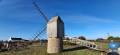
(3) Return to the path, then continue along the road, turning right at the junction and then left twice to reach a restored mill.
(4) Then carry on westwards, turning left towards the clearly visible Creac’h lighthouse.
(5) From the lighthouse, return to the mill.
(4) Take the road on the left at the crossroads. On leaving Kerouat, turn left onto the road to reach the coast and pass through the hamlet of an Niou Izel. Carry on, taking the road on the left at the crossroads, then right at the second one, to reach the eco-museum.
(6) Set off again towards Lampaul, rejoin the D81 by turning left and head for the church at Ouessant.
(S/E) Carry on straight ahead and, shortly after the campsite, you’ll reach a three-way junction.
(7) Carry on along the road to the left, before the first-aid post, and head straight on. After Kerlann, at the crossroads, leave the tarmac and take the track to the left for about 270 metres, then turn right.
(8) On reaching the hamlet of Kergadou, first turn left then right and carry on straight on until you reach the Yuzin slipway.
(9) Take the same road back to Kergadou.
(8) At the crossroads, turn left, then carry on straight for about 400 m and take the road on the left. Pass through the hamlet of Keranchas; the road is circular and you’ll find a path on the left.
(10) Take this path to reach Kerzoncou. You can walk to Penn ar Ru Meur, opposite Keller Island. Superb view of the Stiff.
(11) Turn back towards the road.
(10) Follow the road to the left until you reach the first junction, then turn left. Keep left until you reach the hamlet of Kernic. You can walk down to the coast to visit the old fort and enjoy the view over Calgrac’h Bay.
(12) Head back and, at the crossroads, take the road uphill to the left. Then follow the road, still going uphill, to Frugullou and the D81.
(13) Then turn left, leaving the D81, and carry on straight on to the Stiff Lighthouse.
(14) Set off from the lighthouse, turning left and passing by the old semaphore. Turn left at the crossroads to head down towards the D81 and the crossroads with a picnic area. An old wash house is situated below this. Go straight on past the crossroads, climb the hill and head back down towards the hamlet of Pen Arlan.
(15) Turn left twice to reach the headland of Lann Pen ar Lan, near the cromlech.
(16) Continue south, passing the Cross of Saint Paul, to return to Pen Arlan.
(15) Turn left onto the D181 and head down towards Porz ar Lan beach and its jetty.
(17) Then head back up towards Pen Arlan.
(15) Do not turn right at the two junctions; instead, head left towards Lampaul. After about 850 m, turn left towards the Notre-Dame de Bonne Espérance Chapel
(18) Turn left, then right. The road bends to the right and, when you reach the houses, turn left downhill towards Poutréou, stopping at the end of the cycle path.
(19) Walk back up the slope to rejoin the road and turn left. Continue straight on to Porzh Gwenn.
(20) About 5 metres before the crossroads marked by a wayside cross, turn left onto a path leading downhill between the walls of two houses and stop at the end of the cycle path near the hill, then return to Porzh Gwenn.
(20) Turn left and carry on straight ahead along the road, leaving the wayside cross on your right.
(21) At Toull al Lann, take the path on the left, which climbs slightly, and head towards Cale de Penn ar Roc’h.
(22) Return to Toull al Lann.
(21) Turn left and head towards Feunteun Vélen.
(23) Turn left and continue along the stony path towards the headland of Penn ar Viler.
(24) Turn back towards Feunteun Vélen.
(23) Keep to the left and follow the coast, passing Corz Beach on your left, then continue along the road over the hill. You’ll reach a crossroads with a large wayside cross; turn left towards the church, a little further up (S/E).

