Country:
 City:
City:




Yellow P4 signposted route.
Start at the car park by Roz-sur-Couesnon Town Hall.
(S/E) Turn left, head towards the church and take the first street on the right to reach the cemetery.
(1) Walk past it and take the dirt track on the right, following it to the Corps de Garde.
(2) Continue left along the track, following the signposts, to join the D289 at a place called La Poultière. Continue right onto Rue du Moulin.
(3) Turn left onto Rue du Puits Fouquet, then left onto Impasse Pinet. The road begins to climb and becomes a dirt track leading to a small crossroads.
(4) Take the road heading westwards uphill to reach the top of the hill.
(5) Then turn right onto the dirt track which descends gently towards the D797 at a place called Narbonne.
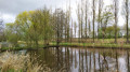
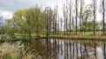
(6) Cross the D797 carefully and follow the path to the right to enter the polders. Turn right twice. The path then branches off at a 90° angle to the left and follows a line of trees flanked by two ditches on either side. The path turns left and joins a road.
(7) Follow it to the right to reach the greenway.
(8) Take it to the right towards the hamlet of Palluel.
(9) Cross a road to follow the greenway and stay on it all the way to a shed.
(10) Carry on straight ahead until you come to another road to cross. Return to the greenway by first turning right then left; after about 230 m, turn right onto the gravel track and keep to the right to reach the Maison des Polders.
(11) Walk past it and, at the next junction, turn left to join the D797.
(12) Cross it carefully and walk up the hill along the road to return to the starting car park (S/E).
 Visorando Member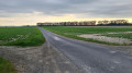



 Difficult
  Association / Club / Walk leader
 Easy
Easy