Circular walk from Saint-Suliac via Pointe du Puits and Mont Gareau

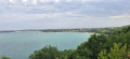
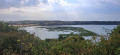
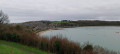
Just ten kilometres or so south of Saint-Malo, Saint-Suliac is a small village situated on the coast of the Rance estuary. It is a former fishing village. The route suggested here allows you to discover the rich variety of landscapes; it passes via Mont Garrot (or Gareau), which, at a height of 73 metres, offers a panoramic view of the Rance valley and the ‘Viking camp’. It runs alongside the river and passes through designated nature reserves.
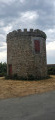
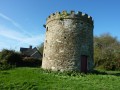
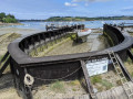
Along the route, you can admire two historic mills: a windmill overlooking the hill (which cannot be visited, as it stands on private land that is not accessible) and the old Boschet tide mill, built inthe 16th century and in operation until the 1940s. A local association has carried out its complete restoration.

Details

101341547
Creation:
Last update:
Last review:
  • Walking
    Activity: Walking
  • ↔
    Distance: 7.16 mi
  • ◔
    Average duration: 3h 45 
  • ▲
    Difficulty: Moderate

  • ⚐
    Back to start: Yes
  • ↗
    Ascent: + 515 ft
  • ↘
    Descent: - 515 ft

  • ▲
    Highest point: 240 ft
  • ▼
    Lowest point: 16 ft

Photos

Description of the walk

Start point near the campsite.

(S/E) Head towards the Rance and take the street on the right, Rue Grainfolet, to reach the oratory.

(1) Then head down to the banks of the Rance (if the tide is high, take the path on the right, then the Chemin de la Vierge de Grainfolet and the path on the right that leads down to the Rance). Otherwise, stay on the riverbank heading south.

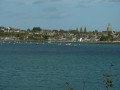
(2) At the Ruette du Port au Riz, continue along the riverbank to the water sports centre, then take the shaded path. Follow it to the tip of the Mont Garrot/Gareau headland (beautiful view of the Chateaubriand Bridge and the Saint-Hubert Bridge).

(3) Carry on along the banks of the Rance until the next junction, about 550 metres away.

(4) Then take the path on the left, which leads uphill. Pass the vineyard on your left and take a look at the remains of the Viking camp – considered by some to be a medieval fortification. At the top, there is a lovely viewpoint over the Rance.

(5) Carry on to the junction with a road and continue along the stony path opposite. After 80 metres, take the path on the right, which leads downhill. Turn left and join the D7. Head right towards Chablé for a quick visit to the menhir known as the ‘Dent de Gargantua’.

(6) Retrace your steps and follow the D7 uphill for about 750 metres.

(7) Follow the path which continues to the right and then turns left to join the D117. Turn right.

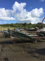
(8) After the last house, take the path on the left. You’ll catch a glimpse of the old Boschet tide mill. Follow the path along the riverbank until you reach a company shed. Walk alongside it and join the road.

(9) After a very short uphill stretch, take the path on the right. It leads to Pointe du Puits.

(10) Continue along the path skirting the banks of the Rance and reach Pointe de Garel, after a short stretch along the foreshore.

(11) Follow the path to the left, which soon veers to the right to rejoin Rue de Grainfolet, which you took on the way out. Then turn left to return to the car park (S/E).

Waypoints

  1. S/E : mi 0 - alt. 112 ft - Car park, Rue Les Cours, near the municipal campsite
  2. 1 : mi 0.27 - alt. 108 ft - Grainfolet Oratory
  3. 2 : mi 0.7 - alt. 23 ft - Ruette du Port au Riz
  4. 3 : mi 1.67 - alt. 75 ft - Pointe du Mont Gareau - Rance (fleuve)
  5. 4 : mi 2.04 - alt. 33 ft - Junction - Rance (fleuve)
  6. 5 : mi 2.55 - alt. 226 ft - Road junction
  7. 6 : mi 3.18 - alt. 59 ft - Menhir
  8. 7 : mi 3.68 - alt. 69 ft - Path
  9. 8 : mi 4.22 - alt. 16 ft - Signpost, Chemin du Tertre, last house
  10. 9 : mi 5.84 - alt. 69 ft - Rue de la Pointe du Puits - Rance (fleuve)
  11. 10 : mi 6.04 - alt. 26 ft - Pointe du Puits - Rance (fleuve)
  12. 11 : mi 6.65 - alt. 20 ft - Pointe de Garel - Rance (fleuve)
  13. S/E : mi 7.16 - alt. 112 ft - Car park, Rue Les Cours, near the municipal campsite

Notes

An alternative option is to park near (6), free car park, coordinates: 48.57057, -1.966161

Toilets are available near (2).

Check the tide times, as some sections of the coastal path may be submerged.

Worth a visit

Church
The church of Saint-Suliac dates fromthe 13th and14th centuries. Considered one of the oldest in Brittany, it has been listed as a Historic Monument (church, portal and cemetery) since 2001.
It was Saint Suliac, a disciple of Saint Sanson, who founded the church around the6th century. Highlights include the stained-glass window depicting the sailors’ procession before their great departure for Newfoundland, the magnificent altarpiece made of wood and plaster, and the parish churchyard.

The Dent de Gargantua
The Chablé Menhir, or ‘Dent de Gargantua’, is an upright white quartz stone approximately 5 metres high. It is now one of the few visible prehistoric remains in the parish. Legend links it to Gargantua.

The Oratory andthe Virgin of Grainfolet
Overlooking the village, the Oratory of the Virgin of Grainfolet bears witness to the history of the Newfoundland fishermen. It was erected in 1894 following a vow made by the fishermen.

Boschet Mill
Boschet’s
tidemillis one of the oldest structures of its kind in the region. It was the largest in the department and the last to cease milling wheat in 1981. Click here for more details.

Other walks in the area

For more walks, use our search engine .

The GPS track and description are the property of this route's author. Please do not copy them without permission.