Circular South-West loop via the Pyramide du Runiou and Penn ar Wiler

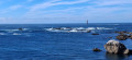
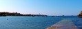
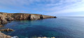
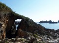
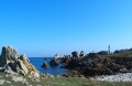
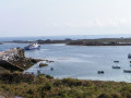
An easy walk offering the chance to explore the Penn ar Viler headland. To the north lies Lampaul Bay, with a view of Créac’h Lighthouse. To the south is the Fromveur Passage and a view of La Jument Lighthouse.
You can make the most of the walk by stopping for a rest either at Corz Beach or Prat Beach, weather permitting.

Details

n°101279984
Creation:
Last update:
Last review:
–
  • Walking
    Activity: Walking
  • ↔
    Distance: 6.37 mi
  • ◔
    Average duration: 3h 05 
  • ▲
    Difficulty: Moderate

  • ⚐
    Back to start: Yes
  • ↗
    Ascent: + 138 ft
  • ↘
    Descent: - 138 ft

  • ▲
    Highest point: 125 ft
  • ▼
    Lowest point: 13 ft
  • ⚐ Country: France
  • ⚐ City: Ouessant (29242)
  • ⚑
    Start/End: N 48.457346° / W 5.096436°
  • ❏
    IGN map(s): Ref. 0317OT
  • Hour-by-hour weather

Photos

Description of the walk

(S/E) From the church square, take the D81 westwards. At the junction, turn left onto the road and follow it for about 60 metres.

(1) Turn left onto the road leading down towards the harbour.

(2) At the end of the street, take the path leading to the harbour. Carry on until you come to three stone steps on the right. Climb the steps and continue straight ahead. Pass the wayside cross on your right and you’ll reach a road.

(3) Turn right onto it, pass Corz Beach and continue along the road which follows the coastline. When the road veers away from the coast, take a path on the right which will continue to follow the coastline and lead you to the top of Prat Beach.

(4) Continue along the path, keeping close to the coast, taking care. Pass Anse de Porz Goret to reach Pointe de Porz Doun.

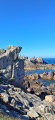
(5) Continue along the coast until you reach the easily recognisable landmark known as the Pyramide du Runiou.

(6) Carry on along the path hugging the coast until you reach the Penn ar Roc’h cove.

(7) Carry on along the path until you reach Anse de Porz Gwenn.

(8) Then take the path on the left, which leads uphill, and head for the hamlet of the same name. When you reach the road, turn left towards the wayside cross.

(9) Take the road to the right of the wayside cross, then take the road on the left, which becomes a footpath. Follow this footpath straight on until you reach the road near Corz Beach.

(3) Walk past the beach and turn left onto the path, continuing close to the coast. Go round the wayside cross you saw on the way out, this time on the left, and carry on until you reach the three stone steps from the outward journey. Take the road on the right as far as the large wayside cross, then turn left to head back up towards the church and return to the starting point (S/E).

Waypoints

  1. S/E : mi 0 - alt. 49 ft - Church Square - Église Saint-Paul-Aurélien (Lampaul)
  2. 1 : mi 0.08 - alt. 46 ft - Ar Straed ar Dro Street
  3. 2 : mi 0.17 - alt. 39 ft - Lampaul Harbour
  4. 3 : mi 0.46 - alt. 52 ft - Road to Corz beach
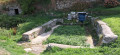
  5. 4 : mi 1.22 - alt. 36 ft - Washhouse, Prat Beach
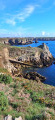
  6. 5 : mi 2.74 - alt. 43 ft - Penn ar Viler Headland
  7. 6 : mi 3.22 - alt. 75 ft - Amer, Runiou Pyramid
  8. 7 : mi 4.44 - alt. 92 ft - Penn ar Roc’h slipway
  9. 8 : mi 5.25 - alt. 59 ft - Porz Gwenn Cove Trail
  10. 9 : mi 5.38 - alt. 79 ft - Waymark
  11. S/E : mi 6.37 - alt. 49 ft - Church Square - Église Saint-Paul-Aurélien (Lampaul)

Notes

Take care when walking alongside or crossing roads.

Take care on the path where it runs too close to the edge of the coast – risk of landslides; see the signs along the path.

Do not disturb any animals, whether wild or domestic.

Worth a visit

Prat Beach
A lovely little beach with fine sand, perfect for a relaxing break.

Saint-Guénolé washhouse and its fountain
Overlooking Prat Beach, a small wash house fed by a spring faces Lampaul Bay.

Runiou Pyramid
A maritime navigation aid: a mark known as the RuniouPyramid. A fixed object – in this case, rocks painted white – situated on the coast and serving as a landmark for ships.

Penn ar Roc’h Harbour
Penn ar Roc’h harbour
and anchorage, built in the19th century.

Other walks in the area

For more walks, use our search engine .

The GPS track and description are the property of this route's author. Please do not copy them without permission.