Country:
 City:
City:


Set off from the car park along the D795 near Magdeleine.
(S/E) Cross the road and head towards Avignon and Cotillé. In Avignon, pass the first farmhouse.
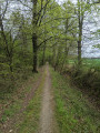
(1) Then, at the second “junction”, take the gravel track on the right, which runs between two stone walls. Follow the track until it joins a small road at a place called Landéjard. Turn left and stay on the road, which curves to the right. After about 400 metres, the road curves to the right.
(2) Then take the dirt track on the left. Follow the dirt track, keeping to the right; it leads to a hamlet at a place called Quelmé.
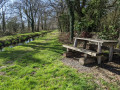
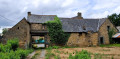
(3) Walk past the farm and join a road. At the first small crossroads, carry on along the road opposite. It becomes a track as you leave the hamlet. Continue on, passing the pond on your right, until you reach a road.
(4) Turn left and carry on along the road until you reach the crossroads at a place called Cotillé.
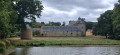
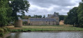
(5) Take the road on the right and continue to the crossroads. Turn left to reach the Manoir du Grand Trémaudan and note the superbly restored dovecote on the right-hand side of the road. The manor house is a sight to behold. Continue along the road for about 250 metres, past the manor’s gate.
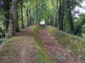
(6) At the junction, take the path through the woodland on the right. After about 750 metres, the path splits in two; take the one on the left and you’ll reach a road shortly afterwards.
(7) Turn left and, at the first junction, take the road on the right, towards the hamlet known as Le Tertre Audie. After 50 metres, turn left onto the path through the woodland. Follow it; it soon turns sharply southwards to join a road. Turn left to reach the hamlet known as Le Tertre Audie. Walk through the hamlet and continue along the road.
(8) At the three-way junction, keep left and carry on to the next hamlet, at a place called La Morandiére (no sign). At the entrance to the hamlet, take the gravel track on the left. After 700 metres, take the path on the right and join a small road at a place called Brande Jean. Turn left and cross the D795. Continue towards La Haute Vallée and Le Champ du Moulin.
(9) 20 metres past the wayside cross, take the sunken path on the right. After 350 metres, at the Croix des Sorciers, take the path on the left which zigzags to reach a road at the hamlet known as La Haute Vallée.
(10) Take the road on the right and continue for 400 metres to the Champ du Moulin farm. Turn left onto the footpath. After 300 metres, turn right, then left shortly afterwards, and head towards the hamlet known as Les Fréchandières. Pass the houses, then cross the road to take the grassy path opposite.
(11) Cross the road and continue straight ahead along the path until you reach the hamlet known as La Saudrais,
(12) Walk through the hamlet along the road and join the D795 to return to the starting point (S/E).

 Association / Club / Walk leader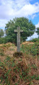
 Easy
Easy 

 Visorando Member