Route of the Megalithic Hemicycle of the Tombs

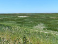
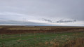
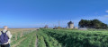
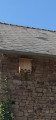
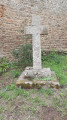
A walk starting from Saint-Broladre, covering the surrounding countryside. It follows a route that includes parts of the ‘marais blanc’ and parts of the ancient coastline. On the heights, it takes you to the Neolithic megalithic site known as ‘Les Tombes’, followed by the Homeaux manor house. The Croix Ferrigand marks the site of a former manor house that no longer stands. As you pass through the hamlet of La Ginclais, you can see a bat box.

Details

n°106248359
Creation:
Last update:
–
Last review:
–
  • Walking
    Activity: Walking
  • ↔
    Distance: 5.41 mi
  • ◔
    Average duration: 2h 40 
  • ▲
    Difficulty: Easy

  • ⚐
    Back to start: Yes
  • ↗
    Ascent: + 194 ft
  • ↘
    Descent: - 194 ft

  • ▲
    Highest point: 230 ft
  • ▼
    Lowest point: 10 ft

Photos

Description of the walk

Start from the car park at Saint-Broladre Church.

(S/E) Leave the car park and take the street on the left. At the junction, turn right, then left again onto Rue de la White Cross for about 75 metres. Turn right onto Rue de la Boussaquière and continue straight on until you reach the D797.

(1) Walk along the left-hand side of the road and cross the D797 to continue towards the Duchesse Anne dyke. Pass the garage and carry on to the first junction; turn left onto the stony track, cross the farmyard and rejoin the D797. Cross the road and keep to the right for about 90 metres, then turn left onto Chemin du Bas Marais.

(2) At the end of the road, turn left towards the bridge.

(3) Cross the bridge over the Canal de la Banche, then cross the D80 and turn onto the path opposite. The path is steeply sloping and joins a farm track. Turn right to reachthe Tombes megalithic hemicycle on your right.

(4) Continue along the path, which forms a circular loop. Pass the crossroads and carry on straight ahead. The path descends and reaches a junction.

(5) Turn right here towards the Croix Ferrigand (signpost on the right-hand side of the road). Carry on straight ahead.

(6) Walk past the Manoir des Homeaux and carry on to the Croix Ferrigand crossroads.

(7) Cross the road towards the hamlet of La Ginclais and turn right at the crossroads.

(8) Look out for the bat box on the wall opposite number 2. Then turn left at the crossroads and carry on to the stream.

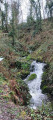
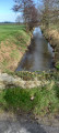
(9) Then take the path downhill which runs alongside the Ruisseau du Riscopp. The path winds through the woodland and emerges with a view of Saint-Broladre Church. Return to the car park (S/E).

Waypoints

  1. S/E : mi 0 - alt. 36 ft - St-Broladre church car park
  2. 1 : mi 0.35 - alt. 20 ft - D797
  3. 2 : mi 1.84 - alt. 10 ft - Crossroads, end of the road
  4. 3 : mi 2.08 - alt. 13 ft - Bridge - Canal de la Banche (canal) - Affluent du Canal des Planches
  5. 4 : mi 2.69 - alt. 167 ft - The Megalithic Hemicycle - Allée Couverte (Saint-Broladre)
  6. 5 : mi 3.65 - alt. 164 ft - Crossroads leading to the Croix Ferrigand
  7. 6 : mi 4.05 - alt. 167 ft - Manoir des Homeaux
  8. 7 : mi 4.31 - alt. 217 ft - Waycross
  9. 8 : mi 4.51 - alt. 200 ft - Bat box
  10. 9 : mi 4.8 - alt. 171 ft - Stream - Etang du Haut
  11. S/E : mi 5.41 - alt. 36 ft - Saint-Broladre church car park

Notes

Takecare when using the roads.

Near the church car park: a picnic table and toilets.

Worth a visit

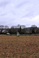
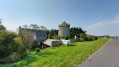
The megalithic hemicycle known as Les Tombes (or Champ des Tombes)
It dates from the Neolithic period. The site comprises several granite blocks. These monuments bear witness to the region’s very ancient settlement. Detailed information available on site.

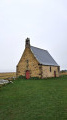
The Homeaux Manor House
The Homeauxor Hommeaux Manor House (1467). It once comprised two courtyards, a pavilion, a dovecote and a chapel. The Chapel of Saint John the Baptist at Les Hommeaux was attached to the manor of the same name, owned in 1551 by Pierre de Férigat. The coats of arms of the Férigat, de Saint-Genys and Arthur families can be seen there.

La Croix Ferrigand (historically spelled La Croix-Ferigat)
The present-day cross marks the site of a former manor house and seigneurial estate, the manor of La Croix-Ferigat. The name derives from a family of the local nobility, the Ferrigats (or Ferigats), who owned land in the region in the late Middle Ages.

La Cinglais
Opposite number 2, you can see a curious bat shelter beneath the guttering.

Other walks in the area

For more walks, use our search engine .

The GPS track and description are the property of this route's author. Please do not copy them without permission.