The Witches’ Route in Combourg

The Circuit des Sorciers takes you through the wooded countryside around Combourg. The route winds its way through the refreshing shade of the Haute Vallée in summer and past the small villages and houses characteristic of the region, offering breathtaking views of the ‘small town of character’ of Combourg.

Details

96590570
Creation:
Last update:
Last review:
  • Walking
    Activity: Walking
  • ↔
    Distance: 5.14 mi
  • ◔
    Average duration: 2h 35 
  • ▲
    Difficulty: Easy

  • ⚐
    Back to start: Yes
  • ↗
    Ascent: + 269 ft
  • ↘
    Descent: - 249 ft

  • ▲
    Highest point: 302 ft
  • ▼
    Lowest point: 112 ft
  • ⚐ Country: France
  • ⚐ City: Combourg (35270)
  • ⚑
    Start/End: N 48.393679° / W 1.753478°
  • ❏
    IGN map(s): Ref. 1217SB
  • Hour-by-hour weather

Photos

Description of the walk

The route starts at the Magdeleine car park.

(S/E) Cross the D795 carefully, heading towards Avignon and Cotillé.

(1) Drive straight through Cotillé.

(2) At the first junction, turn left towards Trémaudan. Once past the Manoir du Grand Trémaudan, it’s time for a break. Walk through the hamlet to the junction and head left towards Le Tertre Audie.

(3) After about fifty metres, turn left onto the path through the woodland. Follow it to the hamlet and rejoin the road. Continue to the left, with a view of Combourg below. Walk through the hamlet along an uphill road, continue to the first crossroads and turn left to reach the hamlet of La Morandière.

(4) At the entrance to the hamlet, take the path on the left before the first house. Follow the path downhill, which veers to the right into the valley. Carry on and turn right onto the sheltered sunken path. Continue uphill to rejoin the road and find the hamlet of Brande Jean on the left. Cross the D795 carefully.

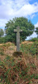
(5) Pass the wayside cross and, immediately afterwards, turn right onto the footpath. You’ll find the Croix des Sorciers on its plinth.

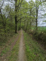
(6) Turn left at a right angle, follow the wide path and head towards the hamlet of La Haute Vallée.

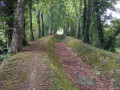
(7) Turn right, then after about twenty metres, take the covered footpath to the left of the road. Follow the footpath, pass the hamlet known as Les Fréchandières and continue along the road until you reach the crossroads.

(8) Take the path opposite. After about 200 metres, turn left towards the edge of the woods. Take the farm track on the right and continue to the hamlet known as ‘La Saudrais’.

(9) Cross the road to return to the starting point (S/E).

Waypoints

  1. S/E : mi 0 - alt. 154 ft - Car park, Magdeleine
  2. 1 : mi 0.62 - alt. 131 ft - Cotillé hamlet
  3. 2 : mi 1.08 - alt. 112 ft - Crossroads leading to the Grand Trémaudan manor house
  4. 3 : mi 1.59 - alt. 226 ft - Crossroads
  5. 4 : mi 2.28 - alt. 276 ft - La Morandiére
  6. 5 : mi 3.05 - alt. 246 ft - Brande Jean
  7. 6 : mi 3.38 - alt. 302 ft - The Sorciers Cross
  8. 7 : mi 3.64 - alt. 282 ft - The Upper Valley
  9. 8 : mi 4.23 - alt. 177 ft - Crossroads, towards Les Fréchandières
  10. 9 : mi 4.74 - alt. 148 ft - Longère, La Saudrais
  11. S/E : mi 5.14 - alt. 154 ft - Car park, Magdeleine

Notes

Watch out for passing cars when walking alongside roads.

Pleaseclose the fencegates after passing through.

Worth a visit

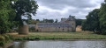
The Manoir du Grand Trémaudan
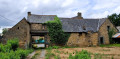
The manor comprises an unfinished main residence, dated 1630; a second, L-shaped wing from the15th and16th centuries, a remnant of the former manor; a chapel from the same period; a dovecote; and farm outbuildings.
See details here.
Private property.

A wayside cross known as the ‘Croix des Sorciers’, near the Haute Vallée.
Built in 1634, granite. Inscriptions: on the reverse, the monogram of the Virgin; on the back, the monogram of Christ; at the base of the shaft, north side: 1634, west side: DIL. See more by clicking here.

Other walks in the area

For more walks, use our search engine .

The GPS track and description are the property of this route's author. Please do not copy them without permission.