Sougeal Marsh Route via La Selle and Les Landelles

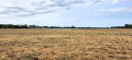
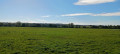
The route runs along the edge of the marsh and its vast 175-hectare wet meadows. These are classified as an “Espace Remarquable de Bretagne” (Regional Nature Reserve). The marsh is home to waterfowl all year round, but you may also come across cows and horses grazing freely there. In winter, access to the marsh is often cut off by floodwaters. The suggested route allows you to go round the marsh. However, two observation points overlooking the marsh remain accessible. The route also offers a more idyllic stretch through the woods and countryside around Sougeal. All in all, a peaceful walk to be enjoyed all year round.

Details

105616256
Creation:
Last update:
Last review:
  • Walking
    Activity: Walking
  • ↔
    Distance: 6.84 mi
  • ◔
    Average duration: 3h 30 
  • ▲
    Difficulty: Moderate

  • ⚐
    Back to start: Yes
  • ↗
    Ascent: + 436 ft
  • ↘
    Descent: - 440 ft

  • ▲
    Highest point: 312 ft
  • ▼
    Lowest point: 23 ft
  • ⚐ Country: France
  • ⚐ City: Sougéal (35610)
  • ⚑
    Start/End: N 48.509865° / W 1.523605°
  • ❏
    IGN map(s): Ref. 1216E
  • Hour-by-hour weather

Photos

Description of the walk

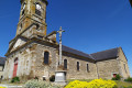
Start from the church car park.

(S/E) Head down Route de Pontorson (D83) on the right. Then turn left into the first side street. Follow the path to reach the D89.

(1) Follow this road to the right for about twenty metres and take the first path on the left, heading due north.

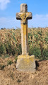
(2) You’ll come out onto the D83; cross it carefully and follow it to the left. After about twenty metres, turn right onto a footpath. Take the first path on the left. Return to the D83 and follow it to the right for a few dozen metres. At the cross, turn right onto a small road towards Vilormel.

(3) At the first junction, turn right towards La Plunière and Launay. Pass the hamlet of Allisson until you reach the Maison du Marais on your right. Continue along the road, keeping to the left, towards the Musse Bird Observatory.

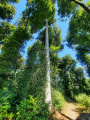
(4) Carry on, keeping to the left, for 200 metres. Take the path on the right, which climbs quite steeply through the woodland and cuts across the road. The path leads out onto another road.

(5) Turn left onto this road and pass through the hamlet of Vaugoubé. Carry on straight ahead until you reach the hamlet of La Selle.

(6) At the crossroads, turn left onto Rue de la Fontaine Saint-Pierre, passing a chapel on your right. Pass through the hamlet of Le Buisson; after 160 metres, the path turns left downhill and joins a road.

(7) Follow the road to the right and climb a fairly steep slope.

(8) Join the D89 and follow it to the right. Then take the first left (cross) and you’ll soon reach the hamlet of Les Landelles.

(9) Carry on along the road until you reach the junction with the D15 (cross).

(10) Cross the road carefully at the junction and carry on straight ahead. Pass the hamlet of La Pillardais on your left and, after about 50 metres, turn right onto a stony track. After about 650 metres, turn left. At a Fork in the road, veer to the right and pass under a high-voltage power line. You’ll reach a road (water reservoir).

(11) Follow the road to the right. Join the D15 and follow it to the left towards Sougeal.

(12) After about 300 m, turn left onto a stony track. Go round the football pitch on the left, then turn left onto a path. You’ll reach a fence on the left, in line with the houses.

(13) Turn left towards the woods. Take a sharp left, then a hairpin bend to the right. Follow the path, cross the woods and step over a small stream. Join the D89 and follow it to the right to quickly return to a junction you passed at the start of the walk.

(1) Turn right onto a grassy path. After a left-hand bend, head towards the village opposite the church. Turn right to quickly reach the car park (S/E).

Waypoints

  1. S/E : mi 0 - alt. 210 ft - Car park - Église Saint-Jean-Baptiste (Sougeal)
  2. 1 : mi 0.17 - alt. 157 ft - Junction of the circular loop
  3. 2 : mi 0.44 - alt. 82 ft - Crossing the D83
  4. 3 : mi 0.93 - alt. 46 ft - Intyersection – Entrance to Vilormel
  5. 4 : mi 2.01 - alt. 36 ft - La Musse Bird Observatory - Réserve naturelle régionale du marais de Sougeal
  6. 5 : mi 2.49 - alt. 194 ft - Small road – Vaugoubé
  7. 6 : mi 2.68 - alt. 210 ft - Saint-Pierre Chapel – La Selle
  8. 7 : mi 3.29 - alt. 46 ft - Narrow road
  9. 8 : mi 3.7 - alt. 210 ft - D89 road
  10. 9 : mi 4.14 - alt. 266 ft - Les Landelles
  11. 10 : mi 4.6 - alt. 292 ft - Crossing the D15
  12. 11 : mi 5.52 - alt. 276 ft - Road – Water reservoir
  13. 12 : mi 5.89 - alt. 272 ft - Start on a stony path
  14. 13 : mi 6.13 - alt. 262 ft - Fence with yellow markings on the posts
  15. S/E : mi 6.84 - alt. 210 ft - Car park - Église Saint-Jean-Baptiste (Sougeal)

Notes

Yellow signposting, except between and (5).

There is also a longer route that takes you through the marsh during the ‘dry’ season; see the Visorando route no. 3138948, ‘ Le Marais de Sougeal’.

This route is not recommended during the hunting season and may be flooded in winter.
Dogs are not permitted in the marsh.

Worth a visit

The Marsh House
Situated in the hamlet of Le Port in Sougeal, it will reveal all the secrets of the history and workings of the Sougeal Marsh. In this museum space, you’ll discover the flora and fauna and how they constantly change with the seasons. Offering stunning views of the marsh with picnic tables available, it’s the ideal spot for observing nature whilst taking a break!

The Hamlet of La Selle
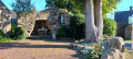
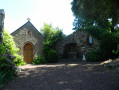
Saint-Pierre Chapel: a charming religious building situated in the heart of the hamlet.
The Grotto: a replica of Notre-Dame-de-Lourdes, built in 1945, stands right next to it.
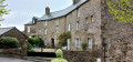
The hamlet boasts some beautiful old houses.

Other walks in the area

For more walks, use our search engine .

The GPS track and description are the property of this route's author. Please do not copy them without permission.