Circular route via Ville Arthur

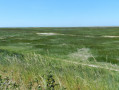
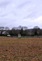
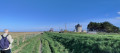
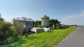
A walk starting from Saint-Broladre, covering the surrounding countryside. It follows part of the discovery trail linking the hamlet of Les Muriaux to that of La Masse, where the Chappe Telegraph is located. The route then alternates between footpaths and roads, leading to the Manoir des Homeaux, built inthe 15th century. A final stretch through the woodland completes a circular route.

Details

n°110697188
Creation:
Last update:
Last review:
–
  • Walking
    Activity: Walking
  • ↔
    Distance: 5.58 mi
  • ◔
    Average duration: 2h 50 
  • ▲
    Difficulty: Easy

  • ⚐
    Back to start: Yes
  • ↗
    Ascent: + 289 ft
  • ↘
    Descent: - 282 ft

  • ▲
    Highest point: 276 ft
  • ▼
    Lowest point: 30 ft

Photos

Description of the walk

Start from the church car park in Saint-Broladre.

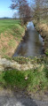
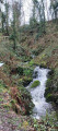
(S/E) Walk past the church towards the south-southeast and, keeping to the left of the stream, take the woodland path that runs alongside the Ruisseau de Riscopp. After a short, steep climb, the path ends at a road. Turn left here and follow the road to the Muriaux crossroads and its beautiful stone cross.

(1) Carry on straight ahead at the crossroads for about 400 metres, then turn right onto the tree-lined nature trail. Continue for 750 metres.

(2) Then turn right onto the path and carry on straight ahead until you reach the next road. Cross the road, cross the stream and carry on until you reach the path junction.

(3) Turn right and carry on until you reach the D87.

(4) Cross the D87, take the path opposite and, after about 150 metres, turn left towards the road and turn right towards the hamlet of Ville Esnoul.

(5) Continue along the road, pass through the hamlet of La Barbotais and enter the hamlet of La Ginclais.

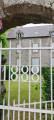
(6) At the second junction, take the road on the left, then go straight on past the next junction until you reach an old manor house with a metal gate bearing the inscription ‘1888’. Continue for about 70 metres.

(7) Turn onto the path on the right. Follow the path through the woodland until you reach the D80 near Saint-Broladre. Turn right.

(8) At the crossroads, turn right onto the fairly steep uphill road which curves to the right. At the top, take the path on the left, which leads back down towards the church. Go round the cemetery on the left to reach the church car park via a path (S/E).

Waypoints

  1. S/E : mi 0 - alt. 33 ft - St-Broladre church car park
  2. 1 : mi 0.86 - alt. 203 ft - Stone cross
  3. 2 : mi 1.58 - alt. 230 ft - Path near the hamlet of Lille
  4. 3 : mi 2.35 - alt. 266 ft - Junction, footpath
  5. 4 : mi 2.87 - alt. 246 ft - D87
  6. 5 : mi 3.56 - alt. 230 ft - Ville Esnoul
  7. 6 : mi 4.24 - alt. 197 ft - Junction
  8. 7 : mi 4.61 - alt. 167 ft - Les Homeaux Farm
  9. 8 : mi 5.21 - alt. 33 ft - D80
  10. S/E : mi 5.58 - alt. 33 ft - St-Broladre church car park

Notes

Takecare when using the roads.

Near the church car park: a picnic table and toilets.

Worth a visit

The Homaux Manor House
The Homaux
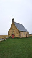
or Hommeaux Manor House(1467). It once comprised two courtyards, a pavilion, a dovecote and a chapel. The Chapel of Saint John the Baptist at Les Hommeaux was attached to the manor of the same name, owned in 1551 by Pierre de Férigat. The coats of arms of the Férigat, de Saint-Genys and Arthur families can be seen there.

La Cinglais
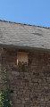
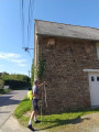
Opposite number 2, you can see a curious bat shelter beneath the guttering.

Les Muriaux
An old stone cross. Its rustic granite workmanship and its location suggest it most likely dates from the end of the Ancien Régime (17th or18th century). It served as a landmark and as a stopping point during religious processions.

Other walks in the area

For more walks, use our search engine .

The GPS track and description are the property of this route's author. Please do not copy them without permission.