The Étang de Boulet and the Grotte Notre-Dame de Lourdes

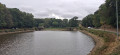
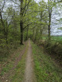
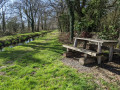
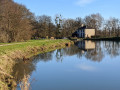
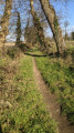
This walk, starting at the Boulet lock, goes round the Étang de Boulet. The terrain is flat and easy, making it ideal for young children. The Étang de Boulet is the largest navigable body of water in Ille-et-Vilaine. The lake is a Natura 2000 site. The route takes you past the Notre-Dame de Lourdes Grotto and along the Rigole du Boulet, which once supplied water to the Ille and Rance Canal. The route ends with a short detour through the countryside near the lake.

Details

107951522
Creation:
Last update:
Last review:
  • Walking
    Activity: Walking
  • ↔
    Distance: 6.56 mi
  • ◔
    Average duration: 3h 05 
  • ▲
    Difficulty: Moderate

  • ⚐
    Back to start: Yes
  • ↗
    Ascent: + 46 ft
  • ↘
    Descent: - 46 ft

  • ▲
    Highest point: 279 ft
  • ▼
    Lowest point: 210 ft
  • ⚐ Country: France
  • ⚐ City: Feins (35440)
  • ⚑
    Start/End: N 48.337187° / W 1.651254°
  • ❏
    IGN map(s): Ref. 1217SB
  • Hour-by-hour weather

Photos

Description of the walk

Parking is available along the D20, on the western bank just before the Étang de Boulet embankment.

The route around the pond is marked in yellow.

(S/E) Follow the D20 towards the pond’s dyke.

(1) Just before the dyke, turn left.

(2) At the Fork in the road that appears immediately, continue straight on. Walk along the pond on your right, following the yellow markings.

(3) At the first crossroads, at a place called Le Bois Baron, continue along the path on the right and stay as close as possible to the pond.

(4) At the T-junction, turn right onto the dyke separating the Étang du Pont au Marquis on the left and the Étang de Boulet on the right. On the other side, turn right immediately and continue along the Étang de Boulet until you reach a birdwatching hide.

(5) Continue along the pond until you reach the D91 (car park). Follow the road to the right for about 200 metres.

(6) Take the first path on the right and continue along the Étang de Boulet. Pass by the beach at the water sports centre. Continue along the pond until you reach the D20 and the end of the signposted route.

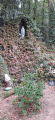
(7) Cross the road and follow it to the left for about a hundred metres. Then turn right onto a path which quickly leads to the cave.

(8) Retrace your steps to the D20 and follow it to the left for about a hundred metres (without crossing it).

(7) Continue along the D20 on the pond’s embankment.

(1) Go down a flight of steps on the left. Take the footbridge over the Rigole de Boulet, then walk alongside this stream on your right. You’ll come out onto the C2 road at its junction with the D20.

(9) Take a sharp right-hand bend onto a path that runs parallel to the D20. After about 200 m, turn left, cross the road carefully and continue along the path opposite.

(10) You’ll come out onto the D285; follow it for about thirty metres. Then turn left onto a path through the woodland. Join a small road and follow it to the right for about a hundred metres.

(11) Take the first path on the right, at the corner of a detached house. Further on, at a junction (marker 81), continue straight ahead along a path leading downhill.

(2) Reach the edge of the Étang de Boulet and turn right.

(1) Turn right straight away, following the D20, and you’ll be back at the car park in no time (S/E).

Waypoints

  1. S/E : mi 0 - alt. 256 ft - Car park – D20 road
  2. 1 : mi 0.05 - alt. 240 ft - Crossroads – Pond embankment
  3. 2 : mi 0.08 - alt. 236 ft - Y-junction
  4. 3 : mi 0.72 - alt. 236 ft - Le Bois Baron - Étang du Boulet
  5. 4 : mi 1.46 - alt. 236 ft - T-junction - Étang du Pont du Marquis
  6. 5 : mi 2.07 - alt. 233 ft - Birdwatching spot
  7. 6 : mi 2.44 - alt. 236 ft - Start of the footpath
  8. 7 : mi 3.98 - alt. 236 ft - T-junction – Pond embankment
  9. 8 : mi 4.2 - alt. 240 ft - Cave
  10. 9 : mi 5.35 - alt. 223 ft - Road C2 x Road D20 - La Rigole de Boulet
  11. 10 : mi 5.77 - alt. 240 ft - Road D285
  12. 11 : mi 6.04 - alt. 243 ft - Start of the path
  13. S/E : mi 6.56 - alt. 256 ft - Car park – D20 road

Notes

Take care when crossing the roads. Stay behind the safety kerbs where they are provided.

Worth a visit

The Boulet (or Boulett) Pond
At 153 hectares, this is the largest body of water in the department. The pond was created in 1828 (the earthen embankment having been built as early as 1825) to meet the needs of the construction of the Ille-et-Rance Canal.
During the summer (low-water period), the lake served as a reservoir. A system of sluice gates on the embankment allowed the precise amount of water to be released to maintain navigation between Rennes and the northern coast of the department.

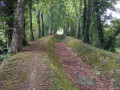
The Boulet feed channel, between (1) and (9)
This is undoubtedly the town’s most iconic engineering structure. Although no longer in use, its banks are perfectly maintained, stretching from the Chaussée de l’étang-réservoir du Boulet in Feins to Ville Morin in Guipel, the canal – otherwise known as ‘l’Ecoulement’ – alternates between curves and straight sections over more than 17 kilometres, with nearly 30 crossing points along a route partially flanked by a double row of perfectly aligned trees, stands as a testament to an extremely ambitious undertaking in the early19th century.

The Notre Dame de Lourdes Grotto (8)
Situated in the commune of Feins, near the Chaussée de Boulet, it is a discreet site. Set in peaceful rural surroundings, it makes for a pleasant stop on a walk around the lake.
Listed in the General Inventory of Cultural Heritage. It was probably built to mark the 1924 mission. Constructed of granite, it features a statue of Saint Bernadette at the foot of the grotto. A statue of Saint Bernadette stands at the foot of the grotto.

Calvary of La Bigotais
On the D20 at the junction with the road leading to Le Maffray, in the hamlet of La Chevrolais. A Calvary featuring a crucified Christ. This granite Calvary is chamfered and bears a crucified Christ on one side and a coat of arms bearing the following initials: E or J (?) C. It is not mentioned in the Napoleonic land register of 1828. However, the form of the Christ figure and the chamfered shaft suggest it dates fromthe 16th or17th century.

Other walks in the area

For more walks, use our search engine .

The GPS track and description are the property of this route's author. Please do not copy them without permission.