Circular walk around the Tertres de la Claye

A short walk through the countryside, between Baguer-Pican and Sains, following forest paths, small roads and passing through rural hamlets. The route follows part of the eastern section of the local PR® trail known as “Le Circuit de la Manceliére”. It is a family walk with no particular difficulties.

Details

105862265
Creation:
Last update:
Last review:
  • Walking
    Activity: Walking
  • ↔
    Distance: 4.93 mi
  • ◔
    Average duration: 2h 25 
  • ▲
    Difficulty: Easy

  • ⚐
    Back to start: Yes
  • ↗
    Ascent: + 141 ft
  • ↘
    Descent: - 141 ft

  • ▲
    Highest point: 272 ft
  • ▼
    Lowest point: 105 ft
  • ⚐ Country: France
  • ⚐ City: La Boussac (35120)
  • ⚑
    Start/End: N 48.542144° / W 1.635164°
  • ❏
    IGN map(s): Ref. 1215OT, 1216O
  • Hour-by-hour weather

Photos

Description of the walk

Start at the hamlet of La Guinguette (48.54215, -1.635608) in the commune of La Boussac. You can park at the side of the road.

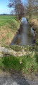
(S/E) Head west on the Voie de la Liberté (D576) and take the first path on the left. It descends gently, running alongside the Guyoult stream on the left-hand side of the path. Pass the ruins of the Moulin de la Claye to reach a road junction.

(1) Take thesecond road on the left, which descends towards the hamlet of L’Éguillère (no signpost). Pass through the hamlet, continuing straight on along the road.

(2) After about 400 metres, in the hamlet of La Mancelière (no signpost), take the yellow-marked path on the right.

(3) Cross the first road you come to and continue through the woodland, following the yellow markings. Then turn left. Join the D576, Voie de la Liberté.

(4) Cross it and take the road opposite, which curves slightly to the right and climbs gently. Pass through the hamlet known as La Petite Lande to reach Le Petit Mesnil, then La Grande Lande (no signpost).

(5) At the next crossroads, leave the PR® and turn right towards La Verdièrerie. At the fork, after about 250 metres, take the stony track on the left. Join a country lane and follow it to the right; then, after about 200 metres, turn right again onto a road.

(6) At the next junction, take the first road on the left towards Val au Banel. Continue straight on for about 450 metres until you reach the third junction.

(7) Take the road on the right, leaving the hamlet on your left, and carry on straight ahead along the gently ascending road, passing the house at a place called La Vallée, before descending again to join the D576, Voie de la Liberté. Then turn left and head for the car park (S/E).

Waypoints

  1. S/E : mi 0 - alt. 131 ft - A place known as La Guinguette
  2. 1 : mi 0.78 - alt. 154 ft - Crossroads - Guyoult (fleuve)
  3. 2 : mi 1.53 - alt. 112 ft - a place known as Le Prieuré
  4. 3 : mi 1.72 - alt. 157 ft - Road
  5. 4 : mi 2.3 - alt. 203 ft - D576
  6. 5 : mi 2.95 - alt. 180 ft - a place known as La Planche
  7. 6 : mi 3.74 - alt. 233 ft - Towards Val au Banel
  8. 7 : mi 4.36 - alt. 253 ft - Gate
  9. S/E : mi 4.93 - alt. 131 ft - A place known as La Guinguette

Notes

Take care when crossing roads and walking along them.
The paths between (S/E) and between (2) and (3) may be very wet; leave the sunken path and walk along the edge.

Worth a visit

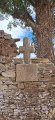
La Mancellière and St Gilles Chapel, near the signpost (2).
The18th-century manor house has been demolished; all that remains is the farmstead, comprising part of the original manor house, the outbuildings, the extensive French-style garden and the chapel (private).
The chapel existed as early as 1634 and has been rebuilt twice.On 1 September, St Gilles’s Day, people would come to have their children blessed to protect them from fear.

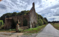
The Moulin de la Claye
In ruins. It is one of the nine former watermills recorded in the history of the commune of La Boussac.

Always be cautious and plan ahead when you're outdoors. Visorando and the author of this route cannot be held responsible for any accidents occurring on this route.

The GR® and PR® markings are the intellectual property of the Fédération Française de Randonnée Pédestre.

Other walks in the area

For more walks, use our search engine .

The GPS track and description are the property of this route's author. Please do not copy them without permission.