


Refine your search for walks in Sainte-Hélène-sur-Isère
Sainte-Hélène-sur-Isère walks


 Grand Roc Circular Trail
 Visorando Member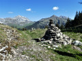
 9.86 mi
 +4,439 ft
 -4,429 ft
 8h 25
8h 25
 Difficult
 Departure from Cléry (Savoie) (Savoie)
The Grand Roc, situated in the Bauges Massif Nature Reserve, boasts a wealth of wildflowers that are particularly striking in May: daffodils and narcissi in abundance all along the path. A steady path leads to the Col de la Fougère after a long climb.
You reach the Col du Haut du Four via a narrow path, then follow the ridge path with its breathtaking views over the Albertville valley, before finally reaching the Grand Roc with its splendid views of the surrounding peaks.
Towards the Grand Arc from the Refuge de la Thuile
4.73 mi
+2,201 ft
-2,201 ft
4h 05
Difficult
Departure from Sainte-Hélène-sur-Isère (Savoie)
A beautiful hike in an area that is very open right from the start, with panoramic views of the Chartreuse, the Bauges, the Aravis and the Beaufortain. On the ridge, the views extend to include Mont Blanc, the Vanoise and the Écrins...
The Dent du Corbeau circular loop via La Thuile
 3.63 mi
+2,024 ft
-2,008 ft
3h 25
3.63 mi
+2,024 ft
-2,008 ft
3h 25
 Moderate
Departure from Sainte-Hélène-sur-Isère (Savoie)
Moderate
Departure from Sainte-Hélène-sur-Isère (Savoie)
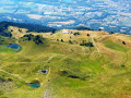
A circular walk in the Grand Arc massif offering magnificent panoramic views of the Albertville valley and the Lauzière massif, whilst enjoying the beautiful La Thuile mountain pastures with their many small lakes. This walk was completed with children aged five and ten.
Refuge de la Thuile – Col de l’Arc
9.24 mi
+4,009 ft
-3,770 ft
7h 45
 Very difficult
Departure from Sainte-Hélène-sur-Isère (Savoie)
Very difficult
Departure from Sainte-Hélène-sur-Isère (Savoie)
A change of scenery: the view opens out towards the Beaufortain, the Tarentaise, the Aravis and then the Vanoise. You pass beneath the Grand Arc, descend towards the Vallon de Bayet, cross the Col Basmont, then spend the night at the Col de l’Arc in the unmanned hut
La Dent du Corbeau
3.53 mi
+2,234 ft
-2,234 ft
3h 35
Difficult
Departure from Notre-Dame-des-Millières (Savoie)
La Dent du Corbeau forms part of the Grand Arc massif. From the ridge, there is a superb view of the valley stretching towards Montmélian, the head of the Tarentaise valley, Mont Blanc (of course!), and the Aravis range.
Le Grand Roc
 7.40 mi
+3,481 ft
-3,455 ft
6h 25
Difficult
Departure from Verrens-Arvey (Savoie)
7.40 mi
+3,481 ft
-3,455 ft
6h 25
Difficult
Departure from Verrens-Arvey (Savoie)
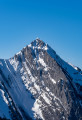
Magnificent ridge walk between Mont d'Orisan and Grand Roc. On one side are Les Bauges and its highest peak, Arcalod (2,217 m), and on the other is the Mont Blanc massif, passing through Beaufortain, Vanoise, La Lauzière, Belledonne and on to the Aiguilles d'Arves. A very beautiful hike.
Circular walk on the hills above Grignon via La Baraque Noire.
 7.56 mi
+2,264 ft
-2,264 ft
5h 25
Moderate
Departure from Grignon (Savoie) (Savoie)
7.56 mi
+2,264 ft
-2,264 ft
5h 25
Moderate
Departure from Grignon (Savoie) (Savoie)
This walk takes place, for the most part, in the forest, on paths and trails, and presents no particular difficulty, either technical or in terms of navigation. It offers beautiful panoramic views of the Isère valley, the Bauges, the Beaufortain, etc.
Route des hauts de Mercury via Fort de Tamié
6.44 mi
+1,686 ft
-1,657 ft
4h 25
Moderate
Departure from Mercury (Savoie)
A challenging hike above Mercury through the undergrowth to discover the balconies of Tamié.
Route of the Gallo-Roman villa at Gilly-sur-Isère
 5.94 mi
+705 ft
-679 ft
3h 20
5.94 mi
+705 ft
-679 ft
3h 20
 Easy
Departure from Mercury (Savoie)
Easy
Departure from Mercury (Savoie)
A hike that will allow you to discover the Savoyard countryside and step back a few centuries with the Gallo-Roman ruins in the village of Gilly. The church and the castle are well worth a visit.
Fort de Tamié circular loop
 1.68 mi
+338 ft
-341 ft
1h 05
Easy
Departure from Plancherine (Savoie)
1.68 mi
+338 ft
-341 ft
1h 05
Easy
Departure from Plancherine (Savoie)
A very short family hike and a visit to Fort de Tamié. Within the fort's grounds, there are tree-top adventure courses, games for children and walks for all, not to mention superb views of Albertville. Rather than taking the car to the fort, it is very pleasant to walk there.
Notre-Dame de Tamié Abbey
8.75 mi
+2,362 ft
-2,388 ft
6h 05
Moderate
Departure from Mercury (Savoie)
This circular starts in Mercury and climbs up to the small pass of Tamié, then continues to Notre-Dame de Tamié Abbey. It continues via the small pass of Tamié before descending towards Plancherine and returning to Mercury .
Combe Fort and Pointe de la Fougère
 5.96 mi
+2,838 ft
-2,841 ft
5h 15
Moderate
Departure from Jarsy (Savoie)
5.96 mi
+2,838 ft
-2,841 ft
5h 15
Moderate
Departure from Jarsy (Savoie)
A hike through a wild area in the heart of the Bauges Massif, offering magnificent views of Pécloz, Arcalod and Orgeval. From Pointe de la Fougère, you can see the Isère Valley, the Beaufortain and Mont Blanc. Chamois and mouflons are abundant in this area.
Pointe d'Arcalod via the Chalets d'Orgeval
 7.21 mi
+3,999 ft
-3,999 ft
6 hrs
Very difficult
Departure from École (Savoie)
7.21 mi
+3,999 ft
-3,999 ft
6 hrs
Very difficult
Departure from École (Savoie)
A beautiful, aerial and technical hike to climb to the highest point of the Bauges Massif (2,217 m).
Magnificent 360° panorama of the entire Bauges Massif and Mont Blanc.
Note on difficulty: following feedback from hikers, this hike has been classified as Very Difficult because the ascent and descent of the peak are quite technical.
Pointe de Chaurionde
 8.83 mi
+4,094 ft
-4,072 ft
7h 35
Difficult
Departure from École (Savoie)
8.83 mi
+4,094 ft
-4,072 ft
7h 35
Difficult
Departure from École (Savoie)
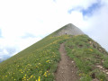
This hike will take you to the Pointe de Chaurionde via the Col du Haut du Four and the south-west ridge. Don't miss the chamois that inhabit the slopes. At the summit, you can admire Lake Annecy and Mont Blanc. You will cross the Vallon d'Orgeval (the valley of bears), which has now become a peaceful valley home to Tarine and Abondance cows and marmots.In June, the flora is magnificent and varied.
Chaurionde means "round summit".
(6) Access to the summit (or descent) via the Chalet de Coutarse is now prohibited (ZR zone of the PNR).
Tour de l’Arcalod
18.64 mi
+6,283 ft
-6,293 ft
2 days
Difficult
Departure from École (Savoie)
A two-day route around the Pointe d’Arcalod, the highest point in the Bauges, passing through unspoilt wilderness, valleys and rivers. The suggested route mainly follows the GR® de Pays Tour de l’Arcalod, marked in yellow and red. Spectacular views of the mountains and Lake Annecy. This wild and little-used route is mainly situated within a Regulated Sensitive Area.
Nant Fourchu stream car park – Chalets de l’Eau Froide
8.13 mi
+4,140 ft
-2,103 ft
7h 20
Very difficult
Departure from École (Savoie)
First day of a two-day route around the Pointe d’Arcalod, the highest point in the Bauges, crossing wild areas, valleys and rivers. The proposed route mainly follows the eastern section of the GR® de Pays Tour de l’Arcalod, marked in yellow and red. Spectacular views of the mountains and Lake Annecy. This wild and little-used route is situated mainly within a sensitive, regulated area.The terrain is good and presents no particular difficulties.
The Col d'Orgeval
 6.19 mi
+2,448 ft
-2,448 ft
5h 00
Moderate
Departure from École (Savoie)
6.19 mi
+2,448 ft
-2,448 ft
5h 00
Moderate
Departure from École (Savoie)
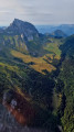
The Col d'Orgeval is located on theGRP® trail in the Massif des Bauges. More than the pass or the chalets, it is the superb Orgeval valley with its gentle slopes that will remain in hikers' memories.
The mountain pasture is owned by the same family, who graze a pretty herd of heifers there.
Mont de la Coche and Tré le Mollard
 7.17 mi
+3,409 ft
-3,389 ft
6h 15
Difficult
Departure from École (Savoie)
7.17 mi
+3,409 ft
-3,389 ft
6h 15
Difficult
Departure from École (Savoie)
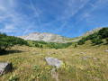
This beautiful, wild circular hike starting from the Nant du Fourchu car park takes you to two peaks over 2,000 m in the Bauges massif in just a few kilometres, and can be completed with a climb to Pointe d'Arcalod. You may even see some marmots!
Pointe de la Fougère
 6.37 mi
+3,248 ft
-3,248 ft
5h 45
Moderate
Departure from École (Savoie)
6.37 mi
+3,248 ft
-3,248 ft
5h 45
Moderate
Departure from École (Savoie)
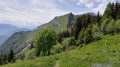
Pointe de la Fougère is not the most popular of the Beaujus peaks. This hike retains a wild character; it is not uncommon to see animals on the ascent. Beautiful panoramic views of the nearby peaks and beyond.
Route de la Belle Étoile and La Négresse / Roc Rouge
 5.64 mi
+3,159 ft
-3,133 ft
5h 20
Difficult
Departure from Mercury (Savoie)
5.64 mi
+3,159 ft
-3,133 ft
5h 20
Difficult
Departure from Mercury (Savoie)
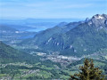
A very lovely hike on the border between Savoie and Haute-Savoie, on the iconic peaks of Albertville: the beautiful Étoile and the Négresse.
In the background, the Bauges massif, the Beaufortain, the Lauzière, Mont Blanc and Lake Annecy.
A hike best undertaken in dry weather, featuring exposed sections equipped with ladders and handrails.
Belle Étoile circular, return via Chalet Périllet
 4.07 mi
+2,484 ft
-2,484 ft
4h 00
Moderate
Departure from Mercury (Savoie)
4.07 mi
+2,484 ft
-2,484 ft
4h 00
Moderate
Departure from Mercury (Savoie)
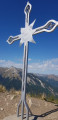
From the summit of Belle Étoile, you will be treated to breathtaking views. Following a path that runs almost entirely through the woods, you will reach the Croix de Périllet and then, after a steep section, the Croix du Sommet de Belle Étoile. On one side, you will overlook Mercury and the Olympic city of Albertville (1992 Winter Olympics) and on the other, the Tamié valley and its Cistercian-Trappist monastery. In the distance, you can see Lake Annecy, Mont Blanc and Mont Granier.
A circular route around the Dent du Corbeau from Saint-Paul-sur-Isère
5.25 mi
+2,556 ft
-2,536 ft
4h 40
Difficult
Departure from Saint-Paul-sur-Isère (Savoie)
A beautiful, little-known summit at the northern end of the Lauzière massif.The approach via the Tarentaise, which is much less frequented, guarantees peace and quiet and the chance to spot chamois.
The Giants’ Trail in the Tamié Valley
 4.11 mi
+1,237 ft
-1,237 ft
3h 00
Moderate
Departure from Plancherine (Savoie)
4.11 mi
+1,237 ft
-1,237 ft
3h 00
Moderate
Departure from Plancherine (Savoie)
In the enchanting setting of the Vallon de Tamié, where an abbey is nestled, set off to discover the wood carvings created in the wake of the storm on1 July 2019, which destroyed more than 300 ‘giants’ in this part of the Tamié Departmental Forest.
Tour of the Val de Tamié
 4.35 mi
+942 ft
-958 ft
2h 50
Easy
Departure from Plancherine (Savoie)
4.35 mi
+942 ft
-958 ft
2h 50
Easy
Departure from Plancherine (Savoie)
The Val de Tamié site is remarkable for its Cistercian abbey nestled on the side of Tête Noire and its former military fort. The hike takes place in the valley. It starts from the abbey car park, with a steep climb, a walk downhill through the woods, a visit to the Fort de Tamié, a magnificent view of Mont Blanc at the Collet de Tamié, then the descent to the Moulin de Tamié.
The Parc du Mouton
7.57 mi
+3,255 ft
-3,255 ft
6h 20
Difficult
Departure from Plancherine (Savoie)
A lovely circular route to reach a summit with 360° panoramic views. A climb through the forest to reach the refuge, then a short ridge. A cool descent along the torrent will take you back to the abbey, which you can visit or buy some of the famous cheese!
Circular walk around the Pointe de la Sambuy in Albertville
29.29 mi
+10,397 ft
-10,443 ft
4 days
Difficult
Departure from Albertville (Savoie)
A 4-day hiking tour with wild camping, starting and finishing at Albertville railway station
The route takes you through the Bauges Game and Wildlife Reserve, where you’ll discover the highest points of the Bauges Massif: the Pointe de Chaurionde (alt. 2,173 m) and the Col de l’Alpettaz (alt. 1,580 m), passing through the forests of Tamié, Saint-Ruph and Les Héris.
From Albertville station to the Refuge du Soplat des Streams
 7.03 mi
+4,177 ft
-604 ft
6h 50
Difficult
Departure from Albertville (Savoie)
7.03 mi
+4,177 ft
-604 ft
6h 50
Difficult
Departure from Albertville (Savoie)
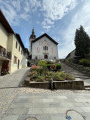
A lovely climb starting from Albertville, passing through the medieval town of Conflans and pretty mountain hamlets with views of the Tarentaise Valley, before reaching the Refuge du Soplat des Stream. The refuge is ideally located near the Tour du Beaufortain with a beautiful view of Albertville and the Olympic Park. Hike to be done from May to November: avalanche risk in winter above 1,100 metres.
Arcalod-Mont de la Coche circular from Bellevaux
 10.29 mi
+5,381 ft
-5,364 ft
8 hrs
Very difficult
Departure from École (Savoie)
10.29 mi
+5,381 ft
-5,364 ft
8 hrs
Very difficult
Departure from École (Savoie)
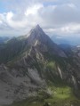
This is a beautiful circular that allows you to see three sides of Arcalod, climb to the summit via Orgeval and descend via a wilder route. It is a demanding but magnificent hike in good weather.
Please note that access to the Pointe d'Arcalod is not recommended with children or in wet weather.
Pointe de Chaurionde as seen from Tamié Abbey
 11.61 mi
+5,135 ft
-5,108 ft
9h 50
Difficult
Departure from Plancherine (Savoie)
11.61 mi
+5,135 ft
-5,108 ft
9h 50
Difficult
Departure from Plancherine (Savoie)
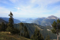
A very beautiful walk in the Bauges massif, with magnificent 360° views of Lake Annecy, Mont Blanc and the Bauges mountains such as L’Arcalod, La Sambuy, etc...
Route of the heights of Conflans to Albertville
6.06 mi
+2,556 ft
-2,556 ft
5h 00
Moderate
Departure from Albertville (Savoie)
A beautiful circular route above the medieval town of Conflans with lovely panoramic views of the Combe de Savoie.
Farette - Bettex - Fort du Mont - Le Chataîgner - Farette
 4.44 mi
+2,185 ft
-2,185 ft
3h 55
Moderate
Departure from Albertville (Savoie)
4.44 mi
+2,185 ft
-2,185 ft
3h 55
Moderate
Departure from Albertville (Savoie)
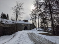
If you love the mountains and beautiful places, and you're not afraid of a little effort, then set off on this walk to discover Fort du Mont and admire the views on the way up and the large pine forests on the way down.
Route in the hills above Albertville
3.11 mi
+558 ft
-558 ft
1h 55
Easy
Departure from Albertville (Savoie)
A lovely, peaceful route to rediscover the old Beaufort road, with beautiful views of Albertville.
Circular route via Mont Pécloz, Mont d'Arménaz and Pointe de la Fougère
 9.19 mi
+5,118 ft
-5,098 ft
7 hrs
Very difficult
Departure from École (Savoie)
9.19 mi
+5,118 ft
-5,098 ft
7 hrs
Very difficult
Departure from École (Savoie)
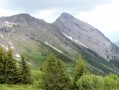
I recommend a lovely circular hike via Mont Pécloz, Mont d’Arménaz and Pointe de la Fougère.
Warning! Some sections are tricky, particularly the descent from Mont Pécloz towards Col d'Armène and the ridge between Mont d'Armenaz and Pointe de la Fougère
See the practical information section.
The Bellacha loop via Col de Basmont
6.93 mi
+4,268 ft
-4,268 ft
6h 55
Difficult
Departure from Montsapey (Savoie)
Ascent of Bellacha via a wild trail on the way up, following the north-west and north ridges of Bellachat. The return route is via the Col de l'Arc and Col de Basmont passes, which offer different landscapes and avoid the descent via the ascent route, which is not always easy to find. This loop is not recommended in the opposite direction.
Col de Basmont
 2.91 mi
+1,883 ft
-1,880 ft
3h 00
Easy
Departure from Montsapey (Savoie)
2.91 mi
+1,883 ft
-1,880 ft
3h 00
Easy
Departure from Montsapey (Savoie)
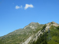
A pleasant walk to the Col de Basmont (1,791m), to fill your bag with blueberries, with the added bonus of views over the Beaufortin, the Chartreuse, Belledonne and the Aravis, amongst others.
The Col d'Arclusaz
 9.19 mi
+3,035 ft
-3,035 ft
6h 50
Moderate
Departure from École (Savoie)
9.19 mi
+3,035 ft
-3,035 ft
6h 50
Moderate
Departure from École (Savoie)
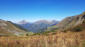
A lovely walk in the Arclusaz valley, dominated by some of the beautiful peaks of the Bauges.The colours of autumn are beginning to set the landscape ablaze.
Route de l'Armène
8.26 mi
+4,186 ft
-4,186 ft
7h 25
Difficult
Departure from École (Savoie)
A hike in the heart of the Bauges Massif towards one of its most beautiful peaks.
The ascent to the Col de l'Armène offers opportunities to spot chamois and enjoy varied panoramic views of the Northern Alps.
On the descent, be sure to visit the ruined village of La Chapelle and the Notre-Dame de Bellevaux Chapel.
The Pecloz and Armenaz mountains
 7.96 mi
+4,951 ft
-4,948 ft
8h 00
Moderate
Departure from École (Savoie)
7.96 mi
+4,951 ft
-4,948 ft
8h 00
Moderate
Departure from École (Savoie)
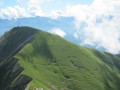
A beautiful, challenging circular route that takes you to two of the 14 2,000-metre peaks in the Bauges massif, Mont Pécloz and Mont d'Armenaz. The climb up to the pass separating the two peaks is quite steep, but you'll be accompanied by chamois. Once you reach the summit, Mont Pécloz offers a 360° view of the Alps. The descent is popular with ski tourers in winter.
Mont Pécloz and Mont d'Arménaz loop
 8.24 mi
+4,944 ft
-4,928 ft
8h 05
Difficult
Departure from École (Savoie)
8.24 mi
+4,944 ft
-4,928 ft
8h 05
Difficult
Departure from École (Savoie)
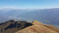
The most beautiful of the Baujus peaks! Loop hike Mont Pecloz 2197m and Mont d'Armenaz 2158m.
Please note: The descent from Mont Pécloz is rather tricky (exposure to rockfalls + some passages requiring the use of your hands).
Le Grand Arc from Tioulévé
 8.19 mi
+4,242 ft
-4,236 ft
7h 30
Difficult
Departure from Montsapey (Savoie)
8.19 mi
+4,242 ft
-4,236 ft
7h 30
Difficult
Departure from Montsapey (Savoie)
With clear skies and no clouds on the horizon, on the morning of 27 August 2018, I decide to discover a superb viewpoint over the Alps. Perched between Belledonne and Lauzière, just above the confluence of the Isère and Arc rivers, the Grand Arc massif is exceptional in its domain. High mountains less than an hour from Chambéry!
The Lac Noir du Grand Arc via the Char de la Turche
5.93 mi
+2,717 ft
-2,690 ft
5h 05
Moderate
Departure from Montsapey (Savoie)
A beautiful loop on the southern slope of the Grand Arc, passing by the dark Lac Noir.
At the start, a discovery trail allows hikers to step back in time.
Directional signs and yellow markings.
The Balconies of Saint-Thomas (Lé lôzè dè Saint Thomas)
 4.47 mi
+1,562 ft
-1,535 ft
3h 25
Moderate
Departure from Esserts-Blay (Savoie)
4.47 mi
+1,562 ft
-1,535 ft
3h 25
Moderate
Departure from Esserts-Blay (Savoie)
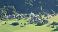
A route that will take you through the remote hamlets of the village of Saint-Thomas, overlooking the valley with magnificent views, a route alternating between footpaths, tracks and roads.
A sunny route early in the morning with very little traffic – enjoy it to your heart’s content.
Col de l’Arc – Refuge du Logis des Fées
8.91 mi
+3,353 ft
-3,406 ft
7h 00
Difficult
Departure from La Léchère (Savoie)
It’s hard to say much about this section, as we completed the whole of it in driving rain and cloud. The route is challenging and stony, with numerous herds of livestock and detours… But it remains so beautiful despite everything. The climb up the Bellachat is less difficult than it looks. The landscape is actually very varied: there’s a lot of rocky terrain on the ascent of the Bellachat, with steep cirques all the way to the Lacs du Loup, where the mountain pastures take over before giving way to the Cirque du Colomban, only to return near the Refuge du Logis des Fées.
The Palatieux Balconies (Lè lôzè du Palatchu)
 2.51 mi
+1,270 ft
-1,260 ft
2h 15
Moderate
Departure from Tours-en-Savoie (Savoie)
2.51 mi
+1,270 ft
-1,260 ft
2h 15
Moderate
Departure from Tours-en-Savoie (Savoie)
A lovely path running along a ridge overlooking the Tarentaise valley with stunning views of Tours-en-Savoie.
Dent de Cons from Allondaz
 Tourism professional
 9.48 mi
+4,928 ft
-4,934 ft
7 hrs
Very difficult
Departure from Allondaz (Savoie)
9.48 mi
+4,928 ft
-4,934 ft
7 hrs
Very difficult
Departure from Allondaz (Savoie)
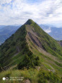
Here is a circular route that allows you to prolong the pleasure of walking along a very narrow ridge with vertiginous slopes.
La Belle Étoile from Les Combes
 6.79 mi
+3,294 ft
-3,294 ft
6h 00
Difficult
Departure from Seythenex (Haute-Savoie)
6.79 mi
+3,294 ft
-3,294 ft
6h 00
Difficult
Departure from Seythenex (Haute-Savoie)
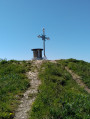
La Belle Étoile is a very popular destination for walkers and trail runners, with most people setting off from the “Les Teppes” car park at a place called La Ramaz. The route I’m suggesting, however, is much less well-trodden. You may not come across a single person for three-quarters of this route, which runs largely through woodland. On the higher ground, you’ll need to use your hands for certain sections.
The charms of Seythenex
 Tourist office
 5.10 mi
+879 ft
-879 ft
3h 05
Moderate
Departure from Seythenex (Haute-Savoie)
5.10 mi
+879 ft
-879 ft
3h 05
Moderate
Departure from Seythenex (Haute-Savoie)
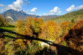
Explore the Tamié valley and the famous Seythenex bridge in a peaceful, bucolic setting.
Route around Césarches via the Col de Montessuit
 4.84 mi
+935 ft
-935 ft
3h 00
Moderate
Departure from Césarches (Savoie)
4.84 mi
+935 ft
-935 ft
3h 00
Moderate
Departure from Césarches (Savoie)
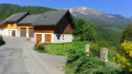
A lovely, peaceful walk alternating between roads and paths, suitable for all seasons, with lovely views of the surrounding mountains. An ideal route in early spring to get back into the swing of things.
Belt of redoubts and batteries around Fort de Montgilbert
 6.32 mi
+1,342 ft
-1,322 ft
4h 05
Moderate
Departure from Montendry (Savoie)
6.32 mi
+1,342 ft
-1,322 ft
4h 05
Moderate
Departure from Montendry (Savoie)
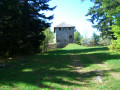
Circular forest path starting from Fort de Montgilbert, following the belt of redoubts and batteries built along a ridge to defend the entrance to the Maurienne valley and passing through a sensitive peat bog site.
La Pointe de la Sambuy circular starting from Seythenex
 7.53 mi
+3,655 ft
-3,655 ft
6h 40
Difficult
Departure from Seythenex (Haute-Savoie)
7.53 mi
+3,655 ft
-3,655 ft
6h 40
Difficult
Departure from Seythenex (Haute-Savoie)
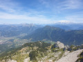
Hike offering a superb 360° view at Pointe de la Sambuy over Lake Annecy and Mont Blanc.
From the Baraque de l'Abbaye to the Chalet de l'Alpettaz
 9.20 mi
+3,583 ft
-2,201 ft
7h 20
Difficult
Departure from Seythenex (Haute-Savoie)
9.20 mi
+3,583 ft
-2,201 ft
7h 20
Difficult
Departure from Seythenex (Haute-Savoie)
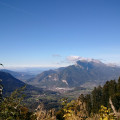
This hike takes you to the heart of the Faverges-Seythenex valley, following the Lac d'Annecy with the Torrent de Saint-Ruph, which is the lake's main source of water, ending with a view of Albertville and Mont Blanc at the Col de l'Alpettaz (alt. 1,580 m).
The Pointières Discovery Trail in Queige:
 3.27 mi
+866 ft
-850 ft
2h 15
Easy
Departure from Queige (Savoie)
3.27 mi
+866 ft
-850 ft
2h 15
Easy
Departure from Queige (Savoie)
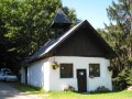
Whether you do it alone or with your family, this hike will allow you to discover how people lived around 60 years ago. It is a pleasant walk through a hundred hectares of forest and small plains. Along the way, you will find barns furnished with tools from the period and numerous photos.
A very interesting route that will take you back to your starting point, where a guest book awaits you.
The Pissus and Lac du Loup circular loop
 Local authority4.20 mi
+1,640 ft
-1,611 ft
3h 20
Moderate
Departure from Bonneval (Savoie) (Savoie)
Local authority4.20 mi
+1,640 ft
-1,611 ft
3h 20
Moderate
Departure from Bonneval (Savoie) (Savoie)
Circular route through the Lauzière massif, which gives this area its distinctive rugged, rocky character.
Circular Pissus - Lakes and Col du Loup
 4.63 mi
+2,260 ft
-2,283 ft
4h 05
Moderate
Departure from Bonneval (Savoie) (Savoie)
4.63 mi
+2,260 ft
-2,283 ft
4h 05
Moderate
Departure from Bonneval (Savoie) (Savoie)
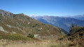
A lovely hike in the Lauzière massif, with views of the peaks and glaciers of the Vanoise, not to mention the inevitable Mont Blanc.
You will also recognise the characteristic silhouette of the Cheval Noir along the way.
Pointe des Arangles loop via La Roche Brisée
 4.01 mi
+2,559 ft
-2,549 ft
4h 05
Difficult
Departure from Bonneval (Savoie) (Savoie)
4.01 mi
+2,559 ft
-2,549 ft
4h 05
Difficult
Departure from Bonneval (Savoie) (Savoie)
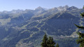
A beautiful, wild hike at the start of the season, with no one else on the route. Beautiful views of the western ridge of Comborsier, the Grand Mont d'Arêches and even Mont Blanc. Be careful to keep quiet, as this is black grouse territory.
More walks in Sainte-Hélène-sur-Isère
Select a point of interest below: