


Refine your search for walks in Refuge de la Thuile
Refuge de la Thuile walks


 The Dent du Corbeau circular loop via La Thuile
 Visorando Member
 3.63 mi
 +2,024 ft
 -2,008 ft
 3h 25
 Moderate
 Departure from Sainte-Hélène-sur-Isère (Savoie)
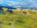
A circular walk in the Grand Arc massif offering magnificent panoramic views of the Albertville valley and the Lauzière massif, whilst enjoying the beautiful La Thuile mountain pastures with their many small lakes. This walk was completed with children aged five and ten.
Towards the Grand Arc from the Refuge de la Thuile
4.73 mi
+2,201 ft
-2,201 ft
4h 05
 Difficult
Departure from Sainte-Hélène-sur-Isère (Savoie)
A beautiful hike in an area that is very open right from the start, with panoramic views of the Chartreuse, the Bauges, the Aravis and the Beaufortain. On the ridge, the views extend to include Mont Blanc, the Vanoise and the Écrins...
Montartier Lakes – Refuge de la Thuile
11.51 mi
+4,298 ft
-5,128 ft
9h 00
 Very difficult
Departure from Argentine (Savoie) (Savoie)
From a bivouac, all alone in the world, a long stage. The secured sections of the Passage des Moutons, Lac de Clartan, the descent to the Chalet du Tour, the paths winding up and down through Pétillat and its waterfall. The ascent to Lac Noir, the passage along the western ridge of the Petit Arc, a bit of off-trail walking; before trudging tirelessly towards a final climb through the woodland to reach the Refuge de la Thuile. What a view from its cross!
Refuge de la Thuile – Col de l’Arc
9.24 mi
+4,009 ft
-3,770 ft
7h 45
Very difficult
Departure from Sainte-Hélène-sur-Isère (Savoie)
A change of scenery: the view opens out towards the Beaufortain, the Tarentaise, the Aravis and then the Vanoise. You pass beneath the Grand Arc, descend towards the Vallon de Bayet, cross the Col Basmont, then spend the night at the Col de l’Arc in the unmanned hut
Tour de la Lauzière
56.01 mi
+20,997 ft
-20,607 ft
7 days
Difficult
Departure from Saint-François-Longchamp (Savoie)
This small mountain range undoubtedly offers one of the most stunning sequences of panoramic views. But beware of the challenging paths and the isolation. Pay particular attention to water management: streams and springs often run dry in summer.The starting point is Saint-François-Longchamp, accessible by public transport or by road. Parking is easy and free there in summer. The stages are connecting days. This route follows the Tour de la Lauzière route with a detour via La Thuile and the Col de l’Arc. You’ll spend every other night in a refuge and the rest in a bivouac.Do not attempt this hike if you are not sure-footed: although it stays on the paths (or strays very little from them), this route requires vigilance and follows routes that are very rarely used. You will almost certainly find yourself alone, or almost alone, for most of the day, in conditions where the markings are often half-faded and the paths obscured by livestock tracks. High-altitude cloud cover is common.
Walks near Refuge de la Thuile
Col de l’Arc – Refuge du Logis des Fées
8.91 mi
+3,353 ft
-3,406 ft
7h 00
Difficult
Departure from La Léchère (Savoie)
It’s hard to say much about this section, as we completed the whole of it in driving rain and cloud. The route is challenging and stony, with numerous herds of livestock and detours… But it remains so beautiful despite everything. The climb up the Bellachat is less difficult than it looks. The landscape is actually very varied: there’s a lot of rocky terrain on the ascent of the Bellachat, with steep cirques all the way to the Lacs du Loup, where the mountain pastures take over before giving way to the Cirque du Colomban, only to return near the Refuge du Logis des Fées.
From Albertville station to the Refuge du Soplat des Streams
 7.03 mi
+4,177 ft
-604 ft
6h 50
Difficult
Departure from Albertville (Savoie)
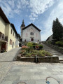
A lovely climb starting from Albertville, passing through the medieval town of Conflans and pretty mountain hamlets with views of the Tarentaise Valley, before reaching the Refuge du Soplat des Stream. The refuge is ideally located near the Tour du Beaufortain with a beautiful view of Albertville and the Olympic Park. Hike to be done from May to November: avalanche risk in winter above 1,100 metres.
Nant Fourchu stream car park – Chalets de l’Eau Froide
8.13 mi
+4,140 ft
-2,103 ft
7h 20
Very difficult
Departure from École (Savoie)
First day of a two-day route around the Pointe d’Arcalod, the highest point in the Bauges, crossing wild areas, valleys and rivers. The proposed route mainly follows the eastern section of the GR® de Pays Tour de l’Arcalod, marked in yellow and red. Spectacular views of the mountains and Lake Annecy. This wild and little-used route is situated mainly within a sensitive, regulated area.The terrain is good and presents no particular difficulties.
Logis des Fées mountain hut – Lac du Cheval Noir
8.21 mi
+3,678 ft
-1,568 ft
7h 00
Difficult
Departure from La Léchère (Savoie)
Fancy a goat’s path? You’re in for a treat. Whilst the climb to the Col de la Madeleine is very smooth going, the path leading to the Col du Cheval Noir from the Grande Combe is more akin to trail running. It’s a difficult climb, sometimes requiring you to get down on all fours, with your hands almost constantly in use, but it’s nonetheless safe if you tackle it without rushing. Camping by the Cheval Noir lakes promises complete solitude.
La Ravoire – Arêches Alpine Refuge
 5.05 mi
+2,425 ft
-961 ft
4h 25
Moderate
Departure from La Bâthie (Savoie)
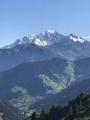
First (easy) stage of a two-day tour of the Grand Mont.
A well-marked path forming part of the Tour du Beaufortain.
Magnificent views of Mont Blanc from the Col de la Bâthie
 Grand Naves – Nant du Beurre Mountain Hut
 7.07 mi
+3,399 ft
-1,719 ft
7 hrs
Difficult
Departure from La Léchère (Savoie)
A magnificent, forgotten valley in the southern Beaufortain. The hike offers varied panoramic views across the entire Vanoise, from the Col de la Madeleine to the Mont Blanc massif and the Lauzière range.
Animal tracks (foxes, wolves, etc.) are not uncommon here.
Chalet des Arolles - Molliessoulaz Lodge
7.87 mi
+2,005 ft
-5,089 ft
5h 20
Difficult
Departure from Beaufort (Savoie) (Savoie)
Another long stage between the Chalet des Arolles and the hilltop village of Molliessoulaz.
Molliessoulaz Lodge - Les Saisies
9.49 mi
+4,888 ft
-2,579 ft
8h 35
Difficult
Departure from Queige (Savoie)
The final stage of the Tour du Beaufortain, between Molliessoulaz and Les Saisies.
From the Baraque de l'Abbaye to the Chalet de l'Alpettaz
 9.20 mi
+3,583 ft
-2,201 ft
7h 20
Difficult
Departure from Seythenex (Haute-Savoie)
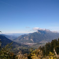
This hike takes you to the heart of the Faverges-Seythenex valley, following the Lac d'Annecy with the Torrent de Saint-Ruph, which is the lake's main source of water, ending with a view of Albertville and Mont Blanc at the Col de l'Alpettaz (alt. 1,580 m).
Alpine pastures and waterfalls of Valmorel
 5.83 mi
+1,253 ft
-1,532 ft
3h 45
Moderate
Departure from Les Avanchers-Valmorel (Savoie)
A short hike with moderate elevation gain, suitable for a family outing with young children. The route takes you through working mountain pastures, offering beautiful views of the surrounding mountains, and passes by the foot of three stunning waterfalls.