The Pissus and Lac du Loup circular loop

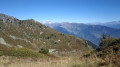
Circular route through the Lauzière massif, which gives this area its distinctive rugged, rocky character.

Details

14883709
Creation:
Last update:
Last review:
  • Walking
    Activity: Walking
  • ↔
    Distance: 4.20 mi
  • ◔
    Average duration: 3h 20 
  • ▲
    Difficulty: Moderate

  • ⚐
    Back to start: Yes
  • ↗
    Ascent: + 1,640 ft
  • ↘
    Descent: - 1,611 ft

  • ▲
    Highest point: 6,496 ft
  • ▼
    Lowest point: 5,167 ft

Description of the walk

Park in a small designated area just before the Gelon Bridge.

(S/E) Head towards the bridge, cross it, then take the path on the right immediately afterwards.

(1) At a large rock, continue to the right towards the Pissus mountain hut. Head up the Ruisseau du Villard valley.

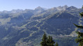
(2) Once you reach the hamlet of Les Pissus (elevation 1,965 m), follow the path to the left as far as Les Teurs (1,970 m) along a balcony-like path offering views of the Vanoise glaciers, Crève-Tête, Mont Blanc and much more besides.

(3) Turn left towards the Chalet de la Cave du Villard.

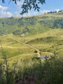
(4) From the chalet, head straight on towards the south-east, then turn right to climb up the mountain pasture to Lac du Loup, taking care to avoid disturbing any Tarines, so as not to curdle their milk, which might turn into Beaufort sooner than expected!

This wetland is home to the Alpine newt and feeds the Ruisseau du Haut Gentil; it is characteristic of our siliceous mountains in the Northern Alps.

(5) Return to La Cave.

(4) Carry on to the right. First follow the Ruisseau du Haut Gentil, then veer away from it by turning left through woodland to reach the junction where the trail began.

(1) Turn right, cross the Gelon bridge again and return to the car park (S/E).

Waypoints

  1. S/E : mi 0 - alt. 5,167 ft - Gelon Bridge
  2. 1 : mi 0.06 - alt. 5,187 ft - Large rock – Junction of the circular loop
  3. 2 : mi 1.06 - alt. 6,440 ft - Les Pissus
  4. 3 : mi 1.64 - alt. 6,496 ft - Les Teurs
  5. 4 : mi 2.04 - alt. 6,070 ft - La Cave
  6. 5 : mi 2.59 - alt. 6,322 ft - Lacs du Loup
  7. S/E : mi 4.2 - alt. 5,167 ft - Gelon Bridge

Notes

(3) You can complete a circular route directly to Lac du Loup from Les Teurs by turning right.

Worth a visit

The scenery is spectacular. The mountain range lends this spot its rugged, rocky character, towering over you with its most beautiful peaks, such as the Pointe des Marmottes Noires (2,339 m) and Combe Bronsin (2,499 m).

Reviews and comments

4.7 / 5
Based on 2 reviews

Reliability of the description
4 / 5
Ease of following the route
5 / 5
Route interest
5 / 5
SiobanS
SiobanS

Overall rating : 5 / 5

Date of your route : Aug 07, 2024
Reliability of the description : Not used / Not applicable
Ease of following the route : ★★★★★ Very good
Route interest : ★★★★★ Very good
Very busy route : No

A superb walk! We set off as a pair, one of us being prone to vertigo, but we didn’t find the walk particularly difficult or vertiginous. At point 3, we followed the sign for the ‘Lac du Loup detour – 15 mins’, which allows you to do a circular route rather than the 4–5 km return route. This also reduces the elevation gain slightly: this alternative route is initially flat and then descends to the lake (with, incidentally, a very beautiful approach to the lake from above). However, there were seven sheepdogs at the start, on the other side of the river, barking and positioned all along the path leading towards a flock. We took a detour to avoid them. A sign warns against bringing dogs or cycling on the trail.

Machine-translated

Vanessalourse
Vanessalourse

Overall rating : 4.7 / 5

Date of your route : Aug 13, 2022
Reliability of the description : ★★★★☆ Good
Ease of following the route : ★★★★★ Very good
Route interest : ★★★★★ Very good
Very busy route : No

Taken on a scorching summer’s morning. A trail marked out by the local council; follow route B1, which climbs to the left of the stream – it’s very easy to find your way. Magnificent views. The start of the walk is tough, with a fairly steep climb for the first 400 metres, especially in the heat of the day. There are a few patches of shade. You cross the stream several times, which is great for cooling off. The walk is rated as moderate difficulty, but I had to put my hands on the ground several times both going up and down, and there are sections where you really need to be sure of your footing as the paths are sometimes very narrow and right on the edge of a precipice – you mustn’t stumble. The view is definitely worth it, though. Very wild, mountains as far as the eye can see, the rocks, the stream… A really lovely walk – I loved it.

Machine-translated

Other walks in the area

For more walks, use our search engine .

The GPS track and description are the property of this route's author. Please do not copy them without permission.