Country:

 City:
City:


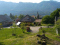
From Bonvillard, follow the road initially, then take an 8.5 km forest track from the Champeney car park to reach the buildings at the Thuile mountain pasture: a sheepfold and a mountain hut.
(S/E) From the car park, head up towards the buildings, go round the mountain hut and set off along the track that passes above it. After 250 m, you’ll reach a fork in the track.
(1) Ignore the track straight ahead towards the Croix de la Malanouette and take the track branching off to the right. Follow it to Lac de Fontaine Claire, after which it becomes a steeper path. Snowfields may still be present on this section. You’ll reach the ridge in just over an hour.
(2) Head right along the ridge; apart from a few cairns, the path is not signposted but is nevertheless clearly marked. The ridge is often narrow, sometimes very narrow: indeed, the path sometimes runs along the left or right flank of the ridge, and caution is advised on these more exposed sections.
(3) Look out for the path on the right, which you will take on the way back, and continue to follow the ridge through a series of short ascents and descents. This will take you to the base of the final slope at the foot of the final ridge.
Only attempt the final ascent in dry weather and when there is no snow on the slopes.
(4) Turn back.
(3) Leave the ridge and take an alternative route via the very narrow path on the left, which crosses the hillside to rejoin the ascent route, then turn left.
Descend via the reverse route of the ascent to return to the starting point (S/E).

 Visorando Member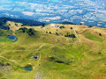
 Moderate
 Easy
Easy