Country:

 City:
City:


Start from the car park behind Tamié Abbey (or walk there from the car park at the Tamié Cheese Dairy).
(S/E) Follow the tarmac road, which takes a hairpin bend to the left and then another to the right.
(1) Continue along the road and take the hairpin bend to the left.
(2) Turn left onto the Sentier des Géants (signposted, with a wooden gate carved with a goat’s head). Set off along the many hairpin bends through the forest, following the red markings (notably on wooden posts driven into the ground) and the green-and-yellow markings.
(3) Cross a track and continue along the winding path.
(4) Carry on westwards along the mountain pasture track, towards the Chalet du Drison (several signs point the way during the climb).
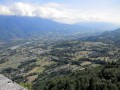
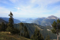
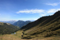
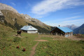
(5) At a left-hand bend, take in the view of the valley with the Chalet du Drison and carry on along the track.
(6) Once you reach the Chalet du Drison, head south towards the Col du Drison. Beautiful view of Mont Blanc.
(7) At the pass, head right (north-west) along the ridge towards Pointe de Chaurionde.
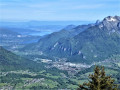
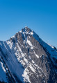
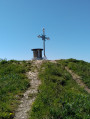
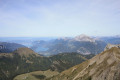
(8) Ignore a path leading down to the right (you’ll take this on the way back) and continue north-west along the ridge. After a few hairpin bends, you’ll reach the Pointe de Chaurionde (magnificent 360° view of Lake Annecy, the Arcalod, the Pointe de la Sambuy and Mont Blanc).
(9) Begin the descent along the same ridge path to the junction taken on the way out.
(8) Turn left onto the path that descends directly to the Chalet du Drison.
(6) At the chalet, take the path that branches off to the left (north-west) towards the Chalet de la Bouchasse. Follow a long but pleasant, tree-lined path on a gentle slope, crossing several streams flowing along the rocks, with consistently beautiful, unobstructed views.
(10) At the junction (elevation 1656), continue north-north-east.
(11) Pass the Chalet de la Bouchasse on your right and continue north-west. Carry on climbing along the hillside, join a path coming from the right and climb up to the Sommet de la Station.
(12) Descend back to the Chalet de la Bouchasse via the same route.
(11) Continue the descent along the same route as on the way up until you reach the junction at elevation 1656.
(10) Take the path on the left. Descend via a series of long switchbacks.
(13) At the T-junction, take the path on the left. Descend parallel to the Ruisseau du Bard.
(14) At the junction, turn right. Join the torrent and then head northwards. Turn eastwards, descend again and cross the Ruisseau du Bard. Head back up and emerge at the hairpin bend of a forest track.
(15) Follow this track to the left and head downwards across the slope.
(2) At the junction you passed on the way up, take the path on the left which winds downwards.
(1) Join the forest track again and follow it downhill to the car park (S/E).

 Visorando Member
 Easy
Easy 
 Moderate