Refuge de la Thuile – Col de l’Arc

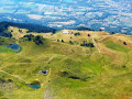
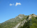
A change of scenery: the view opens out towards the Beaufortain, the Tarentaise, the Aravis and then the Vanoise. You pass beneath the Grand Arc, descend towards the Vallon de Bayet, cross the Col Basmont, then spend the night at the Col de l’Arc in the unmanned hut

This walk is part of a multi-day hike: Tour de la Lauzière

Details

99321197
Creation:
Last update:
Last review:
  • Walking
    Activity: Walking
  • ↔
    Distance: 9.24 mi
  • ◔
    Average duration: 7h 45 
  • ▲
    Difficulty: Very difficult

  • ⚐
    Back to start: No
  • ↗
    Ascent: + 4,009 ft
  • ↘
    Descent: - 3,770 ft

  • ▲
    Highest point: 7,680 ft
  • ▼
    Lowest point: 4,157 ft

Description of the walk

(S) From the Refuge de la Thuile, take the (steep) path behind the dormitory and begin the long climb up an uneven but steep path. Reach Lac de Fontaine.

(1) Continue straight ahead until you reach the Crête de la Thuile.

(2) Take the ridge path to the right, heading south, which winds its way until it reaches a junction signposted for the Chalet de la Bourne.

(3) Turn left onto a very long descent along a well-marked path to the Chalet de la Bourne.

(4) Continue straight ahead into the only small valley, which is, however, completely covered in tracks left by herds, until you reach the Cave de la Gittaz.

(5) Take the forest track, head downhill and, after a few hairpin bends, reach the high-voltage power lines.

(6) Head down to the right, towards the stream below, down a steep slope (zigzag your way down for less than 10 mins) and emerge at the stream (it is easy to cross in August). Head diagonally up to the right, towards the south-west, to rejoin the path.
Note: this route saves 45 minutes’ walk compared to taking the forest track.

(7) Turn right, pass through the Abondance cattle pastures, then begin an ascent through the woodland along a very even, gentle, narrow and cool path. It is a very pleasant climb that takes you not far from the Chalet de la Biolle.

(8) Continue the ascent and you’ll soon reach the Col de Basmont, near the pylons, with views of the Val d’Arc and Belledonne on one side and the Mont Blanc massif on the other.

(9) Take the path leading uphill to the left, then follow a balcony-like trail, with a series of short ascents and descents, to reach the Col d’Arc and its unmanned hut (E), today’s stop.

Waypoints

  1. S : mi 0 - alt. 5,846 ft - Refuge de la Thuile
  2. 1 : mi 0.57 - alt. 6,411 ft - Lac de Fontaine Claire
  3. 2 : mi 1.12 - alt. 7,388 ft - below La Thuile
  4. 3 : mi 1.95 - alt. 7,575 ft - Junction towards the Chalet de la Bourne
  5. 4 : mi 2.95 - alt. 6,293 ft - Chalet de la Bourne
  6. 5 : mi 3.9 - alt. 5,115 ft - Cave de la Gittaz
  7. 6 : mi 6.31 - alt. 4,373 ft - Start of the off-trail section
  8. 7 : mi 6.42 - alt. 4,173 ft - End of the off-trail section
  9. 8 : mi 7.48 - alt. 5,584 ft - Chalet de la Biolle
  10. 9 : mi 7.68 - alt. 5,876 ft - Col de Basmont (1791 m)
  11. E : mi 9.24 - alt. 6,073 ft - Col de l'Arc (1854 m)

Notes

Between (4) and (5): although there is no clearly marked path, there is no risk of getting lost.
(5) Make the most of the wild blackberries in this area.
(8) Chalet de la Biolle: there is a spring here.
(9) Col de Basmont: enjoy a beautiful view of the Val d’Arc and Belledonne on one side and the Mont Blanc massif on the other.
(E) Col de l’Arc: its unmanned hut offers a water supply via a catchment system

Other walks in the area

For more walks, use our search engine .

The GPS track and description are the property of this route's author. Please do not copy them without permission.