Circular walk around the Pointe de la Sambuy in Albertville

A 4-day hiking tour with wild camping, starting and finishing at Albertville railway station

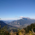
The route takes you through the Bauges Game and Wildlife Reserve, where you’ll discover the highest points of the Bauges Massif: the Pointe de Chaurionde (alt. 2,173 m) and the Col de l’Alpettaz (alt. 1,580 m), passing through the forests of Tamié, Saint-Ruph and Les Héris.

Details

1472715
Creation:
Last update:
Last review:
  • Walking
    Activity: Walking
  • ↔
    Distance: 29.29 mi
  • ◔
    Average duration: 4 days 
  • ▲
    Difficulty: Difficult

  • ⚐
    Back to start: Yes
  • ↗
    Ascent: + 10,397 ft
  • ↘
    Descent: - 10,443 ft

  • ▲
    Highest point: 7,123 ft
  • ▼
    Lowest point: 1,102 ft

Photos

Stages of the route

This route needs several days, find the details below:

  1. S
  2. 2
  3. 3
  4. E

Notes

Worth a visit

Please note: part of the circular route passes through the Bauges National Hunting and Wildlife Reserve

Worth seeing: Park information
Please note: no camping or wild camping; please stay on the paths.
You will be passing through pastureland and mountain pastures where shepherds work all year round; please avoid disturbing the flocks and close any gates behind you.

Always be cautious and plan ahead when you're outdoors. Visorando and the author of this route cannot be held responsible for any accidents occurring on this route.

For more walks, use our search engine .

The GPS track and description are the property of this route's author. Please do not copy them without permission.