The charms of Seythenex

Explore the Tamié valley and the famous Seythenex bridge in a peaceful, bucolic setting.

Details

3193801
Creation:
Last update:
Last review:
  • Walking
    Activity: Walking
  • ↔
    Distance: 5.10 mi
  • ◔
    Average duration: 3h 05 
  • ▲
    Difficulty: Moderate

  • ⚐
    Back to start: Yes
  • ↗
    Ascent: + 879 ft
  • ↘
    Descent: - 879 ft

  • ▲
    Highest point: 2,874 ft
  • ▼
    Lowest point: 2,152 ft

Photos

Description of the walk

Meet at the Les Combes car park (ski club clubhouse).

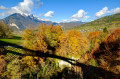
(S/E) From the Les Combes car park, continue along the road that climbs towards the Col de Tamié and enjoy a lovely view of Tamié Abbey. Pass under a power line and carry on, leaving the road on your left.

(1) Take the path leading off to the right, marked ‘Le Parchet’, pass under another power line and carry on until you reach the small local road.

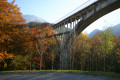
(2) Head down to the left along the road (which has little traffic). Turn left after the wide bend. Cut across a road and continue downhill, following the yellow arrows on a green background until you reach the Seythenex bridge.

(3) With the bridge in front of you, a path leads down beneath it on the right, taking you to an old sawmill. Continue along this wide path to reach the other side of the bridge.

(4) Cross the bridge and follow the road towards La Raynoz to see some old houses in the Baujue architectural style. Continue downhill until you reach a side road.

(5) Turn left, then right, cross a stream and join a road. Follow this road, then turn left towards Frontenex and its bread oven.

(6) At the bread oven, retrace your steps to the junction to head for Frontenex.

(5) Head straight up towards La Recorbaz.

(7) Follow “Les Combes” along the river until you reach the Combes Chapel.

(8) At the chapel, head down towards the car park along a path running parallel to the village road and you’ll reach the Les Combes car park (ski club clubhouse) (S/E).

Waypoints

  1. S/E : mi 0 - alt. 2,746 ft - Les Combes car park (ski club clubhouse)
  2. 1 : mi 0.48 - alt. 2,756 ft - Panoramic view of Tamié Abbey
  3. 2 : mi 1.33 - alt. 2,562 ft - Junction with the village road
  4. 3 : mi 2.01 - alt. 2,343 ft - Path under the bridge
  5. 4 : mi 2.33 - alt. 2,306 ft - Crossing the Seythenex bridge
  6. 5 : mi 2.87 - alt. 2,251 ft - Junction for the descent towards Frontenex
  7. 6 : mi 3.31 - alt. 2,152 ft - Frontenex bread oven
  8. 7 : mi 4.27 - alt. 2,497 ft - La Recorbaz. Walk alongside the - Eau Morte (rivière)
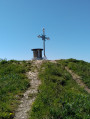
  9. 8 : mi 4.89 - alt. 2,874 ft - Les Combes Chapel
  10. S/E : mi 5.1 - alt. 2,746 ft - Les Combes car park (ski club clubhouse)

Worth a visit

Grand Pont Pottery in La Raynoz.

Reviews and comments

4.1 / 5
Based on 4 reviews

Reliability of the description
4.3 / 5
Ease of following the route
4 / 5
Route interest
4 / 5
Les normands 276
Les normands 276

Overall rating : 3.7 / 5

Date of your route : Aug 26, 2023
Reliability of the description : ★★★★☆ Good
Ease of following the route : ★★★☆☆ Average
Route interest : ★★★★☆ Good
Very busy route : No

A route that requires slightly more visible and consistent signage.

Machine-translated

canardo
canardo

Overall rating : 3.7 / 5

Date of your route : Aug 16, 2022
Reliability of the description : ★★★★☆ Good
Ease of following the route : ★★★★☆ Good
Route interest : ★★★☆☆ Average
Very busy route : No

For a walk in the valley, the starting point would be better situated near the bread oven, as that is the lowest point of the walk

Machine-translated

Lexr8
Lexr8

Overall rating : 4.3 / 5

Date of your route : Oct 21, 2020
Reliability of the description : ★★★★☆ Good
Ease of following the route : ★★★★☆ Good
Route interest : ★★★★★ Very good
Very busy route : No

A lovely, varied and easy walk, ideal for getting back into the swing of things, through a pretty valley with charming villages and, above all, a magnificent view of Tamié Abbey (complete with the perfect bench).
We set off from Frontenex, then climbed up to Les Combes before heading back down to Seythenex, so as not to end the walk with an uphill stretch.
You can also take a detour to the Seythenex cave and waterfall.

Machine-translated

Annie BR
Annie BR

Overall rating : 4.7 / 5

Date of your route : Sep 15, 2020
Reliability of the description : ★★★★★ Very good
Ease of following the route : ★★★★★ Very good
Route interest : ★★★★☆ Good
Very busy route : No

We think it would make more sense to do the route starting from Seythenex; that would mean you wouldn’t have to go downhill at the start and then uphill in the second half of the walk. Otherwise, the scenery is lovely!!!

Machine-translated

Other walks in the area

For more walks, use our search engine .

The GPS track and description are the property of this route's author. Please do not copy them without permission.