The Three Peaks Circular: Arcalod – Chaurionde – Sambuy

This route forms a circular route combining the ascents of Pointe d’Arcalod and Pointe de la Sambuy, via Pointe de Chaurionde. This circuit would be extremely long via the marked paths, but an unmarked section allows you to shorten it so that the circular route can be completed in a day. Please note that the total elevation gain is significant and some sections are challenging on the ascent to the Pointe d’Arcalod and the Pointe de la Sambuy.

Details

n°62801979
Creation:
Last update:
Last review:
  • Walking
    Activity: Walking
  • ↔
    Distance: 11.42 mi
  • ◔
    Duration according to the author: 10 hrs 
  • ▲
    Difficulty: Very difficult

  • ⚐
    Back to start: Yes
  • ↗
    Ascent: + 6,381 ft
  • ↘
    Descent: - 6,381 ft

  • ▲
    Highest point: 7,274 ft
  • ▼
    Lowest point: 3,770 ft

Photos

Description of the walk

Start from the car park at the Sethenex-la-Sambuy resort.

(S/E) Take the wide track that climbs just above the car park.

(1) At the first junction, keep to the right towards the Chalet de l’Aulp de Seythenex: the path is marked in yellow. After the chalet, the track narrows and then becomes a narrow path. Continue uphill along this path until you reach a junction called “Sous Chaurionde”, marked by a signpost.

(2) Turn right to descend to the first Col d’Orgeval. Continue straight on to the second Col d’Orgeval, at the foot of the Pointe d’Arcalod.

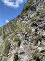
(3) Take the path opposite which climbs to the Pointe d’Arcalod. The climb is steep and, from a certain point onwards, becomes quite technical: many sections are vertiginous and require you to use your hands for support. Continue to the summit.

(4) Turn back, descending to the two Col d’Orgeval passes and then climbing back up to the “Sous Chaurionde” junction.

(2) Head up to the right towards the Pointe de Chaurionde.

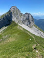
(5) At the summit, turn left onto a faint, unmarked path that follows the ridge towards the Pointe de la Sambuy. The path generally stays on the ridge, occasionally dropping down to the right to go round a hillock.

(6) About twenty metres before reaching the Sambuy cliff, the path veers to the right to run as close as possible to the base of the cliff. Follow this path, which passes a cave used as a shepherd’s shelter, descends through the scree and then gradually climbs again, always staying at the foot of the cliff. The path leads to a gap in the cliff face: the Col des Fenêtres.

(7) Cross the pass and descend diagonally towards the west-north-west. The path is very poorly marked (if at all) at this point. Simply descend the slope where the terrain is most suitable. To find your way: the path leading up to the Pointe de la Sambuy is visible further on. Head for a spot where you can see wooden barriers and follow a better-marked path there, which corresponds to the return route of the ‘La Cordée des Dahuts’ via ferrata. Be careful here : you’ll be passing close to a chasm, which is why the barriers are there.

(8) Follow the path to the left, which joins the signposted route to Pointe de la Sambuy shortly afterwards.

(9) Turn left again and climb up to the Col de la Sambuy, then left once more to reach the Pointe de la Sambuy. A few sections in the final stretch are somewhat exposed and equipped with cables.

(10) Descend via the same route.

(9) Continue left along the signposted path, then left again at the next junction, until you reach a wide track near the top station of the Sambuy chairlift.

(11) Turn left onto this run (the ‘La Forêt’ ski run) and descend to the 1501-metre mark. At this point, after a left-hand hairpin bend, the main run turns right and another ski run (the ‘Fontany’ run) veers sharply left down a steep slope.

Note: throughout this final section of the route, a GPS is useful for finding your way, as there are numerous tracks that are not maintained and are not marked on the map.

(12) Follow the ski run that descends to the left and, after a short steep section, turn left again onto a forest track and follow it to the next junction.

(13) Turn right onto a path which, although still clearly visible, is somewhat overgrown. Continue to the next junction.

(14) Turn left onto a forest track, which is also starting to become overgrown. Carry on, ignoring a few clearly unmaintained paths branching off on either side, until you come to another, better-maintained track.

(15) Carry on straight ahead: the track curves to the right, then joins a wide, motorable track.

(16) Turn left onto this track until you reach the Vargnoz crossroads.

(1) Turn right to reach the car park at the Sethenex-la-Sambuy ski resort (S/E).

Waypoints

  1. S/E : mi 0 - alt. 3,770 ft - Sethenex-la-Sambuy car park
  2. 1 : mi 0.21 - alt. 3,914 ft - Vargnoz crossroads
  3. 2 : mi 3.15 - alt. 6,096 ft - Below Chaurionde
  4. 3 : mi 3.67 - alt. 5,719 ft - Col d’Orgeval - Col d'Orgeval (1732m)
  5. 4 : mi 4.47 - alt. 7,274 ft - Pointe d’Arcalod - Pointe d'Arcalod
  6. 5 : mi 6.65 - alt. 7,103 ft - Pointe de Chaurionde - Pointe de Chaurionde
  7. 6 : mi 7.2 - alt. 6,772 ft - Below the Sambuy
  8. 7 : mi 7.71 - alt. 6,565 ft - Col des Fenêtres
  9. 8 : mi 7.86 - alt. 6,355 ft - Gouffre
  10. 9 : mi 7.92 - alt. 6,306 ft - Junction with a signposted path
  11. 10 : mi 8.49 - alt. 7,178 ft - Pointe de la Sambuy - Pointe de la Sambuy
  12. 11 : mi 9.38 - alt. 5,988 ft - La Sambuy chairlift
  13. 12 : mi 10.48 - alt. 4,872 ft - Path on the left
  14. 13 : mi 10.61 - alt. 4,695 ft - Crossroads
  15. 14 : mi 10.67 - alt. 4,610 ft - Crossroads
  16. 15 : mi 10.88 - alt. 4,249 ft - Trail junction
  17. 16 : mi 11.05 - alt. 4,019 ft - Vehicle track, on the left
  18. S/E : mi 11.42 - alt. 3,770 ft - Sethenex-la-Sambuy car park

Notes

The ascent to the Pointe d’Arcalod from the Col d’Orgeval (and, to a lesser extent, that to the Pointe de la Sambuy) is reserved for experienced walkers who are not prone to vertigo: the terrain is difficult, with numerous exposed sections.

It is strongly advised not to undertake this walk with a dog: it is not prohibited, but the path crosses several alpine pasture areas where mountain dogs are frequently present.

Worth a visit

At the point (6), there is a path leading directly up to the Pointe de la Sambuy (marked on the OSM base map). Follow the route described here until you pass the cave/shepherd’s shelter; the start of the path is visible just after that on the left (a break in the cliff face). I haven’t tried this route myself, but it is clearly quite technical and challenging.

You can stop off at Sethenex to visit the cave and the waterfalls (https://www.openstreetmap.org/#map=18/45.732149/6.299340). Access to the waterfalls is free, whilst there is an admission charge for the cave. There is a zip line above the waterfalls.

Reviews and comments

4.7 / 5
Based on 1 review

Reliability of the description
5 / 5
Ease of following the route
4 / 5
Route interest
5 / 5
Jemzolo
Jemzolo

Overall rating : 4.7 / 5

Date of your route : Jun 24, 2026
Reliability of the description : ★★★★★ Very good
Ease of following the route : ★★★★☆ Good
Route interest : ★★★★★ Very good
Very busy route : No

A lovely route, very physically demanding. And stunning views from all three summits.

It’s fine up to point 6, but between 6 and 7, the narrow chamois track at the foot of the cliff – very narrow in places and running along the side of a very steep slope – isn’t always easy to follow and is borderline dangerous. Caution and good footwear are essential.

I hesitated a bit after the Col de la Fenêtre, but eventually spotted the wooden barriers mentioned in the guide as I descended a little into the valley (don’t head too far north).

The final descent along the track from the resort, in the blazing sun, was no walk in the park… but shorter than I’d feared. (I did this hike on a day of extreme heat, even though I’d set off very early in the morning)

Machine-translated

Other walks in the area

For more walks, use our search engine .

The GPS track and description are the property of this route's author. Please do not copy them without permission.