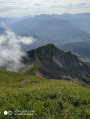
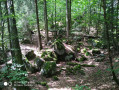
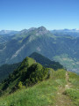
Dent de Cons from Allondaz

Here is a circular route that allows you to prolong the pleasure of walking along a very narrow ridge with vertiginous slopes.

Details

12221146
Creation:
Last update:
Last review:
  • Walking
    Activity: Walking
  • ↔
    Distance: 9.48 mi
  • ◔
    Duration according to the author: 7 hrs 
  • ▲
    Difficulty: Very difficult

  • ⚐
    Back to start: Yes
  • ↗
    Ascent: + 4,928 ft
  • ↘
    Descent: - 4,934 ft

  • ▲
    Highest point: 6,768 ft
  • ▼
    Lowest point: 2,402 ft
  • ⚐ Country: France
  • ⚐
    Areas: Alps, Bauges
  • ⚐ City: Allondaz (73200)
  • ⚑
    Start/End: N 45.707293° / E 6.364997°
  • ❏
    IGN map(s): Ref. 3431OT, 3431OTR, 3432ET, 3531OT, 3531OTR
  • Hour-by-hour weather

Photos

Description of the walk

Get to Allondaz via Gilly-sur-Isère or Albertville. Park at the village exit, just past the council’s green waste collection point, in a small, well-shaded car park.

(S/E) Continue along the road, then cross a wide stream and keep slightly to the left on the other side to stay on the path. You’ll reach a path junction.

(1) Turn right and head up the slope along a direct path; after leaving the Ruisseau de Savoret behind, you’ll reach the Fayère junction near a ruin.

(2) Then turn left and quickly begin a series of tight hairpin bends to reach another junction in the Bois de la Corne.

(3) Change direction and head left across the terrain. Continue until you reach the edge of the wood beneath some rocks. You will then reach the Col de l’Alpettaz.

(4) Turn right to reach the Pointe de la Deuva via a short but steep climb.

(5) Continue along the ridge, initially under a canopy of trees, to reach the Rocher Blanc after passing several very steep rock faces.

(6) Continue along the ridge, alternating between very narrow sections and easier ones. Cables are in place to aid progress, but some are rather in the way. Reach Pointe de Cruessajran.

(7) After a short descent, follow further narrow sections of the ridge. Pass Les Frêtes and complete the ascent of the Dent de Cons via a tricky section.

(8) Begin the descent via the Rocher Prani. Continue through the forest to reach the junction at the Chalet de l’Alpettaz.

(9) Turn left to climb up to the Batteries viewpoint.

(10) Return to the previous junction.

(9) Take theGRP® trail for the Massif des Bauges, signposted in red and yellow, directly opposite; leave it at the next junction to take theGRP® access trail. Reach the Raffort car park.

(11) Continue along thisGRP® trail, known as the ‘Massif des Bauges access’ route and also marked in red and yellow. Pass through several hamlets – Les Molliets, Pré Sémelin and Les Fontainaux – until you reach Sous Pravant.

(12) Keep to the right on theGRP®, then turn left at the Ruisseau de Chiriac, reach the entrance to the village of Allodaz, and take the road on the right to return to the car park (S/E).

Waypoints

  1. S/E : mi 0 - alt. 2,425 ft - Allondaz car park
  2. 1 : mi 0.12 - alt. 2,421 ft - Trail junction
  3. 2 : mi 0.85 - alt. 3,579 ft - The ruin
  4. 3 : mi 1.29 - alt. 4,721 ft - Bois de la Corne
  5. 4 : mi 1.77 - alt. 5,315 ft - Col de l'Alpettaz (1580m)
  6. 5 : mi 1.97 - alt. 5,600 ft - Pointe de la Deuva
  7. 6 : mi 2.38 - alt. 6,175 ft - Le Rocher Blanc
  8. 7 : mi 2.87 - alt. 6,430 ft - Pointe de Cruessajran
  9. 8 : mi 3.62 - alt. 6,742 ft - Dent de Cons
  10. 9 : mi 5.36 - alt. 4,600 ft - Alpettaz Chalet
  11. 10 : mi 5.6 - alt. 4,718 ft - Point de vue des Batteries
  12. 11 : mi 6.38 - alt. 3,917 ft - Raffort car park
  13. 12 : mi 8.64 - alt. 2,792 ft - Below Pravant
  14. S/E : mi 9.48 - alt. 2,415 ft - Allondaz car park

Notes

(4) A water source is marked below the Col de l’Alpettaz, but I haven’t checked it.
For further information, see also this route description
I saw a few chamois below the Pointe de la Deuva as I emerged from the woods and on either side of the ridge.
The return journey from Le Raffort takes longer than the 1 hour 35 minutes indicated on the signpost; usually it’s the other way round.
Note: to avoid this return route, you can leave a car here and then drive back to Allondaz.

Worth a visit

Orientation table at the Dent de Cons.

Reviews and comments

4.5 / 5
Based on 2 reviews

Reliability of the description
4.5 / 5
Ease of following the route
4 / 5
Route interest
5 / 5
trotnatu
trotnatu

Overall rating : 5 / 5

Date of your route : Jun 09, 2025
Reliability of the description : ★★★★★ Very good
Ease of following the route : ★★★★★ Very good
Route interest : ★★★★★ Very good
Very busy route : No

A magnificent hiking route with an aerial ridge that requires sure footing and is not suitable for hikers who prefer a proper trail.
A small personal note about the start.
Parking is easier 300 metres before the sign (near a lodge) and this adds hardly any time to the walk.
- At the very start of the walk, you cross a stream and arrive in a slightly marshy area where the trail is unclear and probably varies from year to year. Cross as horizontally as possible (5 minutes). When you come out, don't be tempted to follow a horizontal forest path (this spot is also likely to vary depending on forestry work), but climb diagonally towards a rocky outcrop in the forest (5 minutes). You will then find a very good, well-marked path that you just need to follow. It's simple: if you're not on a good path, you haven't found the right way yet!
The rest of the route is straightforward and splendidly varied.
At the summit, and then on part of the descent, you will encounter a few other people, but it's no big deal!

Machine-translated

satou
satou

Overall rating : 4 / 5

Date of your route : Aug 15, 2023
Reliability of the description : ★★★★☆ Good
Ease of following the route : ★★★☆☆ Average
Route interest : ★★★★★ Very good
Very busy route : No

We were the first to try this route out yesterday, the two of us. The start is a bit of a mess; the trail takes us off the beaten track into the woods, but then we come back onto a good, signposted path that leads us up to the pass.
It’s a steep climb, and our legs are really feeling it.
Then comes the start of a 3 km stretch along the ridges. Cables, sheer drops, exposed sections. Tourists, run for your lives!
This trail is for experienced walkers only.
After that, the return journey through the forest becomes a bit tedious; the path is poorly marked and the grass is tall.
Overall, a superb hike: challenging, technical and with stunning views.
Only for experienced hikers! Thanks for mapping the route!

Machine-translated

Other walks in the area

For more walks, use our search engine .

The GPS track and description are the property of this route's author. Please do not copy them without permission.