The Palatieux Balconies (Lè lôzè du Palatchu)

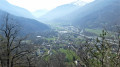
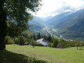
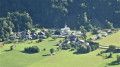
A lovely path running along a ridge overlooking the Tarentaise valley with stunning views of Tours-en-Savoie.

Details

3102276
Creation:
Last update:
Last review:
  • Walking
    Activity: Walking
  • ↔
    Distance: 2.51 mi
  • ◔
    Average duration: 2h 15 
  • ▲
    Difficulty: Moderate

  • ⚐
    Back to start: Yes
  • ↗
    Ascent: + 1,270 ft
  • ↘
    Descent: - 1,260 ft

  • ▲
    Highest point: 2,290 ft
  • ▼
    Lowest point: 1,152 ft

Photos

Description of the walk

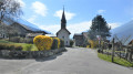
Park in the car park next to the church.

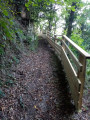
(S/E) From the church car park, walk along the departmental road towards Albertville as far as the ‘Atelier des Cerises’ (car repair workshop). Take the cul-de-sac between the houses on the right, up a few wooden steps beneath the peach tree, and climb up the Chemin du Palatieux.

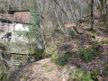
(1) Pass close to an old mill and continue to the right, winding your way up several bends. You’ll reach Le Palatieux, where there is a drinking water point.

(2) Carry on straight ahead (south-east) to reach the buildings at Muradoran.

(3) Turn right towards Saforain; carry on past the junction leading to Les Déberts – leave this on your left – and continue until you reach a junction marked by a cairn.

(4) Turn right and follow the narrow path to the tarmac road. Turn right, then cross the Carré du Village and join the Route du Grand Village, where you turn right

(5) Follow this road to the right until you reach the church (S/E).

Waypoints

  1. S/E : mi 0 - alt. 1,152 ft - Church car park
  2. 1 : mi 0.57 - alt. 1,795 ft - Old mill
  3. 2 : mi 0.8 - alt. 2,218 ft - Le Palatieux, drinking water reservoir
  4. 3 : mi 0.94 - alt. 2,290 ft - Muradoran, junction
  5. 4 : mi 1.85 - alt. 1,430 ft - Cairn. Turn right
  6. 5 : mi 2.21 - alt. 1,214 ft - Route du Grand Village, on the right
  7. S/E : mi 2.51 - alt. 1,155 ft - Church car park

Notes

(2) Drinking water point.

Reviews and comments

4.2 / 5
Based on 3 reviews

Reliability of the description
4.7 / 5
Ease of following the route
4.7 / 5
Route interest
3.3 / 5
Mic Guillot
Mic Guillot

Overall rating : 4 / 5

Date of your route : Sep 05, 2026
Reliability of the description : ★★★★☆ Good
Ease of following the route : ★★★★☆ Good
Route interest : ★★★★☆ Good
Very busy route : No

I went exploring with a friend and her two dogs (whom she knew)
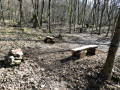
Be warned, it’s quite a steep climb at 400D over a kilometre, but the path is well-marked – you just need a good pair of walking shoes. Afterwards, you get a lovely view of the valley towards Tours, La Bâthie and so on; the top bit is rather pretty but nothing to write home about. It’s mainly a good walk for taking the dogs out and getting a bit of exercise over a total of 4km, right to the end of the circular walk in front of the church in Tours-en-Savoie. There’s not much variety between the heavily wooded and rocky start, before crossing pastures and then heading back down through the forest – a route that requires caution but presents no major difficulties. There are even benches towards the bottom where you can have a bite to eat, for example /

Machine-translated

Jorie73
Jorie73
• Edited:

Overall rating : 4.7 / 5

Date of your route : Nov 29, 2023
Reliability of the description : ★★★★★ Very good
Ease of following the route : ★★★★★ Very good
Route interest : ★★★★☆ Good
Very busy route : No

I did this walk for the first time last week, and I went again yesterday with my two dogs in glorious weather – and I really enjoyed it.
Admittedly, it’s not easy – it’s quite a challenge – and the views aren’t spectacular, but it’s still very lovely.
We were lucky enough to spot a doe and a chamois. I’d definitely go back 🥰

Machine-translated

potaufeux
potaufeux
• Edited:

Overall rating : 4 / 5

Date of your route : Sep 10, 2020
Reliability of the description : ★★★★★ Very good
Ease of following the route : ★★★★★ Very good
Route interest : ★★☆☆☆ Disappointing
Very busy route : No

This route is classified as easy. However, we found it rather difficult. It’s nothing but uphill or downhill on an unpaved track. There are few unobstructed views of the Albertville valley, which, all things considered, isn’t a particularly attractive landscape. The valley is very noisy, with a motorway and a dual carriageway. The noise from cars and lorries echoes throughout the valley.
We therefore do not recommend this walk.

Machine-translated

Other walks in the area

For more walks, use our search engine .

The GPS track and description are the property of this route's author. Please do not copy them without permission.