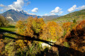
Pointe de Chaurionde via the Chalet du Drison

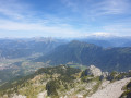
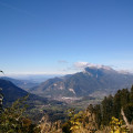
A day’s hike in exceptional surroundings. You’ll be rewarded with a breathtaking view from the summit of the Pointe de Chaurionde.

Details

n°4259094
Creation:
Last update:
Last review:
  • Walking
    Activity: Walking
  • ↔
    Distance: 10.32 mi
  • ◔
    Average duration: 8h 25 
  • ▲
    Difficulty: Difficult

  • ⚐
    Back to start: Yes
  • ↗
    Ascent: + 4,186 ft
  • ↘
    Descent: - 4,193 ft

  • ▲
    Highest point: 7,123 ft
  • ▼
    Lowest point: 3,766 ft

Description of the walk

Park in the car park at the Seythenex-la-Sambuy ski resort.

(S/E) Turn right towards the top of the Seythenex resort, following theGRP® Tour des Bauges trail. You’ll soon reach a junction at a sweeping bend.

(1) Keep left on theGRP® marked in red and yellow. Carry on until you reach another junction at the Praz Rupt ski lift.

(2) Continue along the 4x4 track, turning right. You’ll reach the Sambuy chairlift. Start climbing the winding path here. Reach the top station of the chairlift and carry on to the junction with the Chemin des Chèvres.

(3) Head down this track to the right towards the Chalet de la Bouchasse. You’ll reach the Chalet de la Bouchasse.

(4) Here, join theGRP® Tour des Bauges trail and follow it to the right. Walk almost level until you reach the junction by the Bouchasse stream.

(5) Cross the stream and keep to the right on theGRP®, passing several streams before reaching the Chalet du Drison.

(6) Head uphill to the right and then reach the Col du Drison.

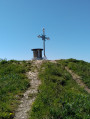
(7) Turn right onto the ridge to complete the ascent of the Pointe de Chaurionde. Reach the summit of this peak.

(8) Continue straight ahead downhill along a new ridge to reach the junction at the Chalet de l’Aulp de Seythenex just before the Col d’Orgeval.

(9) Continue the descent to the right, cross a stream and then return to the Chalet de l’Aulp de Seythenex.

(10) Continue along the wide path, still following theGRP® route marked in red and yellow, to return to the original junction.

(1) Follow the route you took on the way there to reach the car park at the Seythenex-la-Sambuy resort (S/E).

Waypoints

  1. S/E : mi 0 - alt. 3,773 ft - Car park at the Seythenex-la-Sambuy resort
  2. 1 : mi 0.26 - alt. 3,911 ft - Crossroads at the end of the circular loop
  3. 2 : mi 1.02 - alt. 4,377 ft - Ski lift junction
  4. 3 : mi 2.94 - alt. 5,856 ft - Chemin des Chèvres junction
  5. 4 : mi 3.45 - alt. 5,574 ft - Chalet de la Bouchasse
  6. 5 : mi 4.04 - alt. 5,436 ft - Bouchasse stream
  7. 6 : mi 5.08 - alt. 5,384 ft - Chalet du Drison
  8. 7 : mi 5.32 - alt. 5,764 ft - Col du Drison (1756m)
  9. 8 : mi 6.25 - alt. 7,123 ft - Pointe de Chaurionde
  10. 9 : mi 7.1 - alt. 6,099 ft - Junction towards the Chalet de l’Aulp - Col d'Orgeval (1732m)
  11. 10 : mi 8.08 - alt. 5,633 ft - Chalet de l’Aulp de Seythenex
  12. S/E : mi 10.32 - alt. 3,773 ft - Car park at the Seythenex-la-Sambuy resort

Notes

(2) Alternative route here: You can keep left to reach the Pas de l’Ours, taking care at the tricky section where you’ll need to use your hands. Then turn right at the Pra Fournier junction to reach (4) at the Chalet de la Bouchasse. This route follows theGRP® trail through the Massif des Bauges (marked in red and yellow).

Reviews and comments

4.3 / 5
Based on 2 reviews

Reliability of the description
4 / 5
Ease of following the route
4 / 5
Route interest
5 / 5
zit.bouc
zit.bouc

Overall rating : 4.3 / 5

Date of your route : Nov 08, 2026
Reliability of the description : ★★★★☆ Good
Ease of following the route : ★★★★☆ Good
Route interest : ★★★★★ Very good
Very busy route : No

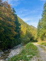
A lovely route to follow in autumn, with magnificent colours and views across various valleys. The variety of landscapes makes this walk particularly appealing to walkers who enjoy the atmosphere of the Bauges massif. Depending on the time of year, you can expect a variety of conditions along the way: a mix of frozen and muddy patches, which can sometimes be a little slippery.

Machine-translated

EVERUN
EVERUN

Overall rating : 4.3 / 5

Date of your route : Jul 31, 2020
Reliability of the description : ★★★★☆ Good
Ease of following the route : ★★★★☆ Good
Route interest : ★★★★★ Very good
Very busy route : No

An amazing day with temperatures of 36 degrees!!!
Took a different route, returning via the Col du Haut du Four...

Machine-translated

Other walks in the area

For more walks, use our search engine .

The GPS track and description are the property of this route's author. Please do not copy them without permission.