


 Country:

 City:
City:


Shelters and springs are dotted along the trail.
Stay on the marked paths.


A two-day route around the Pointe d’Arcalod, the highest point in the Bauges, passing through unspoilt wilderness, valleys and rivers. The suggested route mainly follows the GR® de Pays Tour de l’Arcalod, marked in yellow and red. Spectacular views of the mountains and Lake Annecy. This wild and little-used route is mainly situated within a Regulated Sensitive Area.


This route needs several days, find the details below:
Shelters and springs are dotted along the trail.
Stay on the marked paths.
This route passes through multiple protected areas, which may be subject to special regulations:
Nant Fourchu stream car park – Chalets de l’Eau Froide 8.13 mi
+4,140 ft
-2,103 ft
7h 20
 Very difficult
 Departure from École (Savoie)
Pointe d'Arcalod via the Chalets d'Orgeval
Departure from École (Savoie)
Pointe d'Arcalod via the Chalets d'Orgeval 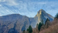 7.21 mi
+3,999 ft
-3,999 ft
6 hrs
Very difficult
Departure from École (Savoie)
Pointe de Chaurionde
7.21 mi
+3,999 ft
-3,999 ft
6 hrs
Very difficult
Departure from École (Savoie)
Pointe de Chaurionde 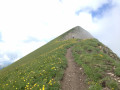 8.83 mi
+4,094 ft
-4,072 ft
7h 35
Difficult
Departure from École (Savoie)
Mont de la Coche and Tré le Mollard
8.83 mi
+4,094 ft
-4,072 ft
7h 35
Difficult
Departure from École (Savoie)
Mont de la Coche and Tré le Mollard 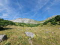 7.17 mi
+3,409 ft
-3,389 ft
6h 15
Difficult
Departure from École (Savoie)
The Col d'Orgeval
7.17 mi
+3,409 ft
-3,389 ft
6h 15
Difficult
Departure from École (Savoie)
The Col d'Orgeval 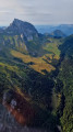 6.19 mi
+2,448 ft
-2,448 ft
5h 00
6.19 mi
+2,448 ft
-2,448 ft
5h 00
 Moderate
Departure from École (Savoie)
Pointe de la Fougère
Moderate
Departure from École (Savoie)
Pointe de la Fougère 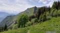 6.37 mi
+3,248 ft
-3,248 ft
5h 45
Moderate
Departure from École (Savoie)
Combe Fort and Pointe de la Fougère
6.37 mi
+3,248 ft
-3,248 ft
5h 45
Moderate
Departure from École (Savoie)
Combe Fort and Pointe de la Fougère  5.96 mi
+2,838 ft
-2,841 ft
5h 15
Moderate
Departure from Jarsy (Savoie)
Arcalod-Mont de la Coche circular from Bellevaux
5.96 mi
+2,838 ft
-2,841 ft
5h 15
Moderate
Departure from Jarsy (Savoie)
Arcalod-Mont de la Coche circular from Bellevaux 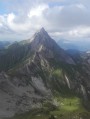 10.29 mi
+5,381 ft
-5,364 ft
8 hrs
Very difficult
Departure from École (Savoie)
10.29 mi
+5,381 ft
-5,364 ft
8 hrs
Very difficult
Departure from École (Savoie)
For more walks, use our search engine .
The GPS track and description are the property of this route's author. Please do not copy them without permission.
Scan this QR code with your smartphone's camera.
To open this route on your smartphone, you must have the Visorando app installed. If not, got to the Apple Store (iPhone) or Google Play Store (Android) to download the app.
 Visorando Member
