A circular route around the Dent du Corbeau from Saint-Paul-sur-Isère

A beautiful, little-known summit at the northern end of the Lauzière massif.
The approach via the Tarentaise, which is much less frequented, guarantees peace and quiet and the chance to spot chamois.

Details

38581700
Creation:
Last update:
Last review:
  • Walking
    Activity: Walking
  • ↔
    Distance: 5.25 mi
  • ◔
    Average duration: 4h 40 
  • ▲
    Difficulty: Difficult

  • ⚐
    Back to start: Yes
  • ↗
    Ascent: + 2,556 ft
  • ↘
    Descent: - 2,536 ft

  • ▲
    Highest point: 7,467 ft
  • ▼
    Lowest point: 4,948 ft

Description of the walk

Access by car from Saint-Paul-sur-Isère via the Villard road, on leaving the village, just before Esserts-Blay. After Le Villard, follow signs for Le Cudray, then continue along the forest track (suitable for vehicles) to the Chalet du Queget, in front of which there is a designated car park.

(S/E) Continue along the forest track, which is circular and crosses mountain pastures to the Chalet de Charvan.

(1) Take the path which branches off to the right behind the chalet. After a gentle climb, it continues straight ahead along the mountainside, due north, for about 1 km to the Chalet de la Lanche.

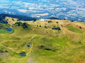
(2) Continue along the well-marked path which climbs at a steady gradient to the small Lac de la Lanche.

(3) Go round the lake to the right and climb up a lovely path to the Col de la Lanche.

(4) Take the ridge on the left and follow it (marked with yellow trail markings on the ground and a few cairns) to the summit of the Dent du Corbeau. On the way, you can see the small Lac Rond (a rather misnamed lake!) below. A large cairn marks the summit and a cross stands about 2 m below it. From the summit, there is a 360° view of the Combe de Savoie, Lake Annecy, the Beaufortain, the Lauzière… and, of course, Mont Blanc.

(5): Descend the ridge, heading broadly south, along a well-marked path that leads to the Col de Charvan.

(6) Leave the ridge by turning left onto a small, more or less visible path. Pass an initial shoulder; note the little Chalet du Golet on the right. The path runs not far away, but there is no need to cross the stream to join it because, at this point, the better-marked path heads due east and leads to the Chalet de la Bottière.
Just below the peak, we came across a herd of 22 chamois.

(7) Follow the path which descends slightly to the left below the chalet. The path, which gets wider and wider, leads back to the Chalet de Charvan, which you passed on the way up.

(1) Head back down via the same route you took on the way up and return to the Chalet du Queget (S/E).

Waypoints

  1. S/E : mi 0 - alt. 4,948 ft - Chalet du Queget – Car park
  2. 1 : mi 0.81 - alt. 5,427 ft - Chalet de Charvan. Junction of the circular loop
  3. 2 : mi 1.55 - alt. 5,823 ft - Chalet de la Lanche
  4. 3 : mi 2.16 - alt. 6,535 ft - Lac de la Lanche
  5. 4 : mi 2.38 - alt. 6,847 ft - Path to La Grande Lanche (2,111 m) - Col de la Lanche (2087m)
  6. 5 : mi 2.97 - alt. 7,467 ft - Summit - La Dent du Corbeau
  7. 6 : mi 3.19 - alt. 7,100 ft - Col du Charvan (2162m)
  8. 7 : mi 3.24 - alt. 7,005 ft - Xx and the CV www from de😗
  9. 8 : mi 4.14 - alt. 5,843 ft - Cabane La Bottière (1790m)
  10. S/E : mi 5.25 - alt. 4,948 ft - Chalet du Queget

Notes

The access road is long and, although it is perfectly passable by car, the journey is rather tedious.
It should be possible to start the hike further down, as there are paths that allow you to cut across the long hairpin bends of the road.

The northern ridge has a few slightly exposed sections, but nothing too daunting. The descent down the southern slope is straightforward.

Worth a visit

Small high-altitude lakes.
Panoramic view from the summit of the Dent du Corbeau.

Reviews and comments

4.5 / 5
Based on 2 reviews

Reliability of the description
4.5 / 5
Ease of following the route
4 / 5
Route interest
5 / 5
ChZambaux
ChZambaux

It is true that the walk has been classified as ‘Moderate’ in terms of difficulty due to its moderate length and elevation gain, but the fact that part of the route follows a ridge may justify classifying it as ‘Difficult’. I will amend this if the website allows it.

Machine-translated

User 31061018

Overall rating : 4.7 / 5

Date of your route : Sep 14, 2026
Reliability of the description : ★★★★★ Very good
Ease of following the route : ★★★★☆ Good
Route interest : ★★★★★ Very good
Very busy route : No

A lovely walk with incredible views.
However, this walk is classified as medium difficulty, which, in my opinion, isn’t entirely realistic.
In fact, the final ridge leading up to the Dent du Corbeau is quite challenging, with sections that aren’t suitable for everyone, especially if you’re afraid of heights.

Machine-translated

User 29619968

Overall rating : 4.3 / 5

Date of your route : Jun 13, 2026
Reliability of the description : ★★★★☆ Good
Ease of following the route : ★★★★☆ Good
Route interest : ★★★★★ Very good
Very busy route : No

We really enjoyed this lovely hike today. Stunning views (mountain lakes, views of Mont Blanc and Lake Annecy) and a lovely sense of peace and quiet!

As for the difficulty level, which is rated ‘moderate’:
the elevation gain is very concentrated, making the hike quite physically demanding even for those in fairly good shape.
Those with a fear of heights should also take care, as some sections at higher altitudes are quite steep.
On the section of the hike between points 6 and 7, the ground will be very wet (this may, in my opinion, depend on the season…), so there is a risk of slipping.

It’s a very beautiful hike and the scenery is well worth the effort!

PS: Please note that to reach the car park at the start, Waze does not provide a viable route (you will need to stop near the chapel at Monslacon, which will add approximately 350 metres of elevation gain over 1 km); I therefore recommend using a different sat-nav.

Machine-translated

Other walks in the area

For more walks, use our search engine .

The GPS track and description are the property of this route's author. Please do not copy them without permission.