Nant Fourchu stream car park – Chalets de l’Eau Froide
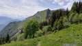
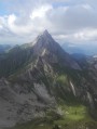
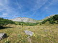
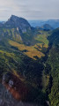
First day of a two-day route around the Pointe d’Arcalod, the highest point in the Bauges, crossing wild areas, valleys and rivers. The proposed route mainly follows the eastern section of the GR® de Pays Tour de l’Arcalod, marked in yellow and red. Spectacular views of the mountains and Lake Annecy. This wild and little-used route is situated mainly within a sensitive, regulated area. The terrain is good and presents no particular difficulties.
Park at the stream car park, or just before the ford leading up to it (a few spaces available).
(S) Follow the signs for the Col d’Orgeval. Head for the Chalets d’Orgeval.
(1) Continue uphill to reach the Col d’Orgeval.
(2) Head downhill, staying on the GRP® trail, until you reach the ONF shelter at Bonverdan.
(3) Carry on until you reach a path junction.
(4) Keep to the right, descend via a few hairpin bends to reach another path junction with a fountain where you can top up your water supplies.
(5) Turn left and follow the yellow and red markings to reach the Sarve Lodge.
(6) Here you have two options: - turn left onto the path leading to the Pointe de Velan, then head down to the Chalets de l’Eau Froide (E), - continue to the right along the GRP® – this is the route shown on the map – to reach the ONF Chalet des Barbus.
(7) Turn left and follow the GRP® to reach the Chalets de l’Eau Froide (E).
5 : mi 5.25 - alt. 3,799 ft - Junction and Fountain
6 : mi 6.62 - alt. 4,731 ft - Lodge de la Servaz (Sarve)
7 : mi 7.36 - alt. 4,738 ft - Chalet des Deux Barbus
E : mi 8.13 - alt. 5,318 ft - Chalets de l’Eau Froide
Notes
(1) Note: there are no public shelters or accommodation options at the Chalets d’Orgeval, which are privately owned. (3) The ONF shelter at Bonverdan is open and has a table and 2–3 basic sleeping places (no water). (7) The ONF Chalet des Barbus has a lovely fountain but is closed and fenced off as it is situated in the middle of a mountain pasture. There is another self-service drinking trough a little further on, towards the Chalets de l’Eau Froide. (E) Chalets de l’Eau Froide: here you’ll find water, drinks and Tome cheese offered by the shepherd, and a building to take shelter in (as well as camping pitches; camping is permitted here).
Overnight accommodation at the end of the stage: for greater comfort, spend the night at the (6) Gîte de la Sarve or Gîte de la Servaz (booking required). (E) For wild camping, the area around the Chalet des Barbus, the Chalets de l’Eau Froide and as far north as the Plan de France is outside the restricted zone and offers some good spots. Check with the shepherd regarding the herds and sheepdogs, but in any case, the Chalets de l’Eau Froide have a suitable campsite available.
This route passes through multiple protected areas, which may be subject to special regulations:
To open this route on your smartphone, you must have the Visorando app installed. If not, got to the Apple Store (iPhone) or Google Play Store (Android) to download the app.



 Country:

 City:
City:


 Visorando Member
 Difficult
 Moderate