Country:

 City:
City:


The start is in the hamlet of Les Combes in the commune of Faverges-Seythenex (74210). From Faverges, head towards Seythenex. On leaving the hamlet of Frontenex (74), take the second left just after the ‘end of built-up area’ sign and follow signs for Val de Tamié. Park in the car park before the wooden sign for Les Combes.
(S/E) As you leave the car park, follow the signposts and head towards Les Combes. Cross the road and take the path opposite towards the hamlet of Les Combes. When you reach a tarmac road, turn left twice, following the signposts, to reach the chapel.
(1) Then turn right. Continue along the road and then the path until you reach a crossroads.
(2) Turn right and continue along this path.
(3) Leave this track and take another track on the left, which climbs quite steeply at first. Stay on this track until you reach a signpost marked “Sous le Chalet de Périllet”.
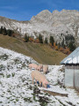
(4) Head towards La Belle Étoile. Please note that the signposting was still being installed when I walked this route in late May 2026. Once you reach the top of this hill, continue to the right and go round the Chalet du Périllet on the right-hand side. You’ll reach the end of a track.
(This marked section is very steep but can be bypassed by continuing along the track for about fifty metres, then turning right to go round the chalet on the left).
(5) Leave the track and take the path leading uphill to the right. Continue along this path until you reach a track not shown on maps.
(6) Follow this track to the left for about thirty metres, then leave it by taking a path on the right. Continue along this path until you reach the “Entre 2 Croix” signpost on the ridge leading to La Belle Étoile (alt. 1841 m).
(7) Turn left and continue to La Belle Étoile.
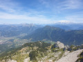
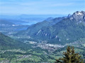
(8) Take in the 360° panorama and check out the orientation table. Head back to the previous junction.
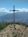
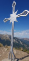
(7) Carry on straight ahead towards the Teppes car park. Some sections will require you to use your hands. Reach the Croix de Périllet at an altitude of 1710.
(9) Take in the panoramic view, then continue down to the sign for “La forêt de Chevron”.
(10) Head down to the right towards “Les Teppes car park via the national forest” until you come out onto a track.
(11) Follow it to the right until you reach the junction you passed on the way up, marked “Sous le Chalet de Périllet”.
(4) Continue straight down the path, following the reverse route of the outward journey, until you reach the car park where you started (S/E).
 Tourist office
 Moderate
 Visorando Member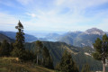
 Easy
Easy