Country:

 City:


Start from the hamlet of Les Combes. Park in the large car park at the foot of the hamlet, on the right-hand side of the road when coming from La Recorbaz, where there are recycling bins.
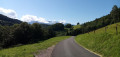
(S/E) Take the exit upstream of the car park (the recycling bins are on the downstream side) and turn right. Walk past a campsite and climb gently up the small road towards Le Parchet. At the T-junction, turn right onto the Route des Prières and head downhill (Tamié Abbey can be seen in the distance).
(1) At the ‘Les Crêts’ sign, continue downhill along the road as it bends to the left. Pass through the hamlet of Les Prières and you’ll come to a fountain.
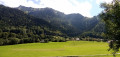
(2) Then turn right onto Route de la Cottettaz and continue downhill. At the bottom, cross the D12, go over a bridge over a river opposite and carry on along a small road. When this turns right, take the grassy path on the left that runs between two meadows. Shortly afterwards, the path approaches the river and runs alongside a small wood on the left-hand side.
(3) Ignore a path branching off to the left and immediately pass by the foot of a wooden sculpture depicting a bell tower. Continue up the valley along a shaded path, crossing a few wooden walkways over damp sections. Further on, the path gives way to a track beneath the spruce trees. You’ll reach a junction with a forest track.
(4) Follow the track to the left and descend to the riverbank. Ford the river and continue on the opposite side along a stony path (the path shown in purple on the IGN map has disappeared beneath the vegetation).
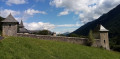
(5) At the edge of the D12, turn right onto a stony path, heading towards the abbey. At the ‘Pré de la Reine’ signpost (junction with the path shown in purple), carry on straight ahead. Walk uphill, with the river below on your right. Take in the view of the abbey and walk along its outer wall on your left. Turn left at the corner of the wall and join a small road, level with a house (sign for ‘Saint-Benoît’; water point).
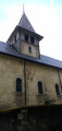
(6) Follow the road to the left until you reach the entrance to the abbey church.
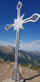
(7) Continue along the road to enjoy a lovely view of the abbey (if you turn round). Those wishing to buy some Tamié cheese can head to the shop marked by a metal cross.
(8) Retrace your steps back to the church entrance.
(7) Then turn left onto a path that climbs towards Sur l’Abbaye. After a hairpin bend to the left, you’ll come out onto a small road; follow it to the right and downhill. After a hairpin bend to the right, you’ll reach the ‘Saint-Benoît’ house.
(6) Turn right at an acute angle onto the path you took on the way there, running alongside the boundary wall. At the ‘Pré de la Reine’ signpost, ignore the sign for Les Prières on the left (the path leads to a dead end) and carry on straight ahead until you reach the D12.
(5) Turn left back onto the path you took on the way there. Cross the river at the ford again and follow the forest track.
(4) When the track turns left and climbs steeply, take the path on the right and head downhill.
(3) About a hundred metres past the wooden bell tower, turn right onto a path that descends and soon reaches the river. Ford the river for a third and final time. On the other side, continue along a path that joins the D12 (the IGN map is approximate here).
(9) Cross the D12 and follow the small road opposite, towards Les Prières and Les Combes. Climb gently and steadily up to the fountain you saw on the way there.
(2) Carry on straight ahead and climb at a steeper gradient.
(1) When the road bends to the right at the ‘Les Crêts’ sign, carry on straight ahead along a stony track and climb more gently. At the ‘Le Parchet’ sign, carry on straight ahead (ignore the sign directing you to turn right towards the Combes car park). Descend slightly, ignore a path branching off to the left, pass under a high-voltage power line and continue along the path, which is now well shaded.
(10) At the start of a gentle left-hand bend, as you emerge from the woods, turn right onto a grassy path (Yellow Cross). The path bends left then right, becoming stony as it climbs through the woods. At the junction that appears shortly afterwards, turn left. Head downhill and turn right at the foot of another wooden structure. Join a road and you’ll immediately find the Combes car park on your right (S/E).

 Tourist office

 Visorando Member
 Difficult
 Very difficult