Mont de Grésy via Montailloset

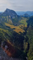
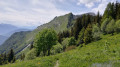
The ascent via Montailloset follows a steep path that no longer appears on IGN maps. It passes above the Gorges des Lavanches.

Details

n°57797242
Creation:
Last update:
Last review:
  • Walking
    Activity: Walking
  • ↔
    Distance: 3.82 mi
  • ◔
    Average duration: 3h 35 
  • ▲
    Difficulty: Moderate

  • ⚐
    Back to start: Yes
  • ↗
    Ascent: + 2,136 ft
  • ↘
    Descent: - 2,126 ft

  • ▲
    Highest point: 3,255 ft
  • ▼
    Lowest point: 1,286 ft

Description of the walk

Park in the car park at the Grésy-sur-Isère cemetery.

(S/E) Begin the ascent by walking alongside the cemetery. Reach and cross the Ruisseau des Lavanches, which is usually dry, as the water flows underground here. Shortly afterwards, you’ll reach a crossroads of paths.

(1) Turn right and follow this stone-lined path to the farm track through the gorges. Take this track towards the village of Montailloset. Before reaching the village, you’ll come to another fork.

(2) Leave this track and turn left onto a farm track, leading to the protective earthwork surrounding the hamlet.

(3) Pass the ‘no entry’ sign, then take the path on the left. Walk for barely ten metres along this path and turn left. Cross the woodland to reach, via a stretch that is particularly steep in its straight section, the Ruisseau du Couloir des Gorges.

(4) Take great care here not to step off the ledge, which is sometimes narrow or obscured by vegetation. This steep path leads to the foot of a cliff equipped with a metal guardrail for 10 metres.

(5) Continue along the rock face, descend a little into a damp forest, then climb back up a gully which ends in a series of switchbacks fitted with a metal guardrail. You’ll reach a small grassy platform.

(6) Take care here: there is no marked path, but climb with your back to the viewpoint, then turn left and keep level. Pass by a boulder and reach the stream at the first weir, a sort of dam to slow down floodwaters. There are four visible weirs. Cross the stream between weirs 1 and 2.

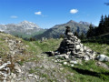
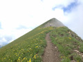
(7) Climb slightly to leave the banks of the stream, then find a well-marked path. Take it to the left, crossing several streams before reaching Mont de Grésy without difficulty.

(8) Now begin a long, easy descent via numerous hairpin bends. Keep to the left on the path, ignoring the various junctions. Reach the junction leading to the old church at Grésy.

(9) Turn left again, cross the Torrent des Lavanches and, a few steps further on, you’ll come to the junction you passed on the way out.

(1) Turn right and retrace your steps along the route you took on the way there to return to the Grésy car park 
(S/E).

Waypoints

  1. S/E : mi 0 - alt. 1,286 ft - Car park at Grésy cemetery
  2. 1 : mi 0.38 - alt. 1,526 ft - Crossroads of the circular loop
  3. 2 : mi 0.57 - alt. 1,480 ft - Farm track
  4. 3 : mi 0.71 - alt. 1,539 ft - Protective earthwork at Montailloset
  5. 4 : mi 1.11 - alt. 2,589 ft - Gorges Corridor
  6. 5 : mi 1.23 - alt. 2,641 ft - Foot of the cliff with a guardrail
  7. 6 : mi 1.34 - alt. 2,808 ft - Viewpoint
  8. 7 : mi 1.5 - alt. 2,927 ft - Torrent
  9. 8 : mi 1.86 - alt. 3,248 ft - Mont de Grésy
  10. 9 : mi 3.28 - alt. 1,693 ft - Montailloset crossroads
  11. S/E : mi 3.82 - alt. 1,286 ft - Car park at Grésy cemetery

Notes

Between (5) and (6) An interesting stretch as it bears witness to human activity from a bygone era. A cable obstructs the path, no doubt a remnant of timber hauling.
Between (7) and (8) Depending on the time of year, crossing the Ruisseau des Lavanches can be tricky, as the vegetation is so dense and tall.
(8) Mont de Grésy: two picnic tables and a spring provide a place to take a break.
Lavanche:
- in the Académie Française dictionary,5th edition, this feminine noun refers to a large quantity of snow that falls suddenly from the mountains. Lavanches are a danger at certain times when crossing the Alps. They are also known as ‘Lavanges’ and ‘Avalanges’.
- In the6th edition, the word is synonymous with ‘avalanche’.
- In the book *Origins of the Names of the Mountains of Savoy*: *Lanche*: derived from the regional words *lanche* and *lanchi*, which describe a grassy strip of land on a sloping terrain between two gullies. The same meaning applies in Savoyard patois: a strip of land with a steep gradient, a mountain corridor that narrows towards the bottom.
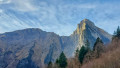
This accurately describes the Bauges slope above Grésy, with its steep slopes featuring numerous scree slopes and torrent channels.

This route passes through a protected area, which may be subject to special regulations:

Worth a visit

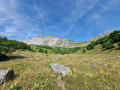
(6) Grass-covered plateau: serves as a resting place and offers a fine view.

Reviews and comments

3.7 / 5
Based on 2 reviews

Reliability of the description
3.5 / 5
Ease of following the route
3.5 / 5
Route interest
4 / 5
User 26966990

Overall rating : 4 / 5

Date of your route : Sep 27, 2026
Reliability of the description : ★★★★☆ Good
Ease of following the route : ★★★★☆ Good
Route interest : ★★★★☆ Good
Very busy route : No

A route that starts with a very steep climb. There are a few dizzying sections where you really have to work out the best way forward, right on the cliff face. I did this hike with my dog – thank goodness she’s so well-behaved, otherwise it would have been tricky!
The descent is a bit gentler 😉

Machine-translated

User 24013754

Overall rating : 3.3 / 5

Date of your route : Jul 05, 2025
Reliability of the description : ★★★☆☆ Average
Ease of following the route : ★★★☆☆ Average
Route interest : ★★★★☆ Good
Very busy route : No

A rather solitary hike, along a route that wasn’t easy to follow. I nearly headed back down the wrong way and found myself lost at a junction. Fortunately, I was able to consult another map online using the IGNrando app, which worked well.
Overall, it’s a pleasant walk through the woodland, so it’s nice and cool, although the atmosphere of the forest is a bit eerie for my liking. I didn’t come across any other walkers along the way. The path is very overgrown: at this time of year, it’s best to wear trousers rather than shorts.
At the top, the view is superb, and I was lucky enough to spot some eagles.

Machine-translated

Other walks in the area

For more walks, use our search engine .

The GPS track and description are the property of this route's author. Please do not copy them without permission.